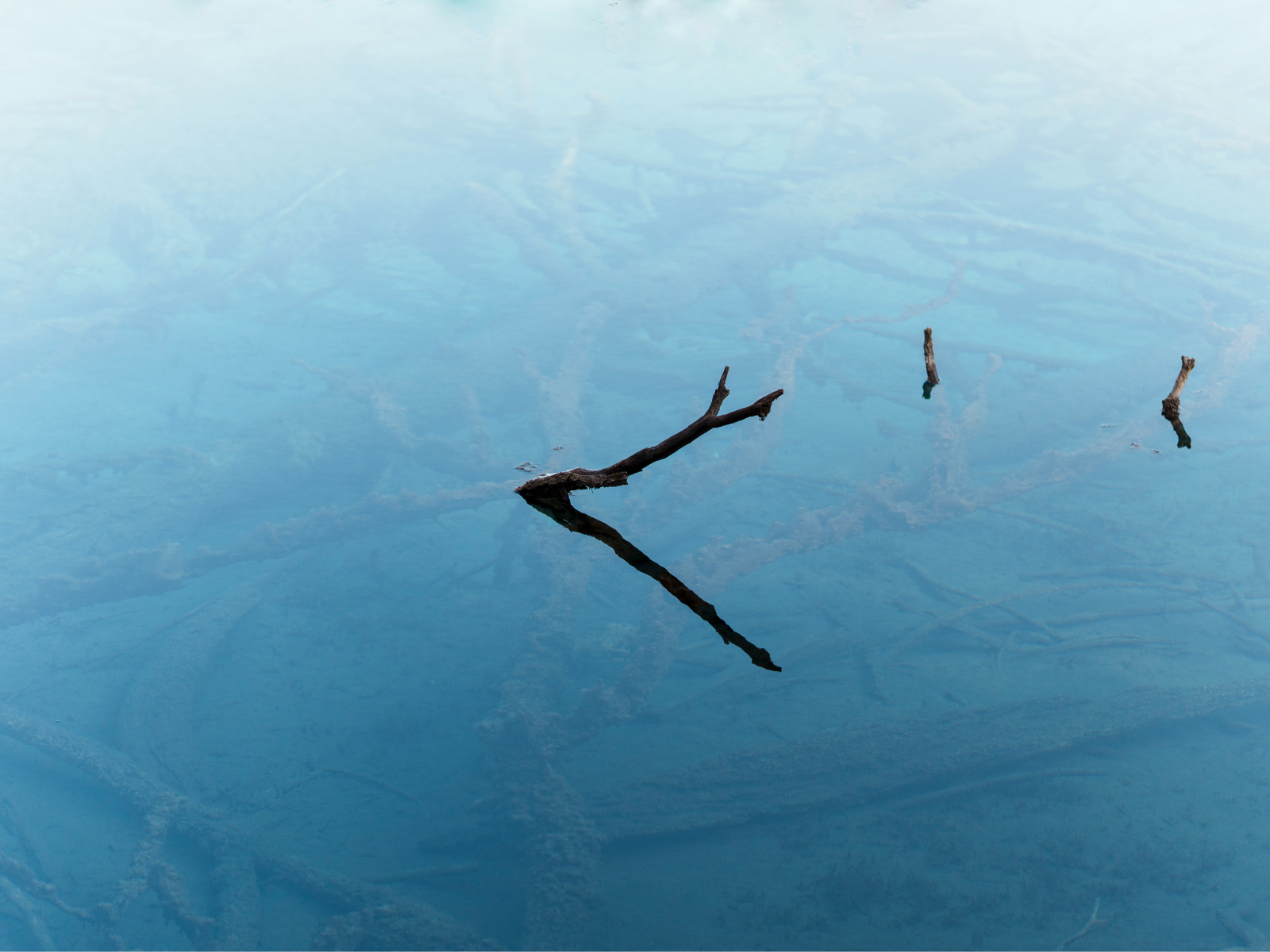
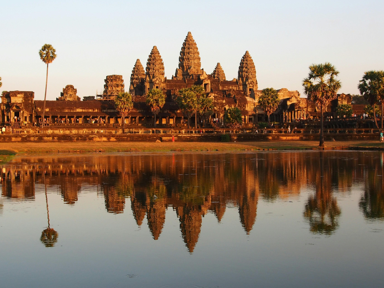
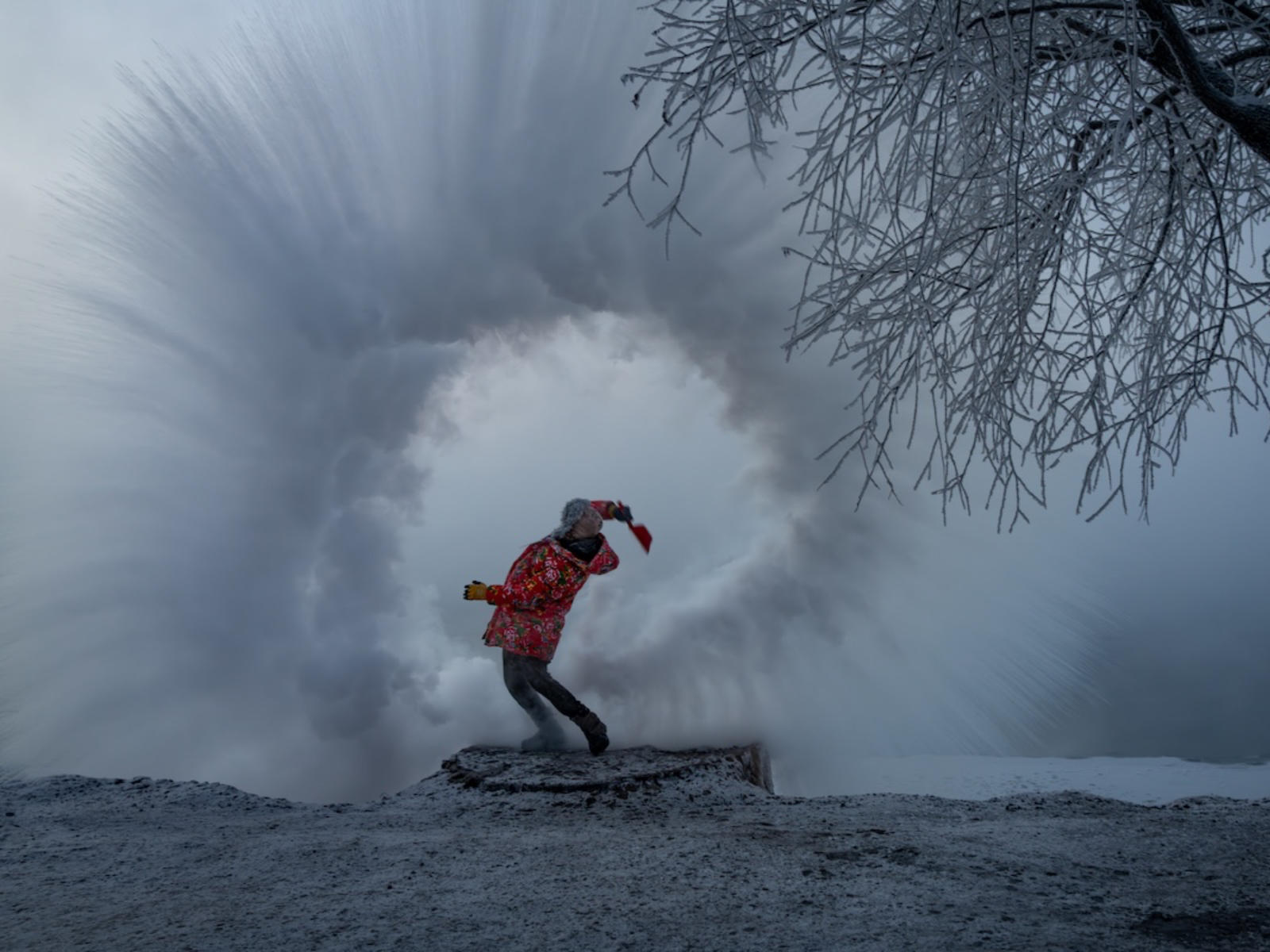
For me, a perfect trip is never just about visiting places that countless others have already checked off their lists. Instead, it holds three completely different experiences within it — the imagination and anticipation before departure, the intimate connection with nature during the journey itself, and the moment after returning home when you look back through the photos, rediscover details you never noticed at the time, revisit the memories, and dive into research that gives you a deeper understanding of the trip. So, through these words and photos, let us return once again to the beautiful Qinghai Lake.
The opportunity: As young people who had just started working, in the context of China’s work culture, the only truly no-questions-asked leave we can apply for is five days. Because of that, both I and the friends around me treasure those five days immensely, and every year, we carefully plan our annual trip while trying to avoid the crowds.
Since we needed to attend two weddings during the National Day holiday, we decided to first drive to Baoji for the wedding on the 2nd in order to save on transportation costs. We left Xiao P (my XPeng MONA M03 — you can refer to my previous article for more details) at Baoji High-Speed Railway Station. Considering that our schedule was relatively tight and that transportation and charging infrastructure around northwestern natural scenic areas might not be ideal, we chose to rent a car locally to complete the Qinghai Lake mini loop.
Armed with Baoji-style rolled noodles and roujiamo burgers, our group officially began the journey. Three and a half hours later, we arrived at Xining Railway Station. Entering a high-altitude region for the first time, none of us experienced any obvious discomfort. Conveniently, the car rental platform had pickup and drop-off points directly inside the underground parking lot of Xining Station, so we were able to load our luggage straight into the car and avoid the hassle of moving everything around repeatedly.
Day 1: Xining – Chaka | Total Distance: Approximately 457 km
Xining – Kumbum Monastery National 5A Tourist Attraction | Ticket: 70 RMB | Recommended Visit Time: Around 2 Hours
Kumbum Monastery is one of the most famous monasteries of the Gelug school of Tibetan Buddhism. Originally built during the Ming Dynasty, it was first constructed to commemorate Tsongkhapa, the founder of the Gelug tradition. According to legend, Tsongkhapa was born here, and later generations built a stupa at his birthplace in his honor. This is also how the monastery got its name — “Kumbum” roughly means “the place with a stupa.”
Kumbum Monastery – The Eight Auspicious Stupas
There are plenty of guides available both at the visitor center and near the monastery entrance, and the prices are quite reasonable. However, as someone who believes in materialism, I approached the site purely as a historical and cultural landmark and chose not to hire a guide. That said, if you are particularly interested in Tibetan Buddhism or the stories behind the monastery, hiring a guide may offer a much richer experience. Or, like me, you can revisit the photos afterward and slowly research everything in detail once you return home.
Tips: Guides will usually explain the “purpose” of different Buddha statues (I’m not sure if that’s the best way to describe it — perhaps more accurately, the things they are believed to bless or protect). Because of that, visitors may sometimes feel subtly pressured into donating money for good fortune. If that makes you uncomfortable, you can simply explore freely on your own as I did.
Since it was still before the holiday rush, there were not many tourists. The crowd felt evenly split between visitors and genuine pilgrims or monks coming to worship. Without overwhelming crowds everywhere, I was able to observe the monastery itself — and the people who had traveled from afar performing full-body prostrations — much more carefully.
Monks arriving for pilgrimage
The moment you enter the monastery, the heavy scent of incense and the slightly stale smell of aging wooden structures lacking ventilation immediately fills the air. Looking at the towering Buddha statues and the neatly arranged prayer cushions lining the walls, you can genuinely feel a very different cultural atmosphere. The place feels quiet yet vividly alive. In particular, watching the believers who had come from who-knows-where performing prostrations along the way — despite their worn-out clothes from the long journey — made me feel that they must have realized something meaningful through all the hardship. Perhaps they did not even know why they set out in the beginning, but somewhere along the road, the answer slowly became clear.
The white stupa inside Kumbum MonasteryDonation area — keeping up with the times, QR code payments are also accepted
There are many temples of all sizes scattered throughout Kumbum Monastery, though to me, several of them felt fairly similar. After focusing on a few of the more notable ones, we headed back to Xining for a meal, stocked up on oxygen canisters, emergency food, and other supplies, and officially set off toward Qinghai Lake.
Nanshan Viewing Platform, Gonghe County, Hainan Tibetan Autonomous Prefecture & Qinghai Lake Erlangjian Scenic Area The former is free to visit, while the latter is a National 5A Tourist Attraction | Ticket: 72 RMB | Recommended Visit Time: Around 2 Hours
After finishing kangguo at around 1:30 PM in Xining, we began driving toward Qinghai Lake. About two hours later, we arrived at our main destination in the area — the southern scenic section of Qinghai Lake Erlangjian Scenic Area. Before entering the Erlangjian Scenic Area, you can first navigate to the “Nanshan Viewing Platform” to overlook the full panorama of Qinghai Lake and the distant mountain ranges from above. However, the mountain road is quite narrow, and construction trucks frequently pass through, so extra caution is necessary.
The scenic area itself does not really feature cultural attractions, though it was once an early torpedo testing base in China. Unfortunately, because we arrived rather late, we did not visit the museum and instead headed straight to the lakeside.
Qinghai Lake is the largest freshwater lake in China by surface area. The water is calm and vast, perfectly complementing the distant mountains and creating an incredibly open and beautiful landscape. Large, surprisingly clean pigeons perched along the railings. After taking countless photos from every imaginable angle, I leaned against the railing and watched the sunset spread across the land in the distance. The sound of birds and the wind filled my ears, while the noise of work and everyday life slowly faded away, leaving only pure immersion in nature.
Clouds, distant mountains, and grasslands formed a breathtaking layered “sandwich”As the clouds parted and sunlight broke through, the grass by Qinghai Lake was still vividly greenSeagulls lining up by the shore, waiting to be fed “French fries”View of the pier
As night gradually fell, we left the Erlangjian Scenic Area and continued driving along Qinghai Lake toward Chaka, where we would stay for the night. Although the journey was only a little over 200 kilometers, it became the most thrilling and nerve-racking stretch of the entire trip. There were countless construction trucks along the way, ongoing road repairs in many sections, continuous U-shaped turns on certain mountain roads, and even stretches where traffic in both directions had to share a single lane. On top of that, we still needed to cross several mountain passes sitting at elevations of around 3,800 meters. The entire drive was tense and exhausting, and only around 10 PM did we finally arrive safely in Chaka Town. Fortunately, restaurants in town were still open, so we found a local spot, had a simple meal, and finally rested for the night.
The Daotanghe–Chaka Highway after nightfall
Day 2: Chaka – Qilian County | Total Distance: Approximately 372 km
Chaka Salt Lake | National 4A Tourist Attraction | Round-Trip Mini Train Package: 167 RMB
“Chaka” means “salt pond” in Tibetan, and the area is famous for producing “Great Blue Salt.” Visiting the salt lake has also become one of the region’s signature tourist experiences. There are actually two scenic areas at Chaka Salt Lake. The older “Sky Mirror” area focuses mainly on natural scenery, while “Sky No.1” leans much more heavily toward commercial attractions. As out-of-town visitors, we were naturally more interested in seeing the original natural landscape, so we chose to visit the Sky Mirror scenic area.
The scenic area itself is enormous. If you want to fully explore every section, it’s best to reserve an entire day. I would recommend first taking the small train all the way to the final stop, Sky Mirror, which sits at the deepest part of the salt lake. The saltwater there is exceptionally clean and also the most photogenic. The park has thoughtfully set up many photo spots and installations, making it easy to spend a long time taking pictures. My only regret was not bringing a drone.
On sunny days, because both the sky and the ground are overwhelmingly white, the brightness can easily strain your eyes. I highly recommend wearing sunglasses. Through the lenses, the lake appears much greener and more transparent, almost like emerald.
The ticket package also includes rental shoe covers, allowing visitors to walk directly into the lake. Stepping on the large salt crystals feels surprisingly similar to walking on a beach. The scenic area is maintained extremely well and feels remarkably clean, making it easy to fully immerse yourself in nature.
Interestingly, perhaps worried that visitors might become bored surrounded by endless expanses of white salt flats, the park has placed numerous photography props throughout the area — including oversized National Geographic-style frames and other installations. Large screens also continuously play photography tips and pose suggestions, clearly hoping every visitor leaves satisfied.
The salt lake with mountain peaks in the distanceSalt lake pierAbandoned salt mining railway
The old salt mining tracks stretch deep into the lake. Viewed through sunglasses, the real-life colors are actually much darker and richer than they appear in photos.
The shuttle train traveling through the middle of the salt lake — so clean it hardly feels like somewhere in ChinaMassive salt sculptures
After leaving the salt lake, we took a short break in the county town before setting off toward Qilian County. After the tense drive the previous night, even though the national highways along the way were likely more scenic, we chose a route with more expressways instead. Fortunately, the road conditions on this stretch were excellent. Even the national roads had very little traffic, with long straight roads and incredibly open views. Grasslands, distant mountains, snow, and sky layered themselves clearly across the horizon. While driving, large groups of lambs and yaks would occasionally cross the road. There was no need to panic though — before long, local herders would appear on motorcycles, gently driving them along and speeding up their crossing.
Roads cutting through the mountainsLarge herds of cattle and sheep across the grasslandsGrasslands at dusk, with the setting sun illuminating distant snow-capped mountainsSilhouettes of yaks beneath the sunset
By nightfall, we finally arrived in Qilian County. After enjoying a local barbecue dinner in town, we drifted off to sleep, preparing ourselves for the third day of the journey.
Day 3: Qilian County – Gangshika Snow Mountain – Xining | Total Distance: Approximately 320 km
Zhuo’er Mountain Scenic Area | Ticket: 60 RMB | Shuttle Bus to the Summit: 20 RMB | Mountain Elevator: 10 RMB
This was without question the most breathtaking scenic area of the entire trip for me. Up close, you can see idyllic countryside landscapes that resemble a Swiss town; in the middle distance, stunning Danxia landforms spread out like a painting; and farther away, you can gaze toward the magnificent Amne Machin Dongso Snow Mountain (elevation: 4,695 meters). From the mountaintop, you can even take photos together with the snow-capped peaks in the background — grand, clean, and majestic.
Self-driving visitors can park in the scenic area’s parking lot and then take a shuttle minibus for about ten minutes to reach the ticket checkpoint.
The scenery on the two sides of Zhuo’er Mountain Scenic Area could not feel more different. One side is lined with endless snow mountains, while the other side looks like rolling hills and villages straight out of a Swiss countryside postcard.
Amne Machin Dongso Snow MountainThe opposite side of Zhuo’er Mountain, looking almost like a European townDanxia landforms blending into grasslands
What surprised me the most was that the scenic area had even built sightseeing elevators to make climbing easier. Ten yuan per ride, divided into roughly three sections — honestly, incredibly user-friendly.
Scenic area elevator
Around noon, we left the scenic area. After a simple lunch at a Sichuan restaurant in Qilian County, we officially began driving toward the highest-altitude destination of this trip: Gangshika Snow Mountain.
While driving through the county town, we stopped at a red light and I noticed a Tibetan middle-school-aged boy staring at our Voyah Dreamer with sparkling eyes. It instantly reminded me of myself as a child, when I would stop and stare whenever I saw a car I liked or had never seen before, filled with curiosity and imagination. I hope that one day, he too can drive the car he loves and live the life he truly wants.
Gangshika Snow Peak Scenic Area | Free Admission | Shuttle Bus to the Mountain: 25 RMB
Gangshika Snow Mountain is located in Menyuan County, Haibei Prefecture, Qinghai Province. It is the highest peak in the eastern section of the Qilian Mountains and is often referred to as the “King of Snow Mountains.” Because the facilities and difficulty level are both relatively approachable, snow mountain enthusiasts also call it “the first snow mountain of your life.” The main peak reaches an elevation of 5,254.5 meters.
The visiting process is similar: park your car in the scenic area parking lot, then take a shuttle bus to the base of the mountain. The official sightseeing area itself already sits at an altitude of around 3,800 meters, so I would strongly recommend carrying an oxygen canister with you. After getting off the shuttle, you are greeted by the incredibly blue Lianxin Lake. Fed by glacial meltwater, the lake is pristine and icy-clear, standing in sharp contrast against the barren dark-brown tones of the surrounding alpine terrain. The scenery is stunningly beautiful.
Lianxin LakeWhen we arrived, the weather was not particularly good, and Gangshika Snow Peak was partially hidden beneath a layer of mistNatural spring water — unfortunately, since we still had more traveling ahead of us, I did not dare risk an upset stomach by trying itAfter leaving the scenic area, the snow mountain gradually revealed its true appearance. As for climbing it, I’ll leave that for another trip.
Following the traces left behind by ancient glaciers uphill, you can eventually reach the starting point for trekking and mountaineering routes on Gangshika Snow Peak. The scenic area also offers horses for rent, allowing visitors to continue deeper into the mountains with guides toward the colorful waterfall area. Due to time constraints and personal fitness considerations, however, we decided not to go too far. After wandering around the river valley for a while, we headed back down the mountain and began the return journey.
As evening approached, we set off back toward Xining. After an extravagant dinner at Haidilao Hot Pot, our joyful Qinghai Lake mini loop officially came to an end.
Day 4: Xining – Qinghai Tibetan Culture Museum – Specialty Shopping
On the final day, accompanied by light drizzle, we took a taxi to the Qinghai Tibetan Culture Museum. The museum itself is not particularly large, and even during the National Day holiday crowds were relatively light, but the exhibits were genuinely rich and fascinating. The walls were covered with intricate thangka paintings, alongside traditional Tibetan Buddhist monk robes that felt as though they had stepped straight out of a movie, as well as exquisite gold artifacts once used by Tibetan nobility. In the museum’s souvenir section, I bought a small prayer wheel, which I kept playing with throughout the journey home. Although I do not personally follow Buddhism, I still found it deeply interesting.
Thangka paintingsFour Kings Golden CupTurquoise-Inlaid Golden Phoenix HeaddressMuseum souvenir shop — prayer wheel. At 38 RMB it was not exactly cheap, but the craftsmanship was genuinely delicate and impressive.
Before leaving, in order to bring some souvenirs back for family and friends, we chose a supermarket-style gift shop and bought local specialties including beef jerky, saffron, goji berries, highland barley liquor, and other regional products. Whether they were truly worth the price or not, at least everything was clearly marked with fixed prices. After stuffing our suitcases full, we finally began the journey home smoothly.
Epilogue
As my annual trip for 2025, I was extremely satisfied with this four-day Qinghai Lake mini loop. There were few crowds, no traffic jams, and the itinerary never felt rushed or overly exhausting. Along the way, we experienced local food and magnificent natural scenery, took turns driving with friends, talked about our impressions of the landscapes, took photos for each other, and commented on the food we ate. Although there were still occasional work calls interrupting the peace, overall the journey felt relaxed and carefree, allowing both body and mind to truly unwind. Everything felt quiet and serene, and the deep connection with nature stood in sharp contrast to the constant noise and chaos of Beijing.
As for transportation, self-driving was undoubtedly the best option. The route takes you deep into nature; although some roads are winding and rugged, they are still paved and generally accessible. Car rental companies such as Shenzhou Car Rental and eHi Car Services both have pickup and drop-off locations at Xining High-Speed Railway Station, making the process extremely convenient. More importantly, driving yourself gives you full control over the schedule and allows you to freely adjust the itinerary depending on how long you want to stay at each location.
For accommodation, since we had relatively high standards regarding cleanliness, we chose chain business hotels associated with the Huazhu Group ecosystem throughout the trip. Below are all the hotels we stayed at and their prices before the National Day holiday. Personally, I found them all very comfortable.
Day 0 — Orange Hotel Xining Railway Station Provincial People’s Hospital Twin Room — 331 RMB
Day 1 — Starway Chaka Salt Lake Hotel Oxygen-Enriched Twin Room — 314 RMB
Day 2 — Ibis Styles Haibei Qilian Zhuo’er Mountain Hotel 421 RMB
Day 3 — Orange Hotel Xining Railway Station Provincial People’s Hospital Twin Room — 412 RMB
As for the overall cost of the trip, even including transportation expenses from Beijing, the total came to only around 3,000 RMB per person, which I would consider extremely cost-effective. The main expenses were simply the rental car and hotels.
Expense overview
Regarding restrooms, facilities at both the scenic areas and roadside service stations were generally quite complete. Since there were women traveling with us, we had also prepared a portable toilet just in case, but throughout the entire journey we never actually needed to use it. Personally, I think anyone following a similar itinerary would not need to worry too much about this issue.
Next Stop, Let’s Go!
The 2025 annual trip has come to an end, which means it is already time to start planning for 2026. Xinjiang or Hainan — wherever it may be, I hope it will once again take me far away from the noise, allowing me to enjoy the beautiful and magnificent landscapes of our country.
Gannan is a breathtaking destination often mentioned alongside western Sichuan, northern Sichuan, and the Qinghai–Gansu Grand Loop. It sits along the transition zone between the first and second topographic steps of China’s vast landscape. Traveling south from Lanzhou through Linxia, once you pass Tumen Pass, you officially enter what used to be the territory of the Tibetan Empire. “Back then, if Han people wandered into Tibetan lands without travel permits, they’d be scalped and burned alive,” our driver told us solemnly over and over throughout the journey. After finishing our trip through Gannan, we entered Yinchuan in Ningxia, bringing my nationwide travel plan close to its conclusion.
The Night Before the Trip
In recent years, I’ve become especially fond of the phrase “the night before a trip.” No matter how many times I travel or how many places I’ve already been, the evening before setting off on a new journey always fills me with excitement—sometimes so much that I can’t even fall asleep.
This trip felt particularly exciting. First of all, I was finally heading to Ningxia, a province I had never visited before, as well as the entirely new geographical region of Gannan. I first learned about Gannan through mountain biking videos on Bilibili, and ever since then, I’d been unable to stop thinking about the vast landscapes around the Rock’s Road area. Secondly, I didn’t even submit the new version of the PFollow app until the afternoon before departure. Right after the submission, I immediately started writing the development summary. In between moments of thinking and writing, I hurriedly packed my clothes. Those few days were complete chaos—in the best possible way.
And finally, most importantly, I ended up planning two trips back to back. Why the rush? There’s actually a pretty funny story behind it. On the night we moved into our new home, my girlfriend and I were making the bed when our cat Zai Zai became incredibly excited after seeing the bedsheets. He burrowed into them and started playing with my girlfriend. In the middle of the chaos, he accidentally scratched her little finger, leaving a long, deep cut.
The scratch was serious enough that we immediately went to the hospital for rabies shots. Our original plan had been to take an “extended Southeast Asia loop” trip before the May Day holiday, but that was completely derailed. The rabies vaccine required five shots, with each interval between injections getting longer, so we could only travel during the two longest gaps between doses. Following that train of thought, we suddenly figured: why not just visit the last two provinces we hadn’t been to in China instead?
Lanzhou
There’s a song literally called Lanzhou, Lanzhou, and honestly, the overall mood of that song perfectly matches my first impression of the city. Although I had passed through Gansu twice before while traveling along the Qinghai–Gansu loop routes, those trips were mostly in the northwestern part of Gansu, around the Hexi Corridor and its western reaches. This time, we chose to stay near Zhangye Road Pedestrian Street. Looking north after stepping outside, you could immediately see Baita Mountain Park, standing there like a giant city wall watching over the endless stream of pedestrians and the Yellow River that has surged onward for thousands of years.
Zhongshan Bridge was our first stop. The moment we arrived, we saw a huge flock of pigeons circling around the bridge, so I quickly pulled out my camera to capture the scene. Walking onto the bridge and looking toward the riverbank, I realized the pigeons had gradually settled there. Plenty of people were feeding them, while vendors carrying pigeon feed wandered back and forth. The feed was cheap—just one yuan per bag—but the pigeons here were nowhere near as friendly as the ones at the Music Stage in Nanjing’s Sun Yat-sen Mausoleum. If you ever go to Nanjing, I highly recommend visiting the Music Stage there to experience what “pigeons right in your face” really means. It’s genuinely fun.
This was also the first time I finally saw the Yellow River actually looking yellow. Last year, I visited the Zoige Grasslands, home to the famous First Bend of the Yellow River, but unfortunately we never climbed up to properly appreciate those winding curves. Trying to save money, we listened to a homestay owner’s recommendation and went instead to a Yellow River viewing platform where you could directly touch the water. Looking back now, it feels like a shame that I missed the beauty of the river bends. Although I did touch the Yellow River—and even filled two bottles with its water—the water I saw back then was surprisingly clear, not yellow at all.
After walking back and forth across Zhongshan Bridge, we headed down to the riverside to splash around and feed pigeons. I stood quietly beside the Yellow River, watching wave after wave roll toward the shore. My shoes stepped into the river and back out again while my thoughts drifted along with the water. I never imagined I would one day actually stand in the real waters of the Yellow River and truly see what the Yellow River meant. We tossed several bags of pigeon feed to the birds, then continued upstream and rode a traditional sheepskin raft near the Yellow River Mother Sculpture.
Sheepskin rafts are such magical things. For someone from deep in southern China, they almost carry an irresistible pull. Once you know they exist, you can’t stop thinking about them—you just want to see one in person and pat it on the backside. Some people say they smell unpleasant, but I leaned in close and sniffed several of the sheepskins carefully. Honestly, I thought they had a kind of fragrance to them, not a bad smell at all. I’ve always found it incredible that something like sheepskin could be used not only for food and clothing, but even as transportation. There’s something strangely moving about that.
The ride cost 90 RMB per person, floating from the Yellow River Mother Sculpture area down toward Zhongshan Bridge before being pulled back by speedboat. Overall, it was a genuinely interesting experience. Before getting on, I was convinced my pants would get soaked, but the staff handed everyone a cushion, so your butt stayed perfectly dry. That said, part of the route passes through rocky shallows, and the open sheepskin raft can easily get splashed by larger waves from every direction—so my pants still got wet in the end.
Even though 90 RMB per person did feel expensive, this is probably a once-in-a-lifetime experience anyway. Later, at the Gansu Provincial Museum, I was stunned to learn that historical Yellow River sheepskin rafts could be made from as many as 300 or even 600 inflated sheepskins. Our tiny raft only used 12 skins, yet it could still support four or five people weighing a combined five or six hundred jin. No wonder these things were once such powerful transportation tools in ancient times.
Finally, we specifically went to Camel Alley in Lanzhou. I’d heard that it was the kind of place documentary photographers loved to shoot. We wandered around the neighborhood for a long time before finally finding the entrance to an abandoned railway track. Walking deeper along the tracks, we saw many residential buildings clustered around the railway area. The environment wasn’t great, and sanitation conditions were rough too, but somehow that atmosphere made me start pressing the shutter nonstop. One friend was confused at first, wondering why I specifically liked photographing places like this. Without even thinking, I replied, “This is the only thing I know how to shoot.” Looking back now, I think I really do open myself up more when I enter spaces like these. But discussions about photography subjects and styles can wait for another time.
Gannan
Starting from Lanzhou, the most classic route is to head south into Gannan, visit Zhagana, and complete a loop along Rock’s Road. I found this three-day itinerary on Mafengwo. I’ve been using Mafengwo since 2018, and whenever I look for chartered car routes, it’s still the first app I open. Only in the past two years did I gradually switch to Trip.com because its membership system and charter services are genuinely good.
What surprised me was that after all these years, Mafengwo is still alive and doing fine. So many new players have entered the travel industry, yet it hasn’t really been pushed aside. The only thing that feels different is that back in the day, you could find tons of veteran travelers sharing experiences there—budget travel, long-distance hiking, wandering the world. Over the years, that kind of content has become rarer and rarer on Mafengwo.
Interestingly, our trip happened during the off-season right before the May Day holiday, so there were barely any tourists along the route. After hesitating for a while, I chose the cheapest “comfortable” four-person shared car package with no breakfast included—the absolute entry-level option. It cost 980 RMB per person. There was another 1,480 RMB “light luxury” package that included breakfast and better hotels. I figured we were only staying two nights anyway, so even if the accommodations were bad, we could endure it. As for breakfast, we’d just buy bread and carry it ourselves.
Unexpectedly, the driver pulled off some truly smooth moves. He negotiated directly with the hotels, and in the end we got breakfast both days. On the second night, our room was even upgraded to the room type included in the luxury package. Rounded up mentally, it felt like the two of us had somehow saved a thousand yuan. Of course, this kind of thing depends entirely on timing and the driver. During peak season—or with a more by-the-book driver—none of this would happen. But honestly, this is part of the fun of traveling. After so many chartered car trips, I’ve realized that the driver’s personality and experience can have a huge impact on the quality of the entire journey.
Day One
We spent basically the entire morning in the car on the first day. After getting in at 7:30 a.m., we drove all the way until noon before stopping for lunch in Xiahe. Along the way we passed through Linxia and officially entered Gannan. The driver specifically reminded us when we passed through Tumen Pass—we were now officially entering Tibetan regions, once part of the Tibetan Empire. Without travel permits back then, Han people who accidentally wandered into Tibetan territory would supposedly be scalped and burned alive if caught. Hearing this left me completely stunned.
Our first stop was Ganjia Secret Land. There were very few tourists that day; including us, we probably encountered only three or four groups in total. Here stands Bajiaocheng Ancient City, a nationally protected heritage site first built during the Han Dynasty. As its name suggests, Bajiaocheng has eight corners, though in reality its layout resembles a giant cross. It originally functioned as a normal county town, but during the Yuan and Ming dynasties it became a relay station for officials and soldiers transporting documents and intelligence. During the Qing Dynasty, there were plans to reclaim farmland here, but the harsh natural conditions made it impossible. Looking down from the observation deck, the entire city seemed completely enclosed by the surrounding white stone mountains, airtight and isolated, with barely any land suitable for farming.
After visiting Bajiaocheng, we continued north to Baishi Cliff. Beneath the cliffs sits Baishi Cliff Temple, a monastery managed by Labrang Monastery and home to a female living Buddha. Unfortunately, our schedule was tight, so we only viewed the monastery from the observation platform. The driver told us that all the promotional photos online are basically taken from this exact angle. Honestly, the internet really does know how to find the best spots. From there, Baishi Cliff looked impossibly smooth, as though sliced cleanly by giant blades, standing like an iron guardian silently protecting the people living below.
Ganjia Secret Land and Labrang Monastery lie in opposite directions from Xiahe. The main road through Xiahe points directly toward Labrang Monastery. As one of the six great monasteries of the Gelug school of Tibetan Buddhism, Labrang immediately reminded me of Kumbum Monastery, another Gelug monastery we had visited previously. The Gelug school is what older Chinese TV dramas often called the “Yellow Sect,” famous for monks wearing tall yellow hats. Last year, when I visited Maiwa Monastery in Hongyuan County just south of Gannan, I noticed monks there wore flat maroon hats instead. Only afterward did I discover that Maiwa is actually the largest Nyingma monastery in northwestern Sichuan.
Labrang Monastery is enormous. More than three kilometers of prayer wheels surround the entire complex. Free monk guides are available, so we followed a young monk through several main halls and one of the academies. Labrang contains six major academies dedicated to Tibetan medicine, philosophy, tantra, and other disciplines. Walking through the monastery’s narrow alleyways felt strangely like wandering through an exotic university campus. I’m not sure how other people feel about religion, but I’ve always found it mysterious—not scary, just unknowable. In the past, seeing Tibetan Buddhist monks draped in red robes made me slightly nervous, but inside Labrang I felt none of that at all.
I’m not sure whether it’s because I’ve simply seen more over the past few years and become calmer, or because the atmosphere inside Labrang somehow closes the emotional distance. The uneasiness I used to feel faded a lot. It suddenly felt like everyone is fundamentally the same, just living in different circles because of various circumstances. Maybe it’s the lack of contact between those worlds that creates those strange feelings in the first place.
After leaving Labrang Monastery, we skipped Tibetan food and yak hotpot. I’d already eaten plenty of those during previous trips around Tibetan regions, so this time I wanted something new. By chance we found a restaurant called Kathmandu Cuisine. Reviews online were mixed, but one comment mentioned that the chef had actually been hired from Nepal, so we decided to try it. The food turned out to be genuinely good, especially the milk tea. It had a very distinctive flavor—probably because of spices like longan or something similar mixed in. It tasted completely different from the milk tea I’d had in Tibetan areas before. We ordered a set meal for two: lots of small bowls arranged on one large plate. The rice used long grains with a rather unusual texture. Overall, though, the entire meal was excellent.
Day Two
On the second day, we got to eat beef noodles for breakfast thanks to the driver pulling some strings with familiar faces. After eating our fill, we got in the car and headed to visit a Tibetan girl’s home not far from Xiahe County. Honestly, I’ve always been a bit resistant to this kind of itinerary item. Wearing Tibetan robes, riding horses, drinking butter tea—these overly formulaic experiences are only really fresh the first time you visit Tibetan areas. They feel like “template experiences,” all form and no soul. But since it was included in the itinerary for free, we went along with it anyway.
In reality, the whole experience felt a bit rushed and tense. First came the ceremonial white khata scarf, then we picked Tibetan outfits to change into, took some photos, and immediately went horseback riding. Personally, I do think horseback riding is far more interesting than riding camels. The camels at Mingsha Mountain in Dunhuang had completely worn out my patience. Toward the end, all I could think was, “How much farther do we have to go?” and “Why aren’t we turning back yet?” Eventually my lower back even started hurting. Though to be fair, the price there is reasonable enough that I’d still call it the ceiling of camel-riding experiences in China. As for horseback riding, after doing it several times, I’ve never really felt that romantic “galloping across battlefields” sensation. You’re always being led by someone holding the reins, so my interest in it has remained limited.
This horseback ride at the Tibetan girl’s house was much the same, except this time we wore Tibetan robes while riding, which made it marginally better. We went out for maybe two hundred meters before returning. Back inside, we drank two bowls of authentic butter tea. The milk had apparently been freshly squeezed before we arrived. I nearly spat it out after the first gulp. Turns out authentic butter tea really does hit differently when you drink it in an actual Tibetan home. The versions served in restaurants have clearly been toned down and modified. Real butter tea is almost impossible to finish a full bowl of—it’s bitter and astringent, and without sugar it’s genuinely difficult to drink.
Once we had more or less finished the two bowls of butter tea, we went outside to play with baby lambs. Now that part was genuinely fun. We chased around two lambs that had only been born a few weeks earlier, half-trying and half-not-trying to catch them. Eventually the owner probably got tired of watching us fail and simply picked one up and handed it to us, teaching us to hold all four legs with both hands so the lamb wouldn’t panic and kick around. The lamb I held reminded me a lot of my kitten Zizai. Once in my arms, it kept rubbing its nose against my face. Up close, the lamb even smelled sweet, carrying a soft milky scent. My paternal instincts almost kicked in again. Absolutely ridiculous.
We were out of the Tibetan girl’s house in less than an hour. If it’s your first time visiting Tibetan regions, I can imagine the experience feeling pretty novel. The driver told us that during summer, when more tourists arrive, they host bonfire parties on the grasslands after dark and lead everyone in Guozhuang dancing. Now that sounded genuinely fun. My girlfriend and I once stumbled into a huge Guozhuang dance gathering in Dali Ancient Town. Even though the bonfire itself was fake, the joy on everyone’s faces while holding hands in a circle was completely real and incredibly infectious.
The driver went to refuel and dropped us beside a boardwalk near a place called Sangke Grassland. We wandered around for a while. A few ducklings skimmed low over the water’s surface, and only then did we finally see water again. Thinking back now, it’s wild that this random refueling stop was actually the only place during the entire trip where we saw water at all. It really drives home how much prettier this route must become in late May or during summer vacation, when everything turns lush green.
The car continued onward. Today’s drive was much longer. We were racing toward Zhagana to catch sunset and see the so-called “place where immortals live.” Though honestly, I’ve now seen several places in China advertise themselves with exactly that phrase. Maybe the real answer is to start cultivating immortality myself—then at least I wouldn’t have to worry about purchase restrictions.
We arrived at Guomang Wetland in Luqu County, a migratory base for red-crowned cranes and many other birds. There was an observation deck topped with three sculptures of cranes in flight. Walking the full loop around the platform took about half an hour, and from the highest point you could look down over the entire wetland. Of course, at this time of year there was basically nothing to see except yaks diligently grazing on dry grass. After taking a few photos of blue skies, white clouds, and the first tiny green shoots poking through the earth, we hit the road again.
I sat in the passenger seat, drowsy under the warm sunlight, when suddenly the driver slammed on the brakes and shouted, “Quick, look! Vultures eating something!” The word vulture jolted me awake instantly. I shot upright, frantically grabbed my camera with both hands, and searched for the birds blending into the yellow-brown earth.
“Wow… so when vultures spread their wings, they can actually cover most of the road.” I couldn’t stop exclaiming in amazement while watching two vultures glide low overhead. Looking more carefully, I realized seven or eight vultures were feasting on a dead calf. The driver kept tossing small rocks near them, trying to make them all take flight. Some simply stood along the roadside, completely unfazed by people or cars. With their wings folded as they crouched there, they almost resembled little mani stone piles.
The driver also told us that without vultures, plagues would spread across the grasslands. They’re the ones that dispose of diseased livestock carcasses. I kept thinking about those words while reviewing the photos I’d just taken. It was my first time observing vultures from such close range. Their heads really are bald, and they hop when they walk. Somehow it was oddly adorable.
At lunchtime the driver took us to a Sichuan restaurant, where we devoured unbelievably delicious tomato-and-egg stir fry and fish-fragrant shredded pork. When your appetite suffers at high altitude, these two dishes are always our comfort food. No matter how little appetite we have, we can still demolish a huge bowl of rice with them. While chatting and joking with the owner, the driver once again brought up a misleading video he had seen on Douyin, the kind that might reduce tourist numbers during the May Day holiday. Things like “Gannan isn’t actually interesting,” or “Langmusi is just a river.” In short, he was furious about it and kept bringing it up to everyone he met.
What he said wasn’t entirely unreasonable. Personally, I don’t obsess over visiting places only during the “perfect” season to see the “best” scenery. But for many people, traveling thousands of kilometers to a destination at the wrong time of year and ending up disappointed is frustrating, especially when real money is involved. Everyone wants their money well spent. So whenever the driver started ranting about this topic, I never really encouraged him too much. Honestly, constantly bringing it up felt like an overreaction. If it bothered him that much, I figured he could simply report the video for false advertising. Beyond that, there’s no point saying more. The truth speaks for itself.
Speaking of Langmusi Monastery, we arrived there right after lunch. The driver told us that the second main hall from the right housed a preserved living Buddha statue whose fingernails had supposedly been clipped before. Then, with one step on the accelerator, he drove straight into the scenic area without buying tickets. We technically saved sixty yuan, but the move was undeniably slick. You really need an experienced local driver for stuff like this.
Once out of the car, we headed straight for the hall. I was curious to see what a preserved living Buddha with fingernails actually looked like.
To my disappointment, after circling around twice and inspecting carefully, it looked basically the same as all the other Buddha statues. I had imagined something more like the mummies I’d seen at the Turpan Museum—those preserved corpses lying in glass coffins with visible hair still attached. Completely different feeling. My expectations had been for nothing.
What truly impressed me instead was the scenery beyond the hall, along the source of the White Dragon River. Outside the monastery stretched a huge meadow. Several water-powered prayer wheels stood where the river flowed past. On one side of the river sat red-robed monks quietly discussing something while looking at their phones; on the other side, local Tibetan pilgrims sat together in circles sharing food and laughing nonstop. Pretending to look elsewhere, I quietly pressed the shutter and captured a photo.
I kept walking deeper toward the river’s source. If you ever visit Langmusi, I highly recommend wandering farther inside if you have time. During summer, when the water level rises, I suspect this pebble path may even disappear underwater. If you don’t mind the cold, taking off your shoes and wading through the stream seems like it would be pretty fun too.
We stayed at Langmusi for less than half an hour. The driver kept insisting that we needed to save time for Zhagana and move quickly through earlier stops. I could understand his good intentions, but I’ve always hated this feeling of being rushed while traveling. You pay money to relax, after all. If time runs short, you can simply skip certain spots. But I held back from arguing with him because I genuinely wanted to see just how stunning Zhagana would be according to his logic.
From the foot of the mountain to the summit, Zhagana contains several villages. We stayed in Dongwa Village, considered one of the most scenic areas in the entire Zhagana region. Even after entering through the main gate, it took nearly another twenty kilometers of driving to reach the village.
We climbed near Fairy Beach and looked down at Dongwa Village nestled deep within the valley. The scenery was indeed beautiful. But for someone who had already visited Lianbaoyeze, it felt slightly underwhelming. It lacked the overwhelming grandeur of Lianbaoyeze, where towering mountains on both sides of the fairytale-like roads seem to silently guard your passage.
Still unconvinced, we kept thinking, Surely this can’t be all there is. Since we had already come this far, we decided to push onward to Fairy Lake. That extra effort nearly exhausted us. The climb involved endless staircases above three thousand meters altitude, and by the time we finally reached Fairy Lake, we were only barely satisfied. The driver had been right—there’s nothing particularly extraordinary about it. If you still have energy, sure, climb up and take a look. If not, there’s really no need. Finally, the driver brought us to Observation Deck No. 1, supposedly the best sunset viewpoint in all of Dongwa Village. The moment I stepped out of the car and stood by the railing, the sight in front of me completely stunned me. Only then did I truly understand what the signs at the entrance meant by “The World’s Best Tourism Village” and “The Place Where Immortals Live.” It was absolutely worth it. The driver mentioned there was an even higher observation deck, but reaching it required riding horses owned by local herders, costing 400 RMB per person round trip. Honestly, hearing that almost excited me enough to blurt out, “Take me there.”
That night we stayed at a guesthouse called Traveler’s Home in Dongwa Village. Because it was still the off-season before May Day, the driver once again leveraged personal connections to upgrade our room. The room was enormous, with giant floor-to-ceiling windows overlooking the mountains of Zhagana. It wasn’t the very best view possible, but considering how little we paid, it already felt like we had scored an unbelievable bargain. Of course, there were downsides too. Since Zhagana sits at relatively high altitude, there’s no air conditioning. In winter, if a guesthouse doesn’t provide electric heaters, you basically rely entirely on electric blankets. As soon as darkness fell, the room temperature dropped sharply. Thankfully, the water heater was excellent. After a wonderfully hot shower, I crawled into the pre-warmed electric blanket and buried myself in the blankets.
Honestly, nearly every village inside Zhagana—especially Dongwa Village—has now become almost entirely guesthouses. There are barely any ordinary local villagers still living there. To curb the tidal wave of homestay construction, the government has already stopped approving any new guesthouses. Though it’s incredibly profitable, anything becomes problematic once there’s simply too much of it.
Day Three
Only in hindsight did I realize that the third day was the true highlight of the trip. During dinner the night before, our driver casually told me that two vehicles would be taking the Rock Road together the next day, and that we should be able to make it through, meaning we could cut nearly 100 kilometers off the route. Naturally, I was thrilled. Years ago, I had already seen several Bilibili creators specifically travel there to ride mountain bikes, and ever since then I’d been fascinated by the vast landscapes of Gannan. If I ever had the chance to complete the entire route myself, it would truly feel like fulfilling a long-held wish.
If the view overlooking Dongwa Village from Observation Deck No.1 at dusk the previous day only gave me a faint understanding of why this place is called “the land where immortals live,” then today’s journey along the Rock Road finally made me understand why it earned the title of “immortal” in the first place. Last year, when I rode through the Lianbaoyeze Scenic Area, I was already blown away by the fairy-tale roads there, lined on both sides with towering landscapes that felt straight out of Middle-earth in The Lord of the Rings. But the scenery I saw this time while traversing the Rock Road in reverse from Zhagana was twice as stunning as Lianbaoyeze. It was also much better suited for cycling — the altitude wasn’t as extreme, the scenery was richer, and the slopes were far friendlier.
Only the first 20 kilometers after leaving Dongwa Village and the 40 kilometers near the official starting point of the Rock Road were paved with asphalt. Once the descent began, there were another 40 kilometers of crater-filled dirt road. At one point we saw a van packed with tourists whose tire had been sliced open by rocks falling from the cliffside, leaving them stranded by the road borrowing a jack from passing cars. We also spotted several solo motorcycle travelers standing beside the cliff roads with their adventure bikes, stopping to take photos. Honestly, even while writing this now, I’m already tempted to come back in summer with my own bike. Start from Dongwa Village in Zhagana and ride all the way to the end of the Rock Road — a full 100 kilometers. Gather a few friends, bring a support vehicle. Road bikes are definitely out of the question though; gravel bikes would be ideal, mountain bikes even more fun. All I can say is I’ll try to make it happen one day. After all, these days it’s hard enough for everyone just to make money, let alone find a time when a whole group of friends can actually get together and have fun.
After stopping for a photo at the official starting point of the Rock Road, we began the long drive back toward Lanzhou. It was already nearly two in the afternoon by the time we finally had lunch in Hezuo City, and by then we were starving. The driver took us to a restaurant that had just reopened after renovation. I originally didn’t want to eat hand-grabbed lamb again, but they happened to be running a special promotion: only 58 RMB per jin. Naturally, I wisely ordered one jin. The moment the food arrived, I was instantly won over by how unbelievably soft and tender the lamb was. If you truly want to taste proper lamb, you still have to make a trip through Northwest China or Inner Mongolia.
Oddly enough, the fruit platter was also amazing. We finished two plates in no time, especially the strawberries and grapes, which were incredibly sweet and bursting with juice. We devoured so much fruit that after finishing one plate, we even tried to pay for another. The owner quickly blocked the payment QR code and said, “The fruit platters are complimentary — we can’t let you pay for them.” Throughout the drive, the driver also refused to let us sleep. Every time he noticed me getting drowsy, he would immediately start explaining where we were, where we were heading next, the stories behind the region, or the names of the mountains ahead. Of course, I was also worried that he himself might get sleepy while driving, but almost every single time I was about to drift off, he would suddenly clear his throat and launch into another enthusiastic explanation. Honestly, it was pretty entertaining.
The moment we arrived in Yinchuan, we were immediately greeted by dry heat and traffic jams. The few of us were still wearing fleece-lined winter pants and sweaters, curled up inside the car like dumplings steaming in a bamboo basket, completely miserable from the heat. It wasn’t until we finally reached the hotel that we could breathe a sigh of relief. The next day, we visited the Gansu Provincial Museum to see the famous Galloping Horse Treading on a Flying Swallow. It was smaller than I had imagined, but that wonderfully amusing expression on the cold bronze sculpture still managed to make people smile across the span of centuries. During the pandemic, the museum’s viral “Green Horse” mascot also exploded in popularity, and countless people came specifically to buy one from the museum as a symbol of safe travels. Even though the pandemic is long over now, we still bought one ourselves — perhaps as a small blessing and wish for a brighter future ahead.
Yinchuan
After visiting the museum, we headed toward Yinchuan around noon. Along the drive from Lanzhou toward the Ningxia Basin beneath the Helan Mountains, we passed countless loess hills. Even though the environment here is already far better than the three great deserts surrounding the Ningxia Basin, it’s still difficult to imagine the hardships the Tangut people once endured in order to preserve their survival. Forced out from the fertile grasslands around Qinghai Lake, they were squeezed between the Tuyuhun in the north and the Tibetan Empire in the south, struggling simply to survive. In the end, with nowhere else to go, they could only turn to the Tang Dynasty in the Central Plains and seek a place to live, wandering endlessly in search of refuge.
Every time I travel through the great northwestern regions of China, I always end up feeling grateful to have been born on this land. I mean that sincerely. I truly appreciate the sacrifices and efforts of those who came before us, because without them, we would never have the quality of life we enjoy today. Especially over the past two or three years, after traveling to other countries across East Asia, the more places I visited, the more I oddly felt that home was even better. At first, I was honestly just like many other people — easily swayed by rumors and negativity, paying attention to unresolved gossip and drawing all sorts of absurd conclusions from them, blindly criticizing and blaming certain people or groups.
But in reality, whenever we choose a place to live — or even have the ability to choose between different countries — we absolutely have to look at that country’s flaws. Only when you can accept its shortcomings can you truly live alongside it. If you only stare at the positives while refusing to see the negatives, it becomes far too easy to get manipulated or carried away. I have several friends living in Japan. At one point, I also seriously considered taking that path and trying to settle there myself. I visited Japan several times to experience different regions, and I’ve always felt that it’s a wonderful country to travel in. Each trip gradually became longer than the last. But those same friends who actually live there constantly complain to me about how inconvenient life in Japan can be, how restrictive and exhausting it feels. They keep telling me to find a chance to stay there for a full month, because maybe then my perspective would change.
But I still haven’t made up my mind. Up to this point, I genuinely still think Japan is a great country for traveling. There are things there that feel both familiar and strangely foreign to us, along with countless emotional ties — love and resentment mixed together — creating a feeling that’s difficult to clearly describe. The only things I see are its strengths. I even think eating at 7-Eleven every day sounds pretty nice. But my friends see the downsides of actually living there long-term, while I’ve simply been blinded by the beauty of travel.
Then there’s the United States. Back in 2019, I spent a week there attending Apple Worldwide Developers Conference. Even though it was only a single week, that short experience completely shattered the mystique I once had about America. I walked away with absolutely no desire to live there. Ironically, among the Southeast Asian countries I’ve visited, those places instead made me feel like I could probably live more comfortably there. The people there always seemed to carry this attitude of fearing nothing — like “whatever happens, happens” — as if life and death were simply part of the flow.
Five Lakes Crossing
That’s enough rambling though — back to Yinchuan. We signed up for a one-day “Five Lakes Crossing” tour. I originally thought it was some unique Yinchuan attraction, but it turned out to be a two-hour drive all the way into the Tengger Desert in Alxa League, Inner Mongolia, before looping around and coming back. Though thinking about it, that does make sense. Plenty of people visit Yinchuan, but if not for the off-road desert tour, probably nobody would willingly drive around the Helan Mountains all the way into Alxa League for no reason.
The Five Lakes Crossing itself was fairly average. Still, if you’ve never seen a desert before, the endless sea of yellow sand will absolutely make you understand the feeling behind the line, “the long river beneath the setting sun, the lonely smoke rising straight above the desert.” We switched into off-road vehicles at a residential parking lot somewhere in Alxa League’s urban area, then drove another half hour before reaching the edge of the Tengger Desert. The driver slammed on the gas and charged straight into the dunes, launching directly up several towering sand hills before timing the descent and steering carefully down the slopes. The intense force pressing us into our seats combined with the weightless drops made everyone scream nonstop. I gripped the handle above the car window with all my strength while clutching the phone in my pocket, terrified it might bounce right out the window.
As for the so-called “Five Lakes” themselves, they’re essentially five separate grasslands managed by local Mongolian herders, each operating independently and charging their own entrance fees. The most famous one, “Ulan Lake,” somehow costs 50 RMB per vehicle. By the time you finish the whole route, you’ve already spent over 160 RMB. I honestly have no idea why the local government doesn’t regulate it. Charging a fee is understandable — someone has to maintain the place after all — but charging that much without even providing receipts feels extremely questionable.
Although this wasn’t considered the best season for viewing the Five Lakes, we heard the scenery looks best during the peak heat of July and August, when much of the water evaporates and the colors become even more vivid. But strangely, nobody ever mentions that entering the desert during the hottest time of the year basically turns tourists into roasted pigs. Later, on the drive back, the driver jokingly said that people often advertise the Five Lakes Crossing this way on purpose: if visitors don’t come during the “best season,” they’ll keep thinking about returning someday. But if they do come during the absolute hottest season, they’ll probably be roasted so badly they’ll never want to return again.
Overall, I personally found the scenery along the Five Lakes Crossing fairly average. It’s the kind of place that’s fine if you’ve run out of other destinations nearby, or if you’ve never experienced a desert before and simply want to try it once. Beyond that, I honestly think your time would be better spent properly exploring the Western Xia Imperial Tombs instead.
Western Xia Imperial Tombs
Speaking of the Western Xia Imperial Tombs, I honestly felt that the ruins themselves were far less interesting than the museum. We only bought the 88 RMB ticket package that included the museum, Tomb No.3, and the shuttle bus. At first, I was a little disappointed that we wouldn’t get to see more of the tombs, but after finishing the museum and coming back out, I realized that visiting just Tomb No.3 was already enough, because the remaining tomb ruins all look pretty much the same. There’s even a local joke about the site: “From afar it’s just a dirt mound, and up close it’s still a big dirt mound.” When our driver first said that line, I couldn’t stop laughing.
The museum itself was incredibly rich in content. It offered extremely detailed introductions to the history of the Western Xia dynasty, its artifacts, and even the Western Xia language itself. One of the coolest parts was that they actually taught visitors how to pronounce Western Xia characters and explained the spelling structure behind the script. There were even interactive spelling challenge games, all done with surprisingly high production quality. The facilities were also very new. Personally, I think the Western Xia Imperial Tombs Museum is a fantastic example of what specialized museums should strive to become. We carefully went through every exhibition hall one by one, and even after finishing, we were still checking around to see if we had missed anything because it felt like we hadn’t seen enough yet.
Once we reached the ruins area, guided tours were only available either through private groups or shared groups, both priced at 200 RMB per session. I loudly shouted around for companions and only managed to gather three other guys to split the cost. The explanation lasted just half an hour. If you can gather ten people and only pay 20 RMB each, then sure, it’s worth listening to. But if you can’t gather enough people and end up paying more than 20 RMB each, it really isn’t worth it. Honestly, you could just use Doubao AI to narrate the experience like other tourists do. Everyone’s wearing earphones anyway, and the scripts are basically the same, so there’s not much difference between following an AI voice and following a real person.
That said, I still strongly recommend spending more time inside the museum carefully exploring the exhibits rather than focusing on the tomb ruins themselves. Seeing one tomb is already enough. Riding the shuttle buses back and forth and waiting around constantly becomes pretty tiring. On top of that, if you visit during winter or summer, there’s absolutely no shade whatsoever in the outdoor ruins area. As for food, entertainment, and overall facilities, although the Western Xia Imperial Tombs officially joined China’s World Heritage list in 2023 and the infrastructure is already fairly decent, by domestic Chinese standards it’s still only considered a 4A tourist attraction, so the supporting facilities still feel slightly lacking here and there.
Originally, we also wanted to visit the Helan Mountain National Forest Park and ride the old-fashioned cable cars there, but after checking the ride-hailing app and seeing that a one-way trip would cost over 100 RMB — not even including the return fare — we gave up on the idea and decided instead to head back into Yinchuan for a city walk. In the city, we each rented a shared electric scooter and rode all the way from the Wanda Plaza near the museum, after finishing lunch, toward the Drum Tower area in Yinchuan’s old城区. That was genuinely a very long scooter ride. After weaving through countless streets and turns, we finally reached the Drum Tower.
Near the Drum Tower pedestrian street, we came across a roadside massage stall offering 20-minute shoulder, neck, and lower back massages for 30 RMB. We decided to try it once, and my girlfriend ended up grimacing in pain the whole time, which was honestly pretty funny to watch. Both the Drum Tower and the nearby Jade Emperor Pavilion are rare historic preservation sites within Yinchuan’s urban area, though only the Jade Emperor Pavilion is officially recognized as a nationally protected cultural heritage site. We barely managed to rush upstairs before the staff got off work twenty minutes later, but honestly there wasn’t much of a view. One interesting spot though was the Nanxun Gate, which locals jokingly call the “Little Tiananmen.” Standing in the small square facing the gate, there really was a faint resemblance to Tiananmen Square.
After visiting those three places, we took a taxi back to the hotel, grabbed our luggage, and boarded the train to the airport. If any of you ever get the chance to visit Yinchuan, I’d recommend staying somewhere near the railway station. Not far away is Yinchuan West Bus Station, which makes taking long-distance buses especially convenient if you’re traveling alone.
Conclusion
I definitely need to come back to Gannan someday. It’s the kind of place best explored slowly by self-driving, taking your time to wander and appreciate the scenery, because so many beautiful spots simply aren’t meant for rushing through. Of course, the ideal setup would be bringing your own bike along as well. In places with great roads and incredible landscapes — like Zhagana — you could easily stay an extra night and dedicate an entire day just to riding for pure enjoyment. If this trip hadn’t suddenly included the Gannan detour on a whim, I think I would’ve left with regrets, always feeling like I hadn’t truly experienced it properly. Come to think of it, traveling well is actually a skill in itself — how to spend the right amount of money to experience different things, how to maximize your energy and time, all of it has its own tricks and nuances.
As for Yinchuan, my feelings are a bit complicated. If it weren’t for wanting to eventually visit every province in China, I honestly doubt Ningxia and I would ever have crossed paths in this lifetime. And if you forced me to name one reason worth specifically coming here for, it would probably just be the Western Xia Imperial Tombs. Funny enough, I originally planned to spend more time traveling deeper within Ningxia itself, hoping for a more immersive experience. But while planning the trip, I gradually realized that many of Ningxia’s famous attractions — whether it’s the deserts and Yellow River scenery of Zhongwei Shapotou, or even the famous Zhenbeibao Film Studio from A Chinese Odyssey — can all be experienced elsewhere in ways that feel even more polished and complete. Of course, I’m not trying to tear one place down just to praise another. I’m simply curious why Ningxia, at least from my own personal perspective, feels like such a low-presence destination when it comes to travel. Hopefully someday I’ll meet the right travel companion who can show me a completely different side of Ningxia culture.
This travel journal once again ended up being written right before my next trip was about to begin. Between writing blog posts and developing the next version of PFollow, I’ve also recently fallen into the new rabbit hole of HarmonyOS development. Honestly, this system is incredibly interesting. Last year, I only scratched the surface before giving up, mostly because DevEco Studio was so painfully difficult to use, and the emulator experience was nowhere near as polished as iOS. It felt like a beautifully plated gourmet dish that, once opened up, revealed complete chaos underneath. But after finally making up my mind recently and buying a Huawei Mate 80, I suddenly realized just how fascinating it actually is. I’m really looking forward to the things I’ll end up building on HarmonyOS in the future.
Taking advantage of the long weekend at the end of April, I made a trip to Nanchang and Ganzhou. Jiangxi had never really been on my travel list before. It wasn’t that I was put off by those online jokes about the province being “surrounded by a ring of development,” but rather that I simply didn’t know much about it—enough to never feel the urge to explore.
The turning point came late one night while scrolling through videos. It showed a humble eatery tucked inside an old residential compound in Nanchang—just a few tables set out in the open, with two aging standing fans creaking away. On screen, the host mixed a bowl of rice noodles. Maybe it was the lighting, or maybe the seasoning had some secret to it—the noodles, coated in sauce, glistened under the light, with slices of pork stomach and chopped scallions scattered on top. As someone who loves mixed noodles, I could almost smell it through the screen. I dug a little deeper and realized that Jiangxi stir-fries weren’t all as “insanely spicy” as rumored. Plus, after over a year of “training” from my girlfriend from Hunan, I had gained some confidence in my spice tolerance.
That moment was all it took for me to decide—I had to go and taste it for myself.
Day 0: Comfort in a Late-Night Arrival
\With limited vacation days like any office worker, I took an evening high-speed train from Shenzhen, arriving in Nanchang well past 11 p.m. It had just rained, and the air carried a cool breeze mixed with the earthy scent of damp soil. On the taxi ride to the hotel, we couldn’t wait and ordered delivery: two bowls of mixed noodles and a jar of egg-and-minced-pork soup.
By the time the food arrived, the noodles had clumped a bit, but after a few vigorous stirs, they regained a soft, chewy texture. The peanuts were glossy and crunchy, the pickled radish added a sharp kick. I chose the pork stomach version—the meat was tender, not exactly mind-blowing, but for a travel-worn night, it hit the spot. The soup, with its fatty pork patty slowly simmered into the broth, offered a warm, comforting sip that balanced out the direct spiciness of the noodles.
Day 1: Freshly Stir-Fried Toppings, Museums Between Eras, Tengwang Pavilion, and Wanshou Palace
We slept in the next morning. As forecasted, a fine drizzle hung outside the window. After a quick wash, we headed to a nearby noodle shop to try freshly made versions.
The moment we stepped in, the temperature inside felt several degrees warmer. In the corner, a cook was stir-frying toppings over high heat, waves of hot air rolling toward us. I ordered beef brisket mixed noodles, while my girlfriend chose minced pork, and we added a jar of peanut pork rib soup as usual.
Freshly made beef brisket noodles were on another level. A quick toss with chopsticks and the pale noodles at the bottom were instantly coated in thick, oily sauce, turning a deep, glossy brown. One big slurp and the aroma of scallion oil and soy sauce surged upward. The brisket leaned toward the leaner cut—tender without being tough—its braised flavor blending with the rich, slick noodles in a way that felt layered and satisfying, far beyond the delivery version. My girlfriend’s minced pork noodles were just as addictive.
In the afternoon, we visited the art museum. What left the deepest impression on me was a crossover exhibition combining ceramic craftsmanship with the Dunhuang Mogao Caves. Buddhist figures were fired onto ceramic tiles, and when artificial light shone from above, the kiln-fired texture gave the Bodhisattvas a kind of frozen, tactile presence. The roughness left by the kiln fire added a sense of weight—more “lived-in” than painted figures on paper. I couldn’t help but wonder: if artisans from over a thousand years ago saw this fusion today, they’d probably find it fascinating.
The museum building itself was also worth noting. Completed in 1969, it blends Soviet-style architecture with Chinese elements like a “mountain”-shaped layout and pavilion-like roofs with extended eaves. Taking the elevator up from the metro entrance, watching the iconic red star on the rooftop gradually emerge from behind the eaves felt like a cinematic long take.
The following museum offered a concise overview of Jiangxi’s history, including the origin of its name—derived from “Jiangnan West Circuit.” Over the next few days, I would come to feel the blend of orderly Song dynasty architectural aesthetics with the everyday warmth and the lingering charm of misty Jiangnan.
We returned to the hotel around 4 p.m. to rest. Two hours later, the rain stopped, and a few rays of sunset broke through the clouds, casting light over the monument and the gradually illuminated museum.
We found a quiet spot a few hundred meters from Tengwang Pavilion. From afar, the wooden structure’s joinery was clearly visible, with the Gan River and modern buildings across the bank forming a dialogue between past and present. Today’s pavilion is nothing like it was over a thousand years ago—but I found that acceptable. Even with an elevator installed, a hundred years from now, it will still be a historical structure—just one with an elevator. Looking up at it from below, its imposing grandeur suddenly made me understand how Wang Bo could write such majestic lines. The colorful lighting, however, felt a bit tacky—warmer tones might have suited it better. Since I couldn’t recite the “Preface to Tengwang Pavilion” to get free admission, I reluctantly skipped going inside, circling around instead, with a hint of regret over the ticket price.
We then headed to Wanshou Palace. The area has been commercially developed, with lights and crowds intertwining, yet it hasn’t lost the charm of an old city. Passing by a small building, we noticed a performer sitting by a second-floor window, veiled lightly, playing the erhu with lowered eyes. The melody drifted down into the street, unexpectedly clear amidst the noise, like a fine thread tugging gently at the heart. Some people stopped to listen, others raised their phones, while some simply stood quietly. That bright, lingering sound softened both the body and mind—reminding me that beyond its bold, fiery flavors and lively street life, Jiangxi also holds a gentle, flowing grace.
Too tired to go out again that night, we ordered delivery once more. A few dishes stood out:
Braised beef brisket with fried eggs: the egg’s surface puffed into airy pockets, soaking up the rich meat broth—an absolute rice killer.
Spicy bullfrog: chopped into small pieces, paired with pickled chili and perilla leaves, tender and aromatic. For me, as someone from Guangdong, the spice level was just at the edge of my tolerance—but the combination of heat and sweetness made it hard to stop eating.
Finally, a plate of blanched baby bok choy with hot oil rounded out the meal perfectly, balancing the richness of everything else.
Day 2: An Oasis Hidden in Living Neighborhoods, Ancient Temples, and Alleyways
The rain finally stopped on our second day in Nanchang. To avoid the crowds at major tourist spots, we chose Beihu, about a twenty-minute drive from Wuyi Square. Getting off at Dunzitang Station, we walked south along the lake before turning west, entering an area closely tied to local residential life.
Beihu turned out exactly as I had imagined—not a famous scenic destination, but more like a small lake woven into the city’s fabric, reminiscent of Shichahai. There were no overly curated landscapes; the shoreline sat right next to apartment buildings, and every few steps you’d pass a modest café. These places didn’t try to stand out too much from the old neighborhood—they blended in naturally. We passed a Jiangxi-style restaurant tucked inside a courtyard; even before stepping in, the aroma of stir-fried dishes drifted out. A few tables were scattered in the yard, and the ground floor had been opened up into a dining space. Unfortunately, we had just eaten and had to give it a miss.
A parked electric scooter by the roadside caught my attention. Nestled inside the wind cover at the footrest was a small cat, curled up peacefully. It wasn’t clear whether its owner had placed it there or it had climbed in on its own. The zipper had been thoughtfully pulled halfway, leaving a small opening for air. When we leaned closer, it didn’t move away—just stretched lazily into a more comfortable position and continued its afternoon nap.
Walking further, traces of everyday life became rougher yet more real. There were street vendors selling fruits and vegetables, and open communal spaces where people came and went freely. In an area called “T16 Oasis,” teahouses, book cafés, and small shops gathered together. It’s not somewhere worth traveling across cities to visit, but for locals, having a place to stroll and chat with friends like this is a very tangible kind of happiness.
Passing by Youmin Temple near Beihu, we didn’t have time to go inside and only paused briefly outside the walls. Beyond the temple walls, traffic and street vendors’ calls rose and fell, while the faint scent of incense drifted gently into the air. The temple sits hidden within the bustle of the city, surrounded by noise, yet it carries a quiet, weighty solemnity. That contrast—ancient architecture wrapped in modern life—creates a peculiar sense of calm. If I return, I’d definitely go in and sit for a while, to experience the stillness of the birthplace of Hongzhou Chan. It would probably form the perfect counterbalance to Jiangxi’s rich and spicy cuisine.
Our final stops were Dashiyuan and Hamma Street. You can think of them as Nanchang’s version of Taiping Street or Shangxiajiu. While the products can feel somewhat homogeneous, it remains the most convenient place to pick up souvenirs before leaving, or to grab a portion of boiled street snacks on the go.
At noon before departure, we finally found an authentic hole-in-the-wall eatery.
Braised chicken feet with soybeans were the first pleasant surprise. The beans were soft and tender, and the chicken feet had been stewed until rich with gelatin, falling off the bone at a touch. The chili aroma had long seeped into the bones. The thick, glossy sauce was perfect over rice—this was the real definition of a “rice killer.” The chicken feet themselves tasted clean and fresh.
The fermented black bean yellow croaker was the owner’s recommended signature dish. A spoonful revealed tender, flavorful fish, and when dipped into the soy-based black bean sauce at the bottom, the savory richness clung just right. It melted in the mouth, more delicate than expected.
The third dish, stir-fried water spinach with garlic, was my insistence as someone from Guangdong—a touch of green on the table. However, the cooking was slightly rushed, leaving a faint raw edge to the flavor.
Day 3: Song Dynasty Relics, a Sichuan Restaurant, Climbing Towers and Wandering Alleys
By the time we arrived in Ganzhou and checked into our hotel, it was already close to 9 p.m. We ordered some barbecue nearby—reasonably priced, but the taste was underwhelming, so I won’t dwell on it.
Out of habit, I checked the weather forecast. March and April are the rainy season in Jiangxi, and it seemed our entire stay in Ganzhou would be accompanied by rain. But since we were already here, we decided to stick to our original plan.
Our first stop was the Confucian Temple in the old city. There were very few visitors. Red walls, yellow tiles, and ancient cypress trees created a quiet atmosphere that made you instinctively lower your voice. Standing in front of the Dacheng Hall, I suddenly remembered how anxious I used to feel before exams as a student. Before my high school entrance exam, I once passed by a church near my school and saw a priest praying for students. Now, looking at these young faces here praying for blessings, I felt a mix of emotions: the ancients prayed for official success—what are we seeking today? Though the forms of belief differ, whether it’s Gothic spires or traditional glazed tiles, they all seem to quietly hold a sense of compassion for the human condition.
Looking up through the trees, I spotted the nearby Ciyun Pagoda—a Song dynasty brick tower standing quietly within a primary school campus. Past and present overlap like this, and somehow it made me feel at ease: some things, even after a thousand years, still remain embedded in everyday life.
Leaving the temple and walking through a residential area, the sky cleared. Bougainvillea blooming from corners and balconies stood out vividly. A few steps further, the Song dynasty city wall stretched along the Gan River. Walking on the wall, what struck me most were the bricks—inscriptions from the Northern Song to the Republican era still clearly visible. Running my hand over them, the rough texture felt real, like flipping through a living history book, with the weight of time pressing in.
Following the wall northward, we reached Jianchun Gate. Looking down from the wall, an ancient pontoon bridge spanned the river—over a hundred wooden boats linked end to end. From above, the structure felt even more striking than from the bridge itself. Walking across, the wooden planks creaked underfoot, with pedestrians passing by. This floating bridge, in use for over 800 years, still connects both sides of the river—a living relic that has never been confined to a museum.
Shouliang Ancient Temple and Zao’er Alley were also within walking distance. Zao’er Alley is only a few hundred meters long but connects to many narrow side alleys, lined mostly with Ming and Qing dynasty buildings. Unfortunately, preservation and revitalization here seem to be struggling. Many old houses stand empty, their doors locked with warning signs of structural danger, with only a handful of restaurants still operating.
Lunch hadn’t been planned. By the time we reached the Standard Clock area, it was nearly noon and the air had turned warm, so we decided to eat nearby. A restaurant at the street corner caught our attention. Its black-and-gold sign read “Bobo Sichuan Restaurant” in both Chinese and English. With a red awning and arched glass doors, its design echoed the blend of Chinese and Western styles from the Republican era. Inside, the décor centered around wood elements, with several round tables arranged around a glass-covered courtyard. A tree stood in the middle, with natural light filtering down, complemented by warm indoor lighting, creating an intimate atmosphere. Through a side window, we could clearly see the chefs at work in the kitchen.
The tomato scrambled eggs followed the classic sweet-and-savory style, perfect with rice.
The stir-fried pork kidney and fresh stir-fried beef shared a similar base flavor, rich with scallion aroma and Sichuan pepper notes that boldly awakened the palate. The beef was tender, and the scored pork kidney carried no off-flavors—both dishes were executed cleanly and skillfully.
After a short rest at the hotel in the afternoon, we took bus route 1314 to the Song Dynasty Night City. The bus itself had a thoughtfully designed retro style, and the fare was affordable.
The Song Dynasty Night City sits at the confluence of three rivers. Broadly speaking, the Jiangnan Song City scenic area includes sites such as Junmen Tower, Yugutai, and the Hakka Compound. By the time we arrived, it was already evening, so for safety reasons, we focused on the streets behind Junmen Tower and Yugutai.
That night, we visited Yugutai. Standing below and looking out at the Qing River flowing north, I suddenly felt a sense of emptiness. I only remember the first half of Xin Qiji’s line—“Below Yugutai flows the Qing River, carrying countless tears of passersby”—but that feeling of inevitability, of “the green mountains cannot stop the eastward flow,” strangely contrasted with my own spontaneous trip here as an office worker. The river, blurred after the rain, carried a hazy sense of age and melancholy. I may not fully grasp the historical weight of ancient worries, but that sense of time spanning centuries hit me squarely in the chest. Missing the chance to see it under clear skies was a bit of a regret.
For dinner, we chose a restaurant converted from an old courtyard near Yugutai Park.
The freshly simmered pear dessert soup was light, cold, and refreshing, paired with glutinous rice balls—a perfect way to cool down.
The sizzling small yellow croaker, cooked in a clay pot with garlic and shallots, resembled Cantonese “jue jue” cooking. The fish was tender, though my girlfriend noted a slight fishy taste.
The abalone and chili stir-fried pork, priced at 68 RMB, was not cheap by local standards, mainly due to the addition of abalone. The fatty pork combined with the chewy texture of abalone made for a richer mouthfeel than the usual version—whether this pairing feels excessive or not depends on personal preference.
Day 4: Bajing Park
On our final day in Ganzhou, the sky was overcast, but at least it didn’t rain. We took the opportunity to complete our walk along the Song dynasty city walls, starting from Yongjin Gate and making our way to Bajing Park.
Climbing up Bajing Terrace, we found ourselves at the confluence of the Zhang River and the Gong River, which merge here to form the Gan River—an extremely significant geographic point. Looking out from above, the rippling patterns where the two rivers met were clearly visible, giving a tangible form to the joys and sorrows described by ancient writers. Walking through Bajing Park, the gloomy sky actually deepened the rich, inky greens of the water and trees. One or two stone arch bridges stretched across the scene, like bright accents in a dark-toned painting, perfectly guiding the eye. Unfortunately, the rain soon picked up from a drizzle to a downpour, and we couldn’t linger long, forced to turn back in haste.
Our final meal was settled near our accommodation. The fermented rice dumplings carried a clean, mellow aroma without any harshness; the duck tongues were intensely spicy, while the tofu soaked up the rich, savory broth; the Ai Mi Guo was filled with pickled vegetables, cured meat, and dried tofu—distinctly local in character; and the home-style fried rice noodles stood out for their wok hei, brought out by scallion oil, eggs, and chili. After finishing this meal full of everyday warmth and flavor, we set off for the high-speed rail station.
Travel Notes: Clothing, Accommodation, and Photography Tips
Clothing Suggestions In early April, Jiangxi has a mild climate. On days without rain, daytime temperatures can reach around 28°C, while at night or during temperature drops, it can fall below 20°C. A short-sleeved shirt paired with a light jacket and jeans is enough to handle the weather.
Accommodation Reference For this trip, we chose Atour hotels in both Nanchang and Ganzhou. They are considered mid-to-high range locally, but compared to first-tier cities, the cost-performance ratio is still excellent. Both properties were relatively new, and the service was solid. However, the breakfast offerings were somewhat less impressive than what I had experienced in other cities. If you want to explore local flavors, it’s better to head to small street-side breakfast spots—you’re more likely to find pleasant surprises.
Photography Gear and Experience Since most of the itinerary involved walking and wandering, I didn’t plan to bring a dedicated camera. Coincidentally, the vivo X300s had just been released, so I borrowed a unit from a colleague at SSPAI to try it out during the trip.
Compared to the previously used X100 Ultra, the camera module on this model is less bulky and easier to carry, reducing the overall burden. Fortunately, its telephoto performance remains solid. Throughout the trip, I used its “Street Photography” mode to document everything. Here are a few observations:
Image characteristics: Compared to the standard mode, the Street mode applies lighter computational processing. It enhances contrast between light and shadow while preserving sufficient detail in both highlights and darker areas, avoiding the overly smoothed, “plastic” look.
Filter preferences: I mostly stuck with the “Textured” and “Negative” presets. These come with a film-like grain and soft glow. During shooting, slight adjustments to saturation and exposure are enough to create a strong personal style. Even without post-processing, the images look very pleasing.
Accessory expansion: When paired with the official photography kit, you can also use a teleconverter lens. This allows the phone to remain usable even at hybrid zoom levels of 200x or 400x, making it easier to capture distant subjects or architectural details outdoors.
Shot on vivo X300s with a 200mm teleconverter lens
Conclusion
What started as a spontaneous trip driven by a craving for bold, spicy flavors turned into a journey through layers of time. In Jiangxi, the boundary between past and present feels blurred: the poetry found in ancient texts is now wrapped in the rich, oil-heavy, and spicy rhythms of everyday life. The temples I didn’t visit, the small eateries I haven’t yet tried, and the parks left unexplored—all of them have become reasons to return.
Except for the phone appearance photos at the end, all travel images in this article were taken with the vivo X300s.
When many people say “Angkor Wat,” they are actually using the most famous single temple to refer to an entire archaeological complex. Strictly speaking, “Angkor Wat” refers to a specific temple—the state temple built in the 12th century by Suryavarman II—renowned for its moat, causeway, five towers, and bas-relief galleries. It is the core and most iconic single structure within the Angkor region.
“Angkor Monuments” (Angkor Archaeological Park / Angkor monuments), on the other hand, is a broader concept. It refers to a vast collection of ruins and historical landscapes around Siem Reap, spanning multiple dynasties. This includes Angkor Thom and its central temple Bayon, as well as Ta Prohm, Preah Khan, Banteay Srei, Pre Rup, East Mebon, the Roluos Group, and numerous other temples and urban infrastructures. It also encompasses hydraulic systems, city walls, roads, moats, and traces of residential areas. In other words, what we commonly refer to as a World Heritage Site usually points to the “Angkor Monuments” as a whole, while “Angkor Wat” is simply the most famous temple within it.
http://www.angkor360.com/angkor-maps/
Angkor Wat
Angkor Wat was built in the first half of the 12th century as a state-level project under Suryavarman II. It is the best-preserved and largest single temple in Angkor. Its defining feature lies first in its spatial organization: a wide moat and long causeway on the outside, with multiple enclosures and galleries that progressively converge toward the center. At its core stands a five-tower structure, with a clear axial layout and hierarchical order, making it feel more like a precisely planned religious complex.
The overall conception of Angkor Wat is closely tied to Hindu cosmology, with the most central image being Mount Meru. In both Hindu and Buddhist traditions, Mount Meru is regarded as the center of the universe, where the gods reside, surrounded by oceans and mountain ranges, forming a layered cosmic model. The most direct architectural expression of this idea is the five-tower layout. The central tower, together with the four surrounding towers, forms a quincunx pattern, often interpreted as representing the main peak of Mount Meru and its surrounding peaks. As you move from the outer areas inward, you pass through the moat, causeway, enclosures, and multiple galleries; the space gradually narrows and the elevation rises step by step. This progression—from the outer to the inner, from low to high—simulates the journey from the mortal world into the divine center. In particular, the steep and narrow staircases leading up through the three levels of galleries and terraces are intentionally designed to evoke a sense of physical and spiritual submission to the divine.
I find it somewhat similar to the aerial layout of Bakong in the Roluos Group. But this diagram makes it easier to understand the relationship between the temple and Mount Meru. Source: https://cambodiaballoons.comI had seen many photos before, but only after being there in person did I truly grasp the monumental scale of these structures.
The most important viewing content at Angkor Wat lies in its bas-relief galleries. The western gallery features the famous “The Battle of Lanka,” drawn from the Ramayana, with dense compositions and an astonishing number of figures. The southern gallery depicts the “Churning of the Sea of Milk,” where gods and asuras pull the serpent king Vasuki to churn the ocean and obtain the elixir of immortality—one of the most iconic mythological scenes in Angkor. In terms of religious identity, Angkor Wat was originally dedicated to Vishnu, but gradually became Buddhist over time. As a result, it accumulated layers of religious traces across different periods, making it both a Hindu state temple and later a vessel for Buddhist practice.
Throughout Siem Reap, you can often see local practitioners dressed in orange robes.
Watching the sunset from Phnom Bakheng also offers a chance to overlook Angkor Wat from above.
Angkor Thom
“Angkor” is derived from the Sanskrit word Nagara (city). It lies between Phnom Kulen and Tonlé Sap, with the Siem Reap River flowing southward from its northern source in Phnom Kulen into Tonlé Sap. It is precisely this water system, together with the surrounding large-scale hydraulic engineering, that elevated Angkor from a collection of temples into a city system capable of long-term operation.
Within this entire “urban system,” the most city-like component is not Angkor Wat, but Angkor Thom. It resembles a clearly bounded royal city: a square enclosure formed by city walls, surrounded by a wide moat, with gates distributed along the walls leading in all four directions. Outside each gate, long causeways are lined with rows of deities and asuras, forming a ritualized path of प्रवेश. The construction and expansion of Angkor Thom are closely associated with Jayavarman VII, who incorporated both the political and religious centers within the city, making it not only a container of administrative power but also a stage for state belief.
At the entrances, the two rows of figures are precisely the gods and asuras from the “Churning of the Sea of Milk” myth, with the southern gate bridge being the best preserved.
At the center of the royal city stands Bayon, which also served as the state temple during Jayavarman VII’s reign. Its most distinctive and unmistakable feature is the dense array of four-faced towers. These faces are numerous and widely distributed, creating a visual effect of “faces surrounding you” from nearly every angle. Bayon’s layout is complex, with densely packed towers, and galleries, doorways, and courtyards that constantly shift and turn. Compared to most Angkor temples, its spatial hierarchy feels more fragmented and compact.
The outer gallery bas-reliefs are extremely rich in content. Beyond religious themes, they depict a large number of scenes from warfare and daily life, including processions, boats, water activities, and market scenes. This makes Bayon not only the religious core of the royal city but also an important site preserving secular visual records. Religiously, it is primarily Mahayana Buddhist, with later Hindu additions layered onto it. This accumulation of different periods is also reflected in its imagery and structural details, giving it a stronger sense of hybridity and historical layering among Angkor temples.
Bas-relief details
Walking along the core of the royal city, you will soon encounter another structure with a completely different character: Baphuon. Built in the mid-11th century, it belongs to an earlier generation of state temples of the “temple mountain” type. Originally dedicated to Shiva, it was later converted to Buddhism. Baphuon is defined by its elevated platform and emphasis on ascent, highlighting a sense of power conveyed through height and vertical movement. The staircases are extremely steep, but once you reach the corridors above, it oddly feels like moving through the world of the game Temple Run.
Steep staircases and corridors reminiscent of Temple Run
Phimeanakas, the “Celestial Palace,” is also located within the royal city, forming part of the palace complex. Though not large in scale, its positional significance is strong, emphasizing the spatial hierarchy along the palace’s central axis. Essentially, it is a small stepped temple mountain, characterized by three tiers of platforms rising upward and its close integration with the enclosed royal living spaces.
Between the religious center and the palace complex, there are also structures that more directly served royal ceremonies, such as the Terrace of the Elephants and the Terrace of the Leper King. These consist of long stretches of bas-relief platforms forming continuous decorative bands, often featuring elephants, garudas, and guardian figures, emphasizing spaces for ceremonies, parades, and public display. The Terrace of the Elephants lies directly adjacent to the royal palace area, a spatial relationship that also gave it ceremonial significance: officials would enter the court system here, completing their audience and ritual procedures before the king.
Elephants on the terrace
A pleasant surprise is a hidden bas-relief corridor below, where you can observe many carvings up close.
Other sites on the small circuit: Ta Prohm, Ta Keo, Chau Say Tevoda, Prasat Kravan, Phnom Bakheng
Ta Prohm was built from the late 12th to early 13th century as part of the temple-city system under Jayavarman VII, with a Mahayana Buddhist background. Its uniqueness lies in the visual result of preservation status combined with the natural environment: large tree roots intertwine with walls, doorframes, and galleries, forming recognizable scenes of “roots pressing against walls” and “roots spanning gateways.” The internal space is composed of repeated combinations of gateways, corridors, and courtyards, with partial preservation of lintels, columns, and collapsed walls layered together. The original architectural order is disrupted by collapse and vegetation, so the visual focus often falls on “points of rupture and connection” rather than central towers or symmetrical compositions. Unlike Angkor Wat’s narrative clarity through bas-reliefs, Ta Prohm’s identity is more about form and condition—it represents a typical state of Angkor ruins after long-term evolution in a humid environment.
Ta Keo, located on the small circuit, is generally dated to the late 10th to early 11th century. It is a typical temple mountain built of sandstone, with an appearance that conveys a unified sense of being “unfinished.” I climbed to the top, but compared to other temples, it did not feel particularly distinctive or worth extended attention.
Chau Say Tevoda, also on the small circuit, is smaller in scale but stands out for its refinement and preservation. Together with the opposite Thommanon, it is considered a more niche temple. I passed by twice and found very few visitors. However, it is surprisingly photogenic—worth stopping by if you want good photos.
Prasat Kravan is not large, but its distinctive feature is the rare arrangement of five towers aligned in a straight line. Inside, the brick chambers preserve unusual brick bas-reliefs, most famously depicting Vishnu.
Phnom Bakheng stands at a higher elevation than most other temples, making it one of the best spots for sunset views. The ruins at the summit are not large, so there is no need to stay too long—just find a good spot, sit quietly, and wait for the sunset.
Left: the old path up the hill
Grand Circuit: Preah Khan, Neak Pean, Ta Som, East Mebon, Pre Rup
Preah Khan was built in the late 12th century and is one of the important temple-city complexes from the reign of Jayavarman VII, with a primarily Mahayana Buddhist background. Its functionality and scale are both prominent. Its defining feature is the layered progression of space combined with repeated sequences of gateways and galleries: moving from the outer to the inner zones, you continuously pass through doorways and corridors, creating a strong sense of “continuous space.” Compared to Ta Prohm, which is famous for its entanglement with tree roots, Preah Khan is more identifiable through its layout and structural system itself, making it especially suitable for observing sequences of gateways, gallery structures, and courtyard combinations. It also preserves some representative components and carvings, but overall it feels more like a “systematic grand temple,” distinguished by its scale and structural complexity.
Neak Pean (also known as Neak Pean / “Nirvana Temple”) is located along the grand circuit and is often interpreted as an architectural expression of medical and purification concepts during Jayavarman VII’s reign. Its structure is highly unique: a central island shrine surrounded by water, connected to the outside by a causeway, with four surrounding pools arranged along the cardinal directions. The entire design revolves around the “distribution and symbolism of water.” Unlike most temples defined by platforms, towers, and galleries, Neak Pean stands out as a temple built in the middle of a body of water. In ancient times, people would travel by boat to the island seeking healing; today, wooden walkways allow visitors to access it, and the experience differs between the dry and rainy seasons.
It’s said that their traditional healing method was to throw patients into one of the pools to wash their heads.
Ta Som is relatively small, a minor temple along the grand circuit. It once stood out among many temples because of a large tree growing over its rear gate, but that tree is no longer there.
If you see the iconic four-faced towers, you can almost certainly identify it as a temple built during the reign of Jayavarman VII.
East Mebon was built in the 10th century and is a typical temple mountain. It originally stood on an artificial island in the middle of the East Baray reservoir, and this geographical setting is a key part of its identity. Although the reservoir has mostly dried up today, the idea of an “island temple” still helps explain how Angkor integrated hydraulic engineering with religious architecture. The temple rises through layered platforms, often decorated with stone elephants at the corners, emphasizing elevation and symmetrical layout.
Pre Rup, also known as the “Transformation Tower,” belongs to the 10th-century temple mountain system. It is relatively large, with high platforms and open terraces, surrounded by forest, and is also a good place to watch the sunset. Scholars generally believe it was closely associated with royal funeral rites and served as one of the state temples for cremation ceremonies of deceased kings or royalty. In Khmer tradition, cremation is common, and within the Hindu framework, death and ritual are integrated into cycles of rebirth and liberation. Royal funerary rites use fire and offerings to symbolically transform the deceased, allowing them to transition from a worldly identity to a higher sacred status.
I arrived a little after 6 a.m. and saw both the sunrise and the moon at the same time. Pre Rup is, in my opinion, one of the better places—besides Phnom Bakheng—for watching sunsets and even photographing the night sky. It has five towers and sufficient height for a wide view, and being surrounded by forest helps avoid excessive light pollution.
The Koh Ker temple complex lies farthest from the city and briefly served as the political center of the Khmer Empire in the 10th century. Its significance is not just its distance, but the fact that it was once the center. Its most recognizable feature is the pyramid-style temple around Prasat Thom, with clear tiers and a highly distinctive form that differs greatly from the typical temple silhouettes of the Angkor core area. The ruins are scattered and require transportation to connect them, and the temples vary significantly in scale, preservation state, and decorative density.
The pyramid can be climbed, making it a good sunset viewpoint. However, if you’re focusing on photographing the Koh Ker pyramid, the light before 10 a.m. is better; after that, it’s not just about lighting—the heat at the top becomes intense. From the summit, if the sky is clear, you can also see Phnom Kulen in the distance. It is said that the stones used to build the Koh Ker pyramid were transported from that mountain.
Beng Mealea, located on the outer circuit, is large in scale and shares a similar layout with Angkor Wat, but its state of preservation is entirely different, giving it the feeling of an “unrestored ruin.” Its defining features are collapse, overgrowth, and traversability: fallen walls forming piles of stone, structures covered in vegetation, and pathways that require climbing over obstacles all shape the viewing experience. Unlike the main temples where you move along galleries, Beng Mealea feels more like navigating through remnants of structures. The visual focus falls on fractures, overlapping collapsed elements, and the interplay between ruins and forest. It is highly distinctive and one of the most memorable types of sites in the outer circuit.
On the way to Beng Mealea, I saw a white cow grazing. The guide said that the white cow is the mount of Shiva, symbolizing protection and witness, often appearing at the entrance or courtyard of temples dedicated to Shiva. This unexpected encounter felt like a small delight during the journey.
The Roluos Group usually includes Bakong, Preah Ko, and Lolei. Dating back to the 9th century, they represent an important starting point before the Angkor system. Their uniqueness lies in their “early forms”: more direct temple-mountain structures, simpler decoration, and proportions that differ noticeably from the mature Angkor style. The focus here is more on historical context and stylistic evolution—you can see early prototypes of later Angkor conventions, such as tower layouts, platform hierarchies, and the combination of gateways and enclosures. It does not aim to impress visually but to make the timeline tangible. Unless you are particularly enthusiastic, it may not be worth a separate trip, as it does not stand out significantly compared to other Angkor temples.
BakongLoleiThe sacred bull at Preah KoIntricately carved lintels
Banteay Srei was built in the 10th century. Though small in scale, it holds an extremely high status in craftsmanship and art history, often considered the pinnacle of Angkor’s bas-relief detail. Its uniqueness comes from its material and carving: extensive use of red sandstone allows for highly refined detailing, resulting in exceptionally dense decorative elements on lintels, columns, and pediments. Figures, deities, patterns, and narrative scenes are clearly defined and richly layered. The themes are mostly drawn from Hindu mythology and epics, making them somewhat difficult to interpret, but even without understanding them fully, the intensity of craftsmanship can be appreciated through the lines and density. It is a temple that rewards time spent on details rather than scale.
One of the most famous anecdotes about Banteay Srei is that in 1923, the French writer André Malraux stole four devata statues from the temple, causing a major scandal. He was quickly arrested, and the stolen artifacts were recovered and returned to Cambodia. Ironically, he later became France’s Minister of Culture—a testament to a certain French nonchalance. This is also one of the temples where I strongly recommend hiring a guide; without explanation and some knowledge of Hindu history, you may only get a superficial understanding.
Additionally, Banteay Srei is the only temple in Angkor where barriers have been installed, preventing close-up viewing. If you are interested in the bas-reliefs and plan to examine them in detail, I would recommend bringing binoculars or a telephoto lens for a better experience.
Left: the Dance of Shiva. In traditional imagery, Shiva is often depicted in a seated position, but when he rises to dance, it symbolizes a dramatic turning point in cosmic order. Guides often explain it in simple terms: when Shiva stands up and begins to dance, it means the force of destruction has been set in motion—the old world will end, and a new cycle will begin.
6. Other Attractions in Siem Reap
Angkor National Museum
Angkor National Museum feels more like a preparatory step before visiting the Angkor complex. Its exhibitions focus on the religious and iconographic systems of the Angkor period—such as deities, nāgas, asuras, apsaras, and symbols of royal power—helping you become familiar with these recurring motifs before entering the temples. The museum also provides some basic explanations of architectural structures, allowing you to roughly understand the relationships between galleries, gateways, tower clusters, temple mountains, and water systems. For first-time visitors to Angkor, this kind of structured introduction is very effective, reducing the sense of unfamiliarity during subsequent visits and improving your ability to interpret bas-reliefs and spatial layouts.
Admission: $12, audio guide $5 (not recommended—it essentially just reads out the printed text)
Note that you need to store your bag before entering; cameras are not allowed, and flash photography is prohibited. The storage counter at the entrance thoughtfully provides a small cloth bag for your personal belongings.
It’s also worth mentioning that the museum’s souvenir shop is well worth browsing, with many interesting items not easily found elsewhere. Across the street is Siem Reap’s largest Chinese supermarket, “Angkor Supermarket,” which also offers a wide selection of food products and souvenirs suitable as gifts.
Kompong Phluk Floating Village and Tonlé Sap Lake
During the rainy season each year, when the Mekong River reaches its peak, it triggers a reversal of flow in the Tonlé Sap River. Water is pushed into Tonlé Sap, significantly expanding the lake and surrounding wetlands. The incoming water brings nutrients, sediment, and migratory fish pathways, flooding forests and lowlands and creating vast shallow-water habitats rich in food for breeding and nurturing young. In the dry season, water levels recede, the lake shrinks, and water and aquatic life retreat into deeper channels and the lake’s center. The floating villages adjust their way of life accordingly, shifting with the changing water boundaries.
Kompong Phluk is a typical example of such a floating village. Houses are elevated to adapt to rising water levels and seasonal flooding. During the rainy season, water transport becomes the main mode of commuting, and infrastructure such as schools, shops, and even toilets is organized around the water. In the dry season, when some waterways become shallow or reveal mudflats, people spend more time living on land.
Local fishermenChildren playing beach volleyball. Our guide, who grew up in the floating village, said that as a child he loved the dry season most, when the receding water exposed land and offered more opportunities to play with friends. In the rainy season, water levels are high, and travel requires boats, which in some ways limits leisure activities.
Another part of the tour involves visiting the village itself. As soon as you disembark, you notice the dusty roads, and the houses and infrastructure are very simple—some places even resemble rural China from over twenty years ago. Along the way, we passed a donated library and school. The guide said: “Because 80% of people in Siem Reap are directly or indirectly involved in tourism, our schools have introduced English classes. English has become a compulsory subject, and because of your presence, our next generation has more opportunities and possibilities.” Hearing this was genuinely reassuring.
Another optional activity during the trip is a boat ride through the mangrove forest. Once the small boat turns from the main waterway into narrower channels, the surrounding sounds suddenly soften, and the air takes on a distinct scent—cool and slightly spicy, like lemongrass. In that moment, I suddenly understood why massage shops in Siem Reap often emphasize lemongrass essential oil. It’s because their natural environment is already infused with this scent; the oil simply concentrates it and brings it indoors, turning it into something that can be remembered in everyday life. A fellow traveler tipped the boatwoman, and we were lucky enough to hear her sing a Khmer folk tune while drifting along—an incredibly relaxing experience.
The final part of the itinerary is watching the sunset over Tonlé Sap. I brought a tripod, planning to shoot a time-lapse, only to realize after boarding that the entire sunset would be viewed from the water—the slight rocking of the boat made it impossible, and before I knew it, the sun had drifted away. The vastness of Tonlé Sap has a very direct, almost overwhelming presence. The horizon flattens into little more than water and sky, with the boat appearing as a tiny dot placed upon it. Because of this, it’s hard not to think about the past. The Khmer people lived, fished, and migrated here, with the lake expanding and contracting through rainy and dry seasons—they must have witnessed countless sunsets like this. In many places, lakes carry the imagination of the sea. For those who rarely see the ocean, a vast body of water can become its substitute. Did people in the past also imagine the sea through great lakes like this?
After sunset, we returned by boat. As we approached the dock, the lights became sparse, and the trees along the shore appeared even darker. Above the silhouette of the forest, I saw the moon again. It hung low and steady, as if it had been reserved as the final image of the day. It was truly a beautiful and peaceful journey—one I would recommend to everyone.
APOPO Landmine Detection Center
APOPO is one of the few “non-temple must-visit” spots in Siem Reap. It is backed by a European non-profit organization that trains African giant pouched rats (HeroRATs) to detect landmines, turning their keen sense of smell into a scalable tool for public health and safety. When talking about Cambodia, one cannot avoid the issue of landmines and unexploded ordnance left over from the civil war and the Vietnam War era. The impact is not limited to border or remote areas—many agricultural lands, forests, and village surroundings still pose risks, leading to long-term consequences such as injuries, unused land, and restricted infrastructure development. (Warning: images of large rats below)
The core of APOPO’s method lies in standardized training and quality control. The rats are trained in controlled environments to identify the scent of explosives and move along grid-based paths in simulated minefields or testing areas to locate suspicious spots. Their light weight reduces the risk of triggering mines. The visit also demonstrates training procedures, the principles behind real-world operations, and the significance of demining for restoring land use. At the end, there is even an opportunity to take photos with the rats—a surprisingly relaxing experience and a nice break between temple visits.
Admission: $10, advance booking recommended
Phsar Leu Thom Tmey
Phsar Leu Thom Tmey is a more local morning market in Siem Reap. The stalls are densely packed, with daily necessities, fresh ingredients, and cooked food all sold side by side. Locals ride motorcycles through the narrow aisles—it feels no different from the morning markets back in my hometown. It’s a great place to observe everyday local life: how people shop, how ingredients are displayed, and how vendors handle prepared food and seasonings. For those interested in exploring food and daily culture, you can find fresh and diverse local fruits and snacks here—it’s a must-visit for culinary explorers.
7. Conclusion
Before departure, my imagination of Cambodia was filled with uncertainty. But once I actually set foot on this land, my mind became strangely calm. The concerns didn’t disappear—they just became less important. People working in tourism here seem to treat “taking care of you” as an instinct, and even their smiles feel effortless. On the last day of the trip, I watched a sunset from inside a car. I simply sat there, waiting as the light slowly faded. After passing through airport security, I saw the moon hanging in the sky again. In that moment, it felt as if the memories of the past few days connected together: papaya smoothies at the night market, the lotus-scented body lotion I bought, the moon hanging above the jungle, the Khmer music played at temple entrances. What I wanted to take away with me were these moments—they are lighter than any souvenir, yet far more unforgettable.
8. References
Books: The Rise and Fall of the Angkor Kingdom, The Beauty of Angkor, Lonely Planet: Cambodia, Southeast Asia: Discovering a Multi-Civilization World, Cambodia: The Cursed Land
Five meals in a single day in Penang, under skies so clean and crystal clear—it couldn’t have been a more perfect ending to this nearly two-week journey, half business, half travel, heading south along the railway.
With a taste shaped by Cantonese cuisine and Yunnan flavors, Southeast Asia feels like home turf—I can walk into any local eatery or street stall and fully embrace it.
A collection of spontaneous stories along the way, plus photos taken almost entirely on my phone (about 90%), feels like enough to make for a pretty interesting travelogue.
Too lazy to do anything but go with the flow as soon as I landed, blending in with the locals. Too lazy to even think about being a vlogger during the trip.
The start of 2026 has been quite something. In the early hours of March 6, the night before heading back to Shanghai, I posted on my Moments. A few hours later, during the morning rush hour on Shanghai’s Line 2 and Line 14, there was one more person walking against the crowd in the cold wind—wearing a short-sleeved shirt.
Opening
Ever since the China–Laos Railway opened in 2023, I had wanted to experience it for myself, but work and time kept getting in the way. This year, the opportunity finally came—my company had business in Thailand, and some colleagues were heading there on a trip. Following the ultimate principle of “since I’m already here,” I opened 12306 and Thailand Railway’s D-ticket while having Lunar New Year’s Eve dinner in Kunming, and quickly mapped out the earliest possible itinerary. On the fourth day of the Lunar New Year, I took my parents’ car to Kunming Railway Station, and just like that, this pleasant southbound journey along the “Pan-Asia Railway” began. As for photography gear this time—I really didn’t bring much.
I’m a film and video enthusiast. Since this was a spontaneous solo trip, I didn’t want to carry too much professional equipment—keeping things simple was the goal. In the past, “keeping it simple” still meant at least bringing a somewhat serious film camera, like my long-time companion, the Voigtländer Bessa R4A. But this time, I happened to have my friend’s Konica 28WB on hand—a compact point-and-shoot that’s quick and easy to use—so I just grabbed a couple rolls of color film and headed out.
Konica 28WB
There was one more variable this time: my phone. In reality, once the focus of the trip shifted toward enjoying the journey itself, and photos were mainly for documenting moments on social media, the proportion of phone shots easily exceeded 90%. I brought the vivo X300—not the Pro version—the black one shown below. Mainly because after using the Pro for a long time, I wanted to try a smaller device for a change.
The real protagonist:
vivo X300 / X300 Pro
The Journey Begins
Traveling south along the railway, I had actually been to many of the places before, so I wasn’t particularly interested in checking off landmarks or deliberately taking photos. What mattered more was moving slowly along the tracks, blending into local life, wandering casually, and eating truly authentic food. From here on, I’ll write by region, dividing the journey into food and street photography.
Vientiane
Street Photography
A familiar yet unfamiliar hammer-and-sickle flag… and a cat beneath itA tangle that can’t be cut, can’t be sortedProbably the presidential palaceA hint of spring in the air
Food
Pad Thai from a street stall downstairs on the first nightCan’t remember what this was calledA French-style breakfast from a well-known local spot in this former colony
Worth mentioning: Lao rice noodles feel like they’re made from glutinous rice—stickier and more elastic. Not exactly refreshing, but they absorb flavors really well, making them quite distinctive. Eating them somehow reminded me of Er Si noodles with braised pork in Dali.
Before moving on to the Bangkok section, there are two interesting little anecdotes worth sharing. The first one involves Beerlao, the famous Lao beer. It’s quite popular in Yunnan—almost like the local equivalent of “Moutai” in Laos. I brought a few cans with me from Vientiane into Thailand. Drinking alcohol is technically prohibited on Thai sleeper trains, but a local guy from Bangkok pulled me over to secretly share a drink. When the police came by, he just laughed it off, drew the curtain, and we kept drinking.
Once in Bangkok, I wandered the streets in a “city drink” mood, casually carrying a can of Beerlao. Along the way, at least five street guys enthusiastically asked if I was from Laos. Maybe homesickness sometimes comes in the form of a small can of beer. Or maybe it’s my Yunnan roots—I’ve tanned enough to blend in just a bit better with the locals.
BeerlaoSharing a good drink with a bro
Bangkok
Since I had already visited Bangkok once as a tourist, I didn’t follow the usual sightseeing route this time. On top of that, I had some work to handle, so I simply stayed near the junction of Thailand’s two main railway lines, immersing myself in a raw, open, and vividly lived-in urban railway lifestyle.
Street Photography (railways, cats, railways and cats)
Blending into natureEven the computational blur feels quite naturalCatI meant to photograph the cat, but after pressing the shutter, the multi-frame processing seemed to have ideas of its own (photo taken with the subject’s consent)The contrast between HiFi backgrounds in the distance and LowFi neighborhoods up close never gets old for photographers—probably because wandering the streets is easier than climbing buildingsA laid-back old dog lounging between the tracksA long-time resident downstairs from where I stayedA stylish newcomer by the railwayWaiting for the last train to the suburbs each dayThe wheels keep rollingDon’t forget to return it after drinking“Zhou, why are you making such a big deal out of this?”“ ” — Luo DayouNot far from Bangkok Hua Lamphong Station (the old railway station)Guided by a true localInside and outside the train window, both scenes capture the simple beauty of people settling into their evening meals after a day’s work
Food
As someone from Yunnan, Bangkok’s flavor profile feels very similar to Xishuangbanna. While my colleagues advised first-time visitors to be cautious with street food, my rule for choosing where to eat was simple: if I’m hungry, just walk into any small restaurant or stall that looks busy with locals. As I write this, my stomach is still perfectly fine—and I enjoyed every meal along the way.
Tom Yum in the tomato and coconut milk style, with salmon papaya saladBoat noodles I never got tired ofA classic combo: 7-Eleven milk tea and random street skewersBoat noodles I never got tired of *2 (takeout)Working overtime away from home—“Nine Dragons pulling a coffin”A budget boxed meal picked up at the train station to eat on the go
I actually stayed in Bangkok for a full nine days, with about five of those spent on work. So this stretch felt more like setting up a temporary base for work and rest. After that, I headed straight south to Malaysia. Time-wise, it was probably about right to return to Shanghai—but the urge to keep traveling was hard to resist. Of course, the fact that flights from Penang to Shanghai were about half the price of those from Bangkok also played a part.
Penang
This is a city with a high concentration of Chinese culture—at times, it felt like walking through the old districts of Xiamen. In Penang, I finally saw the sea, and the weather was unbelievably good, making the whole city feel brighter and more vibrant.
Aside from wandering around, I also made a point to catch a Chinese New Year film in the cinema. The food and drinks were excellent, and the pace of life was comfortable. Not wanting to deal with long queues in Johor alongside daily commuters, I decided not to continue south to Singapore.
Alright, the Penang chapter begins.
Street Photography
Butterworth railway to the ferry terminal, getting ready to cross the seaFerryClear and sunny street sceneClear and sunny street scene 2Clear and sunny street scene 3The last time I saw a sunset this good was in GuangdongNot sure what’s being dried, but the green looks greatA colorful alleyA well-known landmarkSearching for food in the wet marketAfter the fish stalls close, it’s the cats’ turn to feastStill an incredible sunsetFamiliar Lunar New Year elements“Black Cat Detective”Douban refuses to rate
Food
When it comes to finding good food in Penang, aside from picking places packed with locals, I have another trick. Years ago in Shenzhen, a Cantonese friend taught me a simple truth: “Follow the old folks when they eat—you won’t go wrong!”1 Throughout this trip, I’ve come to fully believe it.
A classic plate of char kway teowThe usualChicken rice with a solid flavorSatay skewersAn incredibly well-reviewed asam laksa—personally, I found it more punchy than the curry-style version“Oily wontons that just look irresistible”A rojak stall I rushed to grab for a colleague—an authentic local snack, a must-try for anyone with a sweet tooth
End of the Journey
And with that, the journey comes to a close. I took a five-and-a-half-hour red-eye flight back to Shanghai—blink once, and I was already there. The next morning, in Shanghai’s single-digit temperatures during rush hour, there was one more person on the street wearing a short-sleeved shirt—body back in the city, but soul still somewhere in the tropics.
Transport: Another Chapter
This trip may look long—15 days in total—but about five of those were taken up by a business trip in Bangkok.
But I’ve always been someone who enjoys being “on the road.” Whether it’s railways or flights, they feel like a kind of citywalk—a way of measuring the world beneath your feet. Often, the space that accompanies you the longest during a journey is the mode of transport itself. Looking out through the window, watching the coordinates shift, seeing the landscape gradually change—that feeling is captivating.
China–Laos Railway
From Kunming to Vientiane, the capital of Laos (China–Laos Railway)Kunming Railway Station, the starting point of the journey, CR200 high-speed trainKunming Railway Station
There was a small hiccup along the way. On a whim, I hadn’t arranged my visa in advance, and the Mohan railway port doesn’t offer visa-on-arrival for Laos. So I had to get off at Mohan Station, take a car to the road border crossing to apply for a visa on arrival, and then head to Boten Station on the Lao side to continue the journey. The two-hour gap in between was more than enough.
It might sound a bit ridiculous, but it also gave me a chance to experience the raw, unpolished atmosphere of a border road checkpoint. Exchanging some Lao currency with locals was fairly straightforward as well.
Boten road border crossing (Laos side)
Since the railway was built by China, waiting at Boten Station felt both familiar and unfamiliar at the same time.
Boten Station, waiting platformThe cross-border tourist train “Starlight Lancang-Mekong” was also parked at Vientiane Station—its design and livery looked fantastic. Maybe next time.
After arriving at Vientiane Station, there’s really no need to haggle with roadside taxi drivers. Just use a ride-hailing app. The drivers may not speak Chinese or English, but they’re incredibly friendly and will quietly take you to your destination. Among all the places on this southbound journey, the people of Laos might just be the most simple and genuine.
Thailand Railway
Vientiane – Bangkok
The Vientiane station of the China–Laos Railway and the Vientiane station of Thailand’s railway are very close to each other. My original plan was to arrive early at the high-speed rail station and enjoy the air conditioning, but it turned out that ticket checks at the Thai station were almost nonexistent, and Lao border control was rather perfunctory as well. So no matter how grand the high-speed rail station looks from the outside, the actual experience feels more like a small local station: no air conditioning, and you can board the train in just five minutes.
The overall sleeper experience on this route is quite good—if you manage to get a ticket. There are also air-conditioned hard seats and fan-cooled seats, but sitting overnight for 10 hours can be quite exhausting. The sleeper cabins are arranged in a 2×2 layout with two tiers; both the width and height are decent, and you can sit upright comfortably—much better than the old green trains in China, and the ticket costs less than 200 RMB.
This train arrives at Bangkok’s newly built central station. When crossing the border, you’ll need to get off the train for Thai immigration, so remember to fill out your arrival card in advance. As someone who had prepared an eSIM ahead of time, I ended up sharing my hotspot at the checkpoint and helped at least half a carriage of fellow travelers. Ironically, I forgot to fill out my own form.
Waiting areaStill a low platformStill an unbeatable sunset outside the windowAfter midnight border crossing, waiting for the same train to pass through
Bangkok – Padang Besar (Malaysia–Thailand border)
After finishing my time in Bangkok, I continued south toward Malaysia from the central station. Unlike the direct route to the capital, this Thai train terminates at the border station Padang Besar. After completing exit and entry procedures at the same location, you transfer to Malaysia’s KTS train.
The layout of this train is quite unique. There’s a central aisle, with standard hard seats on both sides during the day. At night, the lower seats can be converted into berths, while the overhead compartments—similar to airplane luggage bins—can be pulled down to form upper bunks, creating a basic sleeper setup. However, the space is narrower, and the upper bunks have no windows, so the experience is only average.
Still, along the way, I caught another visually stunning sunset—worth the ticket price on its own.
Work, roadside skewers, views outside the window, continuing southAn intense, vividly purple sunsetA fairly average sleeper experiencePassing through Hat Yai at dawn, nearing the borderArriving at Padang Besar in the morning, going through immigration
Malaysia
Padang Besar – Butterworth (Penang)
Malaysia’s KTS train takes just two hours from Padang Besar to Penang. The infrastructure is far better than I expected, and the carriages are clean and tidy. That said, the seating is more like metro-style hard seats, making the whole ride feel like a “bladder challenge”—not ideal for drinking too much water. Fortunately, the journey is filled with blue skies and lush greenery, with wide, open views that make it quite comfortable to sit through. After arriving in Butterworth, I transferred to a ferry, officially bringing this cross-border railway journey to an end.
Pleasant scenery along the way, somewhat reminiscent of Guilin
Urban Transport (Penang)
After exploring George Town, I made a point to head out toward the suburban areas beyond the hills. In the evening, I boarded a nearly empty bus and slowly made my way back into the city along winding mountain roads. On one side were Penang’s signature island views—green hills, sunsets, and expansive sea vistas; on the other, layers of old shophouses spreading across the city. Along the way, I even spotted facilities from multinational companies like AMD and Western Digital. Traditional Southeast Asian architecture coexisting with modern industrial parks, everyday life blending naturally with industrial development—this added a new layer to my understanding of the city.
The nearly empty bus rolled quietly along the mountain road—no one rushing, no transfers needed. I simply sat there, taking in Penang’s old town, its natural landscape, and its modern side all at once. This relaxed bus ride became one of the most healing moments of the entire trip.
It almost felt like taking a taxi across Hong Kong Island toward Repulse BayClean buses, winding mountain roadsA fiery sunset passing through the city
Conclusion
On this journey heading south, I left behind my heavy camera gear and relied almost entirely on a single phone. No complicated settings, no burden of equipment—just point and shoot, capturing images good enough to document every moment worth sharing. For travel, this might just be the most comfortable way to take photos.
On the China–Laos Railway, I met a fellow Yunnan native from Luquan, traveling to Laos for work on a multi-entry visa. I didn’t ask about his story or his destination. We helped each other through border control, said a simple goodbye at the station, and parted ways—clean and straightforward.
On the train from Vientiane to Bangkok, I met a man from a pharmaceutical company in Kunming. He didn’t speak English, yet he traveled alone. I helped him sort out his train ticket, and we spent the journey chatting about drones and our respective industries. When we arrived in Bangkok, he treated me to a seafood buffet. Just a chance encounter, but filled with sincerity.
Even more surreal was the four-person sleeper compartment: a French Muslim traveler, a local Bangkok guy, a wealthy man from Kyoto—and me. In that small space, four lives from different countries converged. Some didn’t need to work, traveling simply to find meaning; some casually boasted in English—despite their companions not understanding—about “temporary companions”; and there was the Bangkok local who held everything together. Alcohol was technically prohibited on the train, yet we drank and talked anyway—when the police came, he said a few words in Thai, laughed it off, and that was that.
No script, no persona, no deliberate curation. The people I met, the stories I heard, the small acts of kindness, the absurd, pretentious, or streetwise moments—all of them became the most vivid footnotes of this journey.
I embraced all the randomness.
No intention of being a vlogger, no obsession with perfect angles, no chasing must-see checklists. If I was hungry, I walked into a local eatery; if I was tired, I slowed down like the locals. Whatever I encountered, I recorded.
And in doing so, there were no regrets on this trip. It was simply about going to places others have grown tired of, and living my own version of life there—however roughly; about stepping into unfamiliar streets and experiencing a different kind of everyday life. There’s no need to see everything in one go, nor to force a flawless journey. As long as you stay open and spontaneous, there’s nowhere in the world you can’t visit again.
The beginning of 2026—free enough, and unforgettable enough.
This was all the luggage I brought—a single shoulder bag, with a Zephyrus G14 tucked inside for work.
Editor’s note: If you follow the lead of a seasoned foodie, you’re unlikely to end up with a bad meal. ↩︎
Ten years ago, I got my first iPhone. Since then, every upgrade has also been an iPhone. So for the past decade, all my photos have been stored on my phone and in iCloud, always ready to revisit.
Among them is a sizable collection of photos of the Summer Palace.
I’ve lived in Haidian since my university days. After graduating, every company I’ve worked for has also been in Haidian, and every place I’ve rented has been there too. What’s even more interesting is that all these locations lie along a north-south road, no more than 3 kilometers apart at their furthest. The Summer Palace sits roughly 5 kilometers from my usual range of activity—about a 12-minute drive or a 25-minute bike ride.
By Beijing standards, it can practically be considered the park next door to home (or the office).
Search “Summer Palace,” and the system returns 1,988 photos
Thanks to the convenient access and my inexplicable fondness for the place, I’ve visited the Summer Palace on and off over the years. On days I get off work early, I’ll go catch the sunset; when the weather is especially nice, I’ll take a lunchtime stroll; on snowy days, I’ll go admire the winter scenery; on days I play hooky, I’ll go relax… Each time I visit, I casually snap a few photos. Over time, they’ve accumulated into a large album.
It’s worth noting that I’m not a professional photographer. All photos are straight out of the iPhone camera (across iPhone 6s/8/12/16), with no color grading or post-processing. Through these casual snapshots from an ordinary visitor, I hope to give you a glimpse of the true beauty of the Summer Palace—though in reality, it’s even more stunning than the photos suggest.
Basic Information
The Summer Palace is a 5A-rated scenic attraction and is crowded year-round. Weekends, school holidays, and major public holidays such as National Day and Spring Festival are especially busy.
Admission Tickets
From April 1 to October 31 is peak season, with opening hours from 06:00 to 20:00 (last entry at 19:00). The main gate ticket costs 30 RMB (excluding additional attractions such as the Tower of Buddhist Incense and Suzhou Street). From November 1 to March 31 is off-season, with opening hours from 06:30 to 19:00 (last entry at 18:00), and tickets cost 20 RMB. Tickets can be purchased via the mini program “Summer Palace Official Online Ticketing,” and there are also ticket counters at the entrance.
Electronic park pass interface—this year’s cover features the Summer Palace
For visitors based in Beijing or those planning multiple visits, the Beijing Park Annual Pass is also a great option. For just 100 RMB per year, it grants multiple entries to the main gates of major attractions such as the Summer Palace, Temple of Heaven, Jingshan Park, and the Botanical Garden. This is something I buy every year. It used to be a physical card, but now it’s a digital QR code within the “Beijing Yikatong” app, making entry very convenient.
Entrances and Exits
The Summer Palace has multiple entrances. The most popular and convenient ones include Beigongmen (North Palace Gate), directly accessible via Subway Line 4, close to Suzhou Street, the Tower of Buddhist Incense, the Long Corridor, and the Marble Boat. There are also Donggongmen (East Palace Gate) and the New Palace Gate on the eastern side, accessible by bus (routes 332, 584, 374, 74, etc.). These are near the main scenic areas and Kunming Lake; entering through the New Palace Gate, you’ll immediately see the famous Seventeen-Arch Bridge and the Bronze Ox—perfect photo spots. Entering through any of these gates allows you to cover all major attractions within a relatively short distance.
Summer Palace sightseeing route (online image)
If you’re a frequent visitor or want to avoid crowds, you can choose the Ruyi Gate in the southeast or the West Gate in the southwest (accessible via the Xijiao Line). These are slightly removed from the main scenic areas but are excellent for leisurely walks and appreciating the beauty of imperial gardens. If you’re specifically heading to the Jade Belt Bridge, entering from the West Gate and heading north along smaller paths is a convenient option.
As for me, I usually enter through the New Palace Gate and head toward Ruyi Gate, walking 2–3 kilometers along the southeastern side of Kunming Lake before exiting through the West Gate. This route is never too crowded, offers a reasonable walking distance, and features beautiful scenery. If needed, you can also exit at any point along the way—it’s very convenient.
Best Time to Visit
Finally, a note on timing. The Summer Palace is busy year-round, and each season offers its own charm. If you had to pick a quieter time, the coldest weekdays in winter (when temperatures are below freezing) tend to have fewer visitors. Dress warmly, and you’ll enjoy a peaceful daytime experience. During the pandemic, I often took walks there, witnessing many tranquil and breathtaking everyday scenes—memories that remain vivid.
Within a single day, early mornings and evenings are undoubtedly the best. I’m not much of a morning person and have never entered at dawn, but older family members say that around 6–7 a.m., before the crowds arrive, the park is incredibly quiet and pleasant— their favorite time to visit. Personally, I recommend arriving just before the last entry time—before 6 p.m. in the off-season or before 7 p.m. in peak season. On one hand, for those of us who finish work late, as long as you make it in before closing, you can still enjoy a full hour before the park shuts, with most tourists already gone—leaving only locals and a few dedicated photographers. On the other hand, this is often when the sunset and evening scenery are at their most beautiful—the very reason I keep coming back.
Next, I’ll use simple, straight-out-of-camera phone photos to showcase some lesser-seen views of the Summer Palace.
Afterglow at Sunset
Southerners who have long lived in northern China may share the same feeling as I do: the blue of the northern sky is something rarely seen in the south. Especially on clear days with clouds, the sunset in the evening is absolutely worth watching.
Coupled with Beijing’s rainy summers, in July and August the sky often suddenly darkens in the afternoon, followed by an unexpected downpour. If the skies clear up by evening, that day’s sunset will almost certainly dominate everyone’s social feed. Whenever such weather appears, I prepare in advance—finish my work early and head to the Summer Palace to catch the sunset.
The first sunset photo of the Summer Palace in my phone is a very classic scene:
Taken on: October 27, 2015, 17:00
Three minutes later, on the Seventeen-Arch Bridge:
Taken on: October 27, 2015, 17:03
At 17:09 that day, the sun had dipped behind the Western Hills, leaving only colorful clouds across the sky:
Taken on: October 27, 2015, 17:09
Sometimes, after the sun sets, the sky darkens quickly; other times, once the sun fully disappears below the horizon, the western sky bursts into vivid red clouds, as if the entire world has been softly painted over—utterly dreamlike. A few days ago, I went to the Summer Palace again. The daytime weather was mediocre, so I didn’t expect much. I rushed there after work and managed to enter just before closing, at first only seeing a rather “ordinary” sunset:
Taken on: March 9, 2026, 17:55
The weather forecast showed sunset at 18:15 that day. Right on cue, as the sun slipped behind the hills, red clouds illuminated the sky, and a few girls beside me couldn’t help but exclaim in awe:
Taken on: March 9, 2026, 18:15
Soon the sky deepened in color, the warm red glow bringing a sense of calm and comfort. I couldn’t help but think: what a beautiful day.
Taken on: March 9, 2026, 18:21
My album contains many such “Magic Time” moments—each one a joy to revisit. Here are a few more particularly stunning examples. On this day, the clouds stole the show—what shape do you think they resemble?
Taken on: May 2, 2018, 19:10
On this day, the sunset glow was incredibly saturated. If the photo already looks like this, I must have been completely immersed in it at the time—especially during the pandemic:
Taken on: August 31, 2020, 18:51
My album also preserves some full sequences, capturing the entire progression of a sunset:
Taken on: May 29, 2019, 19:16–19:37
Of course, not every visit to the Summer Palace brings such beautiful scenes. One particularly memorable time was a weekend evening in late spring. I entered the park just before 6 p.m. The sky was thick with clouds. Although sunlight broke through gaps in the clouds, forming cone-shaped beams, I still felt a bit disappointed, thinking there would be no good sunset that day.
Taken on: May 26, 2019, 18:00
But just as I was about to leave, within a matter of minutes, the sunlight suddenly pierced through the clouds and shone onto the Tower of Buddhist Incense, giving me renewed hope.
Taken on: May 26, 2019, 18:05
For nearly an hour afterward, the clouds gathered and dispersed unpredictably—sometimes revealing the sunset, sometimes hiding it. My mood rose and fell along with it. Finally, at the moment of sunset, the long wait paid off with a breathtaking view.
Taken on: May 26, 2019, 18:58
Of course, I was never alone. At every sunset moment, there was always a group of elderly photographers beside me, equipped with long lenses and professional gear, quietly watching the same sunset together.
Taken on: the evening of May 26, 2019
Blue Hour Night
In terms of quantity, sunsets are what I’ve photographed the most. But in terms of preference, I’m even more drawn to what comes after—the gradual darkening of the sky, as the Summer Palace slowly fades into the night.
Let’s start with an overall impression: this set of photos directly follows the sunset series above. At 19:37 that day, the overall tone of the sky shifted abruptly from red-orange to a pale blue. Apart from the direction of the sunset, the rest of the scene resembled an ink wash painting (see the middle image in the first row): the sky, mountain silhouettes, and water surface all shared a deep blue palette, differing only in intensity.
Taken on: May 29, 2019, 19:37–19:48
As blue hour sets in, the surface of Kunming Lake appears even more tranquil than during the day. Perhaps it’s because the distant mountains, clouds, and pagodas all turn into silhouettes, creating a stronger sense of calm.
Taken on: May 27, 2020, 19:49
At this time, there are very few visitors left in the park. The occasional passerby is quietly admiring or photographing the scenery—hardly anyone speaks loudly or laughs, adding another layer of stillness to the atmosphere.
Taken on: September 15, 2018, 18:42
Before closing, the park repeatedly plays soft background music and announcements. The lingering melodies, paired with scenery that is almost fading into darkness, create an unreal, dreamlike feeling.
Taken on: September 15, 2018, 19:08
Recently, I noticed that after night falls, various structures within the Summer Palace—including the arches of the Seventeen-Arch Bridge—are illuminated. The lights reflect off the dim lake, creating a subtle harmony. I can’t quite remember when this change began. While it has softened the once profound sense of quiet mystery, it has also introduced a different kind of charm.
This photo was taken from the south side of the Seventeen-Arch Bridge looking north, with the illuminated Tower of Buddhist Incense in the distance:
Taken on: March 9, 2026, 18:37
Ten minutes later, taken from the north side of the bridge looking south. As the sky darkens further, the lights shimmer across Kunming Lake, appearing both dignified and dazzling—evoking Van Gogh’s Starry Night series:
Taken on: March 9, 2026, 18:47Van Gogh, Starry Night Over the Rhône
Once, I stayed until it was completely dark before leaving the park (still within official opening hours). When all human voices had faded, leaving only the sound of water and my own footsteps, I felt a slight sense of unease—but even more so, a deep reverence for nature, as if I had fully become part of it in that moment.
If you’re interested, try visiting during peak season when the park closes at 8 p.m. In September or October, pick a day when sunset comes relatively early, and linger a little longer in the Summer Palace. Experiencing it under moonlight will surely leave a lasting impression. Overall, the park is quite safe, but it’s still best to stay alert—and ideally, go with a companion.
Winter Scenes
As mentioned earlier, winter is the off-season for the Summer Palace. Combined with Beijing’s strong winds and low temperatures, visitor numbers drop significantly during the coldest days. Compared to spring, summer, and autumn, I actually prefer visiting the Summer Palace on clear winter days during the daytime—and over the years, I’ve captured quite a few beautiful scenes.
This photo captures a perfectly ordinary winter noon—entering from the West Gate and walking toward the Jade Belt Bridge, facing the Western Hills. This route is less crowded and the scenery is relatively understated, making it ideal for casual strolls. Just remember to wear a hat, or your head will freeze numb.
Taken on: December 23, 2025, 12:43
In recent years, Beijing’s air quality has improved noticeably. In earlier times, winter smog was severe, so I especially cherished the rare days of good weather. Whenever the weather looked promising, even during a short lunch break—and even if it meant skipping a meal—I would come to the Summer Palace for a quick walk and some time with nature. This habit has continued to this day, and I suppose it’s a bit of a “luxury complaint.”
Some photos are special not because of the scenery, but because of the moment and state of mind when they were taken. For example, when I took this photo, the entire country was at one of the strictest stages of pandemic control, right on the brink of reopening. I was overwhelmed by constant streams of negative news online, leaving me mentally exhausted. Then I had an idea—since I couldn’t go to the office anyway, why not come to the Summer Palace instead? This image was taken at the same location and angle as the previous one, except the lake hadn’t frozen yet. You can faintly see a black swan on the left. Watching these carefree creatures play in the water brought me a sense of relief.
Taken on: December 9, 2022, 09:03
In winter, sunsets in Beijing come very early. By the time I leave work, it’s often already pitch dark—another day gone in a blur. This photo left a deep impression on me: it was taken on the last day of 2021, a Friday afternoon. That day, I had no motivation to work, feeling like I had wasted yet another year. At the very least, I wanted to do something meaningful before it ended—leave behind a memorable closing moment. So I skipped work and went to the Summer Palace. To my surprise, the sunset that day was exceptionally beautiful, the sky glowing with a warm orange hue, as if the whole world was gently embracing me. I love that sunset dearly—it gave 2021, a rather heavy year, a precious moment of beauty.
Taken on: December 31, 2021, 16:49
Every winter, once the ice reaches a certain thickness, the park allows visitors onto designated areas of Kunming Lake. The ticket prices are a bit steep though. This winter, the current rates are: simple ice sleds (wooden boards requiring both hands and feet to move) at 50 RMB with no time limit, and ice bicycles (similar to children’s four-wheeled bikes) at 100 RMB with no time limit. I’m not very athletic, and despite living in Beijing for years, I’ve never ventured onto the ice—I’m afraid of falling.
The final set of photos holds a particularly important place in my album.
Taken on: December 7, 2020, noonTaken on: December 7, 2020, 13:17
The sky that day was unbelievably blue. I compared it with other photos taken before and after—there’s absolutely no color adjustment. The location was near the North Palace Gate, at the rarely visited Back Lake of the Summer Palace. Even though the trees were mostly bare, the sky was a vivid blue, and the water was crystal clear. Whenever I show these photos to friends, some think they were taken in Jiuzhaigou, others in Xinjiang (I haven’t been to either, so I can’t say how similar they are), but no one believes they were taken in Beijing—let alone in the middle of winter.
Since then, I’ve revisited the Back Lake many times in winter, but I’ve never seen the same light and scenery again. It truly was a fleeting moment, and I’m incredibly grateful to have captured it, allowing me to revisit it again and again.
Conclusion
As mentioned above, once you’ve lived in Beijing long enough, no matter the season, there will always be days when the weather feels almost unreal in its perfection. For people like me, stuck in the pressures of big-city life, these moments offer a rare chance to breathe. That’s why I keep returning to the Summer Palace—wandering, taking photos, and simply being.
Over the past decade, many of the Summer Palace photos in my album are quite similar or repetitive. They take up a significant amount of storage space, even pushing me to upgrade my iCloud plan just to keep them accessible. My family often complains that I never clean up my photo library, that there’s too much clutter—but deep down, I simply can’t bring myself to delete any of them. To me, these captured moments are my real life. In between work hours, or after finally finishing a long day, these scenes and the experiences they bring have healed me, giving me the strength to return to the endless routine of daily work with renewed energy.
One last note: many people might notice that I haven’t shown the classic “Summer Palace icons” like the Tower of Buddhist Incense, the Long Corridor, or the Marble Boat. I do have plenty of those in my album. But what I wanted to share more is the Summer Palace as a place of everyday leisure—a park near home that has accompanied me for over a decade—rather than a distant, prestigious 5A tourist attraction.
Thank you for reading. If any photo has moved you, feel free to download it—I would be honored. And if you have a park near your home or workplace that you often visit, don’t hesitate to take photos. Over time, you too may build an entire album filled with beautiful moments.
Xinjiang has become incredibly popular—everyone wants to go. But after visiting, I realized it is still underestimated.
The fiery sunset clouds over Sayram Lake
During the recent off-season, I spent 24 days traveling solo across Xinjiang, moving between both northern and southern regions. I visited Urumqi, Turpan, Fuyun, Altay, Shache, Kashgar, Tashkurgan, Aksu, Yining, Bole, and more. I rode the snowfield train to Koktokay, passed herds of camels, cattle, sheep, and horses scattered across the winter wilderness, witnessed the golden sunset glow over Bogda Peak, saw horses treading through snow-laden pine forests in the Tianshan Mountains, yaks slowly crossing the frozen Baisha Lake, the silent “Father of Ice Mountains” on the Pamir Plateau, pigeons and timeworn high-platform dwellings, the Karakoram Mountains sealing the road like a wall at the edge of the world, mandarin ducks shaking water off their feathers in the wetlands of Ili at dusk, fiery clouds reflecting red across snow mountains and dissolving into the tears of Sayram Lake, and wild ibex wandering at 3,300 meters, grazing on moss in the mountain winds…
Snowfields, grasslands, mountains, glaciers, lakes, hills, wetlands, volcanoes, canyons, forests, deserts, oases… To contain such a rich diversity of landscapes within a single province feels almost unbelievable. Nature’s craftsmanship here is vast and intricate, making Xinjiang astonishingly rich in travel possibilities. Its multicultural blend also gives cities a distinctive, almost exotic atmosphere. Over these 24 days of travel, every place overwhelmed my senses—from landscapes to people to all living things—expanding my understanding of what travel can be.
My map after completing the journey
I am not a trekking expert, nor a cultural scholar, so I cannot share the most extreme scenery or lost relics of Xinjiang. But I am a traveler—someone good at saving money and traveling on a budget. Contrary to the growing perception that Xinjiang is becoming increasingly expensive, my nearly month-long, free-spirited journey made me realize that Xinjiang is actually an ideal destination for budget travel during the off-season—a place to truly relax both body and mind. It’s genuinely affordable.
Sayram Lake
Expenses
Talk is cheap—let’s look at the actual bill. From flights to accommodation, food, transportation, and various miscellaneous costs, my total spending over these 24 days was under RMB 8,000 (see detailed breakdown below). This is not the typical “per capita” calculation often used in headlines (where accommodation costs are shared), nor is it a hardcore, ultra-frugal trip. I did not deliberately lower my travel standards or resort to energy-draining ways of saving money, such as long hours on hard-seat trains or staying in low-quality hostel beds with unpleasant conditions. My trip included high-speed rail business class, occasional stays at Hilton hotels, and experiences like horseback riding and ski resort visits. In other words, I traveled comfortably and freely the entire time—not cutting costs deliberately, but also not planning everything far in advance, simply going with the flow. It’s worth noting that affordability, comfort, and flexibility form an almost impossible triangle in travel—especially in a place like Xinjiang, where prices are often assumed to rival those of major cities like Beijing, Shanghai, and Guangzhou.
The expense record is quite long and shown across multiple images; it was manually tracked without missing a single entry
One thing to clarify: my return flight out of Xinjiang happened to be reimbursed due to a photography-related invitation. However, even without reimbursement, using a flight pass like China Eastern’s “Fly Freely” would have only added around RMB 269.
Earlier, I shared both my expenses and travel photos with a European friend, who remarked, “Do you know how expensive a similar experience would be in Europe?” That was when it struck me—this might actually be the best time for domestic travel. Since the pandemic, prices have risen globally, yet within China, costs have been decreasing. Factors such as the real estate slowdown, economic adjustments, and the country’s strong push to develop western regions have led to airline subsidies, discounted newly opened chain hotels, and increasingly affordable travel and accommodation. Meanwhile, infrastructure continues to improve rapidly—from the upgrade of Diwopu Airport to Tianshan Airport, to new energy facilities and rapidly developing cities—enhancing the overall travel experience. This combination is rare on a global scale and likely won’t last forever. It feels like a unique dividend of this era.
A frozen lake surface
Of course, taking advantage of this “dividend” requires some strategy. Based on the expenses and this journey, let’s talk about how to travel Xinjiang comfortably on a budget.
Flights: Off-Season, Flight Passes, and Flexible Deals
Flights are the first hurdle for most people. Many have searched for peak-season ticket prices to Xinjiang after being inspired by viral travel videos, only to label it as an expensive destination. And it’s true—if you book last minute during peak season, flying to Xinjiang can be extremely costly. However, I used a Hainan Airlines “Fly Freely” pass during the off-season. The pass itself costs RMB 666, and each flight has a fixed cost of RMB 199 plus airport taxes and fuel surcharges. These flight pass products have been widely known since the pandemic, but availability depends on routes and seat inventory. This year, with the economy still sluggish, airlines such as Hainan Airlines, China Southern, Sichuan Airlines, Spring Airlines, China Express, and Loong Air continue to offer similar products. However, each airline has different rules and usage methods, which can be quite complex. For example, with the Hainan Airlines pass I used, I flew from Luoyang to Urumqi. Each flight has limited seat availability, requiring reservations several days in advance, and all eligible flights are red-eye flights—meaning you may occasionally lose a night’s accommodation. Different airlines have varying route networks and operational strategies, so I won’t go into detail here. Instead, I recommend following specialized bloggers and information sources such as Feifei Travel (WeChat), Feifei (mini program for checking routes), “This Is Not Excessive” (Xiaohongshu), Travel Radar Assistant (WeChat), and Stan Cheap Flights (WeChat).
As a side note, for Xinjiang-specific flight passes, Chengdu Airlines and China Express operate many regional routes and offer dedicated Xinjiang passes, such as Chengdu Airlines’ “Xinjiang Unlimited Fly” starting from RMB 150. These are limited to flights within Xinjiang and are very cost-effective, though they require booking several days in advance. They are ideal for experienced travelers planning in-depth trips. I originally purchased one of these for this journey, but due to platform issues I couldn’t use it—otherwise I would have saved even more.
A small aircraft at Altay Airport
Flight passes come with complex rules and are better suited for experienced users. Beginners or those simply planning a Xinjiang trip can consider multi-flight passes. These are sold through various channels, including OTA platforms, airline livestreams on Douyin or Xiaohongshu, as well as airline apps and mini programs. Sales periods are irregular, so it’s best to follow the information sources mentioned earlier. Although all are “multi-flight passes,” their rules vary significantly by airline, so be sure to read the details carefully (or search for user experiences—I often do this myself).
Finally, and just as importantly, there are discounted flight tickets. Flights and hotels are opportunity-based products, with prices fluctuating over time. By using OTA price-checking tools and planning ahead, you can sometimes find deals comparable to flight passes or multi-flight packages, while saving effort. Based on my experience, Ctrip offers the most intuitive discount flight search function. In “Home – Flights – Special Deals,” you can search across a large database ranging from cities to provinces to entire countries, with calendar-based pricing tools. For example, using Ctrip, the cheapest flight in December was a China Express flight (G52885) from Hohhot to Erenhot on December 20, costing only RMB 170 including taxes and fees.
Although I often use Ctrip for price comparisons, I usually book flights through Fliggy. Thanks to the 88VIP membership and Fliggy’s partnerships with Marriott and Hilton, I prefer booking there to accumulate membership benefits. This is mainly because I don’t participate in airline loyalty programs—otherwise booking directly through airlines might be more reasonable. Hotel memberships, airline memberships, and OTA platform memberships all offer different benefits, so choosing the right platform based on your status is key. For example, I don’t have airline status, but I am an F5 member on Fliggy. By booking through Fliggy, I can redeem points for airport lounge access and fast-track security, which helps me rest and recover during travel transitions. Overall, making good use of membership perks is an effective way to recharge during a trip and avoid exhausting yourself with overly intense travel schedules.
First Stop: Urumqi
For this trip to Xinjiang, I made no prior itinerary plans, so my first destination was the typical beginner-friendly choice: Urumqi.
As the capital of Xinjiang and a major hub in Northwest China, Urumqi naturally offers the densest network of inbound and outbound flights. Benefiting from the “Belt and Road” initiative, Urumqi Tianshan International Airport has undergone continuous upgrades in recent years—not only changing its name (officially renamed from Diwopu International Airport in March 2025), but also expanding to Terminal 4 (with T1–T3 under renovation). Its annual passenger capacity has grown from the originally designed 35 million to 63 million. The airport facilities are highly advanced, with comprehensive routes that make it convenient to travel across the entire region.
A glimpse reveals the whole picture—Tianshan Airport is a microcosm of Xinjiang’s overall development. Throughout my 20+ day journey, I often felt that Xinjiang today resembles coastal cities in Southeast China before the pandemic, or even around 2008—a sense of economic upward momentum. Urumqi is filled with newly constructed high-rises, giving me a feeling surprisingly similar to Shenzhen. This is also reflected in the data: Urumqi’s urbanization rate has reached an astonishing 97%, second only to Shenzhen’s 98.5% nationwide, and far exceeding Guangzhou’s 86.5% in third place.
A rapidly rising cityscape
As a result, Urumqi shares similarities with Shenzhen: well-planned urban design and developed infrastructure, but relatively limited travel attractions and (comparatively) less remarkable food. The logic is simple—Shenzhen also has beautiful coastlines and a rich mix of Cantonese cuisine, yet high living costs and rapid urbanization often compress local culture and culinary diversity. Starting your Xinjiang trip in Urumqi is like starting a Guangdong trip in Shenzhen. Out of curiosity, I stayed in Urumqi for a few extra days, but in hindsight, it wasn’t necessary. Despite frequent recommendations online, my advice is to treat it as a transit point and move on as soon as possible.
My first plate of pilaf in Xinjiang
If you do want to explore Urumqi briefly, places like Hequan Second Street, the Grand Bazaar, and Consulate Lane do offer ethnic charm, but they are not particularly unique within the broader context of Xinjiang and can be skipped if time is limited. Three more worthwhile options are Hongshan Park, Yama Mountain, and Shagou. Hongshan Park is the most accessible choice, offering excellent viewpoints for sunset over the mountains and cityscapes.
View of Bogda Peak from Hongshan Park
Bogda Peak, meaning “God of Mountains” in Mongolian, stands at 5,445 meters and is considered a sacred mountain. For many visitors, it is the first major peak they see in Xinjiang. While it wasn’t the tallest mountain I encountered on this trip, it carried a profound sense of presence. At sunset, as golden light falls upon it, the towering mountain overlooks the city skyline, and the Tianshan range stands like a crowned deity—enduring through time, silently demonstrating the unimaginable forces of nature.
Hongshan Park is easily accessible by taxi, making it a convenient viewing spot. If you’re looking for a higher vantage point, Yama Mountain is a better choice. At 1,391 meters, it is the highest point within Urumqi city, though still lower than Mount Tai’s 1,545 meters. However, it is much easier to climb—thanks to its higher starting elevation, shorter route, and gentle slopes. With a good path and decent fitness, you can reach the summit in just over half an hour. There are even shortcuts that can be found on Xiaohongshu. Locals call it “Monster Mountain.” I didn’t feel much on the way up while chasing the sunset, but descending after dark was a different story—bare trees, strange rocks, winding paths, and complete darkness made it genuinely unsettling. Thankfully, I had a bright photography flashlight; otherwise, walking down alone would have been quite intimidating.
Shagou in the southern part of Urumqi County deserves special mention. I went there for horseback riding, which is often described online as a hidden gem activity in Urumqi. To give the conclusion upfront: the experience is unique and affordable, but I don’t recommend it due to safety concerns. The area is underdeveloped, and horseback rides typically come with a teenage local guide (one-to-many, paid, with limited Mandarin communication), and no protective measures. Local herders have lived here for generations, mastering horseback riding from a young age—some, like the Kyrgyz guide I met, even train eagles. The horses, however, can be unpredictable. Mine suddenly sprinted at full speed at one point, ignoring commands, until I managed to pull the reins tightly and the guide caught up to regain control. Others seemed to have calmer horses, but if you try this, be sure to ask for a gentle one.
Shagou is located in Urumqi County, about 1 to 1.5 hours by car. There is a shuttle bus from the parking lot of Friendly City Outlets, costing RMB 20 per person, with stops along the way. It’s best to go in the morning, and get the driver’s contact information for the return trip. Drivers in Xinjiang often coordinate rides through internal networks, which I also experienced in Altay, Sayram Lake, and Shache—you may not return with the same driver, but they’ll arrange transport as long as you confirm your timing. Many herders offer horseback riding services; you can book online or ask drivers for recommendations. Prices generally start at RMB 60 per hour, depending on the horse. In more developed scenic areas in northern Xinjiang, horseback riding is more expensive but safer, with one-on-one guides, helmets, and insurance. Even then, accidents do happen. In contrast, riding in Shagou feels raw and untamed—no protective gear, minimal instruction, and risks that local herders seem unconcerned about. While I admire their carefree confidence, I must caution those unfamiliar with such environments: if you lack experience, avoid it; if you lack physical strength, don’t even consider it. Riding is physically demanding—your thighs will endure intense friction, so be prepared. Avoid carrying handheld camera equipment; instead, use a chest-mounted action camera for first-person footage. You can take photos with your phone during breaks. Secure your pockets or travel light. Bags can be left in the herders’ yurts, guarded by large dogs capable of fending off wolves. Never stand behind a horse, and if you bring a drone, operate it far away from horses to avoid disturbing them.
Despite all these warnings, galloping across the Tianshan Mountains still feels exhilarating. When the horse runs, it feels like flying, and the snow becomes clouds. All worries fall behind you, and the distance ahead becomes your destination.
Altay · Fuyun
After horseback riding, my body ached for several days, so I decided to leave Urumqi and head to northern Xinjiang. The cheapest flight option required a transfer via Turpan to Fuyun. I took a hard-seat train for RMB 24.5 to Turpan, where the overheated carriage left me feeling dizzy. Cheap as it was, the journey was still quite long—distances between cities in Xinjiang are immense. I didn’t explore Turpan at all, instead staying in a small hotel without an elevator near the station, waiting for my flight. Skipping Turpan was one of my few regrets during the trip—the station is right next to the airport but far from the city center, so if you follow a similar route, planning is essential. But what came next made up for it: the flight from Turpan to Fuyun cost only RMB 119. Most airports in Xinjiang are quite small, without jet bridges—you simply walk to board the plane. The aircraft was a Bombardier CRJ900 operated by China Express. It’s an interesting plane—Bombardier jets are often used as private aircraft, so it felt small and somewhat cramped. I’ve heard these flights often operate from dawn till dusk with rotating crews, almost like airborne buses. I recommend choosing a window seat near the front. If you happen to take off on a clear day after snowfall, you’ll feel exactly what I did.
This was, without a doubt, the best RMB 119 I’ve ever spent.
Flying from south to north, we crossed the Tianshan Mountains. From cruising altitude, looking down at Bogda Peak was a breathtaking, almost tear-inducing experience. There was even a hint of guilt in those tears—what right did I have to view such a sacred mountain from a godlike perspective?
Flying over the Tianshan
Lin Zexu once wrote at the foot of the mountains, “I smile with the spirit of the mountains.” Li Bai imagined the frontier: “The bright moon rises from the Tianshan, among vast seas of clouds.” Cen Shen wrote, “Snow clouds never part over the Tianshan, peaks upon peaks stand towering in white.” And I, in the sky, was left speechless—lost in awe. Without the words of poets or heroes, how could an ordinary person ever describe such an eternal mountain?
Fuyun is a county under Altay Prefecture. The writer Li Juan, author of My Altay, is from here. The famous Koktokay lies nearby. In winter, everything here is covered in endless white. Koktokay is home to a ski resort, and recently even made headlines for a rare snow leopard sighting. Snow leopards are incredibly elusive—many researchers spend their entire lives without seeing one in the wild. That alone tells you how pristine and untamed the environment is.
Melting ice flows swiftly through the rivers
There is no public transportation from the airport to Fuyun County—taxis cost around RMB 100, or RMB 80 if you bargain. Ride-hailing services are rare; taxis are the main option. Fuyun feels somewhat like Northeast China: low prices, generous food portions, and warm, straightforward people. I stayed at what might be the cheapest Hilton DoubleTree in the world. As a member—and likely one of very few here—I was upgraded to a spacious suite for just over RMB 200. The room even had a tea table and a mahjong table, and the bathroom was so large it included a sofa.
A sofa in the bathroom—something I’d never seen before
From my room, I could see snow-covered mountains in the distance. Fuyun is surrounded by mountains on all sides, with icy rivers flowing swiftly through the landscape. People move carefully but with quiet determination. The sky is white, the mountains are white, and even the half-frozen rivers gleam with brightness. Only the town itself carries a hint of color, as people go about their daily lives. Imagine a campfire burning across a snowfield—that flicker of warmth is Fuyun.
Fuyun straight out of an iPhone shot
My days in Fuyun were wonderfully unhurried. Walking along the streets, footprints sank deep into the snow, while tiny snowflakes settled into my hair. Meatball soup was rich and warming; lamb and naan were so hearty they felt overwhelming; pilaf with a couple of thin-skinned dumplings, and oil-slicked stir-fried noodles often left me in a blissful carb haze.
Days of indulgence in Fuyun
Li Juan once described Fuyun like this: “Fuyun County is as quiet as the end of the world, with only four streets crossing in a grid, and filled entirely with trees. Whenever I walked between school and home along that straight, silent, tree-lined road, dense canopies intertwined above, forming a shaded corridor. The world before me felt endlessly deep and ancient, a mystery that still lingers in my heart to this day.”
Altay
From Fuyun to Altay city, you should definitely take the train. However, the hard-seat carriages can be quite crowded. I recommend booking a sleeper instead—it’s much less crowded and not significantly more expensive. The carriage between the hard seats and sleepers is locked.
You can take a bus from Fuyun to the train station for just RMB 5
The scenery on this train is unlike anything I’ve ever seen—a true snowfield train. Along the way, you’ll see camels, herds of horses and cattle, and scattered yurts. It feels like… the planet with potential for life that Matt Damon sends coordinates to in Interstellar. Everything looks like it could sustain life.
The snowfield train
Compared to the small-town feel of Fuyun, Altay city is much larger, more commercialized, and very popular. In Fuyun, I didn’t visit Koktokay; in Altay, I didn’t go to Hemu—looking back, that’s a bit of a regret. At the time, however, continuous snowfall made travel difficult, and those places are quite commercialized. Many local herders have already sold their land to outsiders and moved into the city. Wooden houses converted from cattle sheds in Hemu can sell for several thousand RMB per night during New Year’s Eve. I visited in November, typically considered the off-season, but it was just before Altay’s peak winter season—the ski resorts had just opened, and hotel prices were already rising. Reports say that during peak snow season last year, rooms were nearly impossible to book. With a limited budget, I didn’t dare venture to places like Baihaba or Hemu. Ski enthusiasts have strong spending power and a certain vitality—you can almost sense their polished, middle-class presence even at breakfast in the hotel. It’s the scent of urban life, higher education, and high income, mixed with a hint of snow and wilderness.
Altay city
Prices in Altay are not low. A local specialty—black mushrooms—has a distinct umami flavor. A bowl of black mushroom meatball soup in a small roadside restaurant costs RMB 38. I also ordered a simple tomato-and-egg rice dish at a tiny family-run eatery for RMB 20. The owners were warm and friendly, but the prices reflect the influx of wealthier visitors—Altay feels almost “Shanghai-ized.”
Prices at a small local eatery
Cats in northern Xinjiang are very affectionate. Living in the snow, they take any chance for food they can get. The cats I met in Altay would come right up to you if you crouched down, trotting over and rubbing against your legs—thin but agile, and friendly to people. Later, in Kashgar, the cats I encountered were plump and seemed less attentive, completely ignoring me while busy fighting with other cats.
Cats in northern Xinjiang approach me, while cats in southern Xinjiang turn their backs on me
Jiangjun Mountain Ski Resort is located within Altay city and is likely a great spot for sightseeing. When I traveled to northern Xinjiang, there was a promotion offering free skiing with flight tickets, but I didn’t fully understand the terms and missed it. After that, I lost motivation to visit Jiangjun Mountain—telling myself that everything happens for the best.
Shache
If Fuyun County was my unexpected delight in northern Xinjiang, then Shache was its southern counterpart. The ancient Kingdom of Shache was one of the Western Regions states—Zhang Qian passed through here, Ban Chao came here, and Xuanzang also visited on his westward journey. Within the old city of Shache, there is even a historical site known as the “Xuanzang Lecture Platform.” It is often said that northern Xinjiang is about landscapes, while southern Xinjiang is about culture—and Shache, a city with over a thousand years of history, proves this well. Modernization in eastern cities tends to be rapid and thorough, often loosening the connection between long-standing traditions and contemporary culture. But from Shache across southern Xinjiang, culture is deeply embedded in everyday life. The poetry engraved on royal tombs, the bargaining gestures hidden in sleeves at livestock bazaars, the old shops tucked deep within Kazanqi—culture here is not confined to museums, but lives in the streets and daily routines.
Airports in Xinjiang are all quite small
I wandered deeper into Kazanqi and came across a market. At a stall steaming lamb, I bought RMB 20 worth of meat priced at RMB 30 per jin—it was incredibly satisfying. From an elderly woman, with whom communication was not very smooth, I bought a bottle of fresh milk for RMB 3. From another old lady selling fruit, I bought fresh grapes that tasted like raisins—I picked quite a lot, but she only charged RMB 2. Feeling it was too cheap, I added more fruit, but she refused to take more money. I transferred RMB 4 anyway, and upon seeing it, she immediately grabbed another handful of grapes and gave them to me…
Good fortune in Shache
Shache is known as the “home of almonds,” the largest almond-producing region in China. I didn’t buy almonds themselves, but I did try almond ice cream—and it was truly outstanding. The rich combination of milk and nutty flavor surpassed even pilaf and lamb skewers, becoming my number one most memorable food in Xinjiang.
Kashgar
I took a train from Shache to Kashgar. The ride itself was quite interesting—the station was packed with people, and I seemed to be the only Han Chinese there.
Kashgar Prefecture has a slightly larger permanent population than Ili, making it the most populous region in Xinjiang. Traveling from northern to southern Xinjiang, the climate changes noticeably, and the architectural styles become distinctly different—you can clearly feel the vibrant, lived-in atmosphere of southern Xinjiang. In Kashgar Old City, pigeon keepers release flocks of pigeons in circles, which looks especially beautiful under the setting sun. The most recommended viewing spot online is the observation deck of the Licheng Hotel in the old city. Even the cheapest windowless rooms there cost over RMB 300 during peak season, but when I visited, an executive room with a view was only a bit over RMB 200, so I booked a night. Compared to the observation deck, the view wasn’t much different.
The view from my room window
The pigeons in Kashgar are unlike those elsewhere—I can’t quite identify their breed. I came across a few in the Gaotai residential area, waddling along the streets like penguins.
You little pigeon
This is one of the cities in China—besides Zhongshan—that loves pigeon dishes the most. Just outside the east gate of the old city, there’s an entire row of pigeon restaurants. From grilled pigeon to pigeon soup, there’s a wide variety, and the flavors are excellent. Unlike the Cantonese style of roast pigeon that retains juiciness, here they are grilled quite dry, yet still richly flavorful.
Pigeon soup and grilled pigeon
Kashgar also has a strong football culture. In People’s Park, I came across a live broadcast of the Kashgar Cup football tournament opening. Many men, women, children, and even kids playing with footballs gathered in front of a large outdoor screen to watch the entire match. The students here seem to have lighter academic pressure, leaving them more time to play sports and stay active—which is genuinely refreshing to see.
Kashgar offers more than just culture. It lies near the Kunlun and Karakoram mountain ranges—places where myths are born and the earth itself seems to shift. “Brilliant as the cosmos, rising above Kunlun.” Nearly all of the world’s mountains above 7,000 meters are concentrated around the Qinghai-Tibet Plateau and the Pamir Plateau, and Kashgar sits right among them. K2, the world’s second-highest peak, is here, along with Mustagh Ata—the “Father of Ice Mountains”—the pearl of the Pamir Plateau, Baisha Lake, the crimson Red Mountain, and Oytagh Glacier Park…
I joined an off-season day tour booked through Ctrip, costing only RMB 131. From morning to evening, we traveled in a small minibus with few passengers, while the driver covered more than 400 kilometers round trip. A border permit is required along the way, and it’s recommended to carry a small oxygen canister just in case—they cost only a dozen yuan. At Baisha Lake, you can also ride yaks at a reasonable price.
Photos taken with the consent of both the “uncle” and the yak
If you visit here, definitely bring a drone—preferably with extra batteries and a power bank for charging. One word: incredible flying experience.
Mavic 4 Pro: Never flown in Xinjiang? Then you’ve missed out.
Ili
Heading north from Kashgar with connecting flights, I arrived in Ili. Ili is often called the “Jiangnan beyond the Great Wall,” and for good reason. Here I experienced the most humid climate in all of Xinjiang—my room didn’t even need a humidifier, and I never had nosebleeds. The region is rich in waterways and wetlands, with an exceptionally favorable ecological environment. It serves as a major grain-producing area in western China and has long been a core region of the Western Regions. Historically, Sun Yat-sen once described it as “Ili as the key to governing a continent,” almost like an Asian capital.
Lush grasslands and even mandarin ducks
The development of Yining feels steady and grounded—much like Jiangnan, which has been prosperous for centuries, Yining carries a similar sense of being “old money” within Xinjiang. Compared to the rapid expansion of Urumqi, the sudden popularity of Altay, and the dense population of Kashgar, Yining’s commercial development feels more rational and measured. Areas like Qixing Street and Kazanqi are quite commercialized, lacking some of the raw simplicity found in Shache’s Kazanqi, but they haven’t lost their essence in pursuit of profit. Their reputation matches their substance, making them well worth a visit.
The night sky captured straight from a phone
My original plan was to travel from Yining to Khorgos, then take an eight-hour bus to visa-free Almaty in Kazakhstan to see Soviet-era architecture. Unfortunately, due to time constraints, I couldn’t make it. If you plan to go, I’d recommend attending an opera in Almaty—the city has a rich cultural atmosphere. You can check available performances and purchase tickets on this website.
website
Sayram Lake
I gave up on Almaty, but Sayram Lake was not something I could miss.
When the scenery is this beautiful, technique doesn’t matter—just shoot straight from your phone
From Yining’s Ili Prefecture Bus Station, a bus to Sayram Lake costs only RMB 49. It’s best to go early in the morning. Sayram Lake is a designated drone flight zone, where drones can fly up to 1,000 meters. Check whether your device supports this and enable the altitude limit in the settings. Before takeoff, you need to register your drone at the scenic area.
There are two main ways to explore the lake: self-driving or taking the shuttle bus. I chose the shuttle. During peak season, the shuttle operates like a hop-on, hop-off bus. In the off-season, however, passengers follow a fixed schedule—the driver drops you at scenic spots and asks you to return within a set time. The downside is that drivers finish work early. We thought we would miss the sunset, and the driver, seeing the weather worsen, encouraged us to leave earlier. But just after exiting the gate, we were greeted by an intense, fiery sunset. With barely any battery left after a full day, I risked flying my drone to capture the scene—one of the most stunning sunsets I’ve ever witnessed.
Left: view from outside the gate; Right: drone perspective
When taking the shuttle, sit in the front row on the right side. The route circles the lake clockwise, making this the absolute best seat—like the emperor’s seat.
A perfect viewing spot
I recommend staying overnight near the east gate. Ever since Sayram Lake became popular through viral content, it has become one of the most commercialized destinations in Xinjiang. The east gate area has developed rapidly, with hotels and guesthouses opening one after another. However, food options are expensive and fairly average. It’s also worth noting that, throughout my Xinjiang trip, Sayram Lake was the only place where the majority of visitors were Han Chinese, with a very high tourist density.
The ski resort
If you can wake up early the next morning, go watch the sunrise. Ask your driver about the early shuttle schedule—they usually have internal arrangements. I took a free shuttle to the Sayram Lake ski resort. It’s less famous than resorts like Hemu, Jiangjun Mountain, or Koktokay, but it boasts the longest ski lift in Asia. I bought a sightseeing ticket and enjoyed a long cable car ride. The view from the top was stunning, and in the distance, I spotted horned wild ibex.
View from the top of the ski resort
Leaving Sayram Lake, I took a car to Bole, again arranged through a driver. From Bole back to Urumqi, I managed to book a business-class high-speed train seat. If Sayram Lake is your main destination, you can try booking business class from Urumqi to Bole instead. The journey takes about four and a half hours, with fishbone-style seats—one of the best-value business-class experiences in China. Meals used to be included, but since new regulations last May, they are no longer provided. Still, if you can get a ticket, it’s absolutely worth it—you can lie flat and sleep the entire journey.
An incredibly cost-effective business-class seat
Tips
That’s my journey through Xinjiang. Here are a few practical tips for budget travel worth taking advantage of: for the first and last nights of your trip, look for hotels that offer airport transfers—it saves both time and money; many airports in Xinjiang provide overnight transit benefits—for example, Urumqi offers transit perks such as sleep pods and free meals. You can check the details based on your flight itinerary. For accommodation, I found that Jinjiang hotels have a strong presence in Xinjiang, and with an 88VIP membership you can get Gold status, which includes complimentary breakfast. When booking hotels, compare prices across platforms—sometimes Fliggy’s “special deals” section offers surprisingly good prices, while Jinjiang’s own platform allows you to use points to offset costs. I’ve stayed in rooms costing just over RMB 70 per night, and they were all quite decent.
A room costing just over RMB 70 per night
Everyone should visit Xinjiang at least once in their lifetime—ideally more than once. Snow-capped mountains and the sea, one in the west and one in the east, feel like two forms of redemption destined for those who live in China, quietly waiting for you to arrive. We are used to structured cities governed by rules, but when you witness vast landscapes that exist beyond human control, you begin to realize how immense the world is and how small we are within it. All hardships and struggles feel fleeting. Xinjiang is vast enough to hold everything. It is a place without noise, without explanations. There, simply breathing is enough. Camels will not spare you a glance, horses only neigh. Snow falls, flowers bloom, mountains stand still, lakes remain blue, and the universe carries on.
AI can only imitate feelings through words, while our words are themselves a part of those feelings.
This piece invites you to revisit this journey with me, and to experience a kind of romance that perhaps belongs uniquely to silicon-based life.
Preface
It has been over a month since returning from Jiuzhaigou. I never planned to write a travelogue about this trip, but on a night during the Spring Festival, when the sound of firecrackers finally faded and left behind a brief stillness, I found myself missing the crisp mountain streams and the lakes shimmering under sunlight—so pure that no adjective seems capable of describing them.
Why Winter?
The city I live in never snows, yet my memories are filled with the sensation of cold.
As a typical child from the south, I have always longed for “snow.” Those pure white scenes that exist in words, images, and videos feel like a quiet pilgrimage within me. The imagined thick layers of snow, and snowflakes resting gently on my shoulders, have shaped my understanding of what a “real winter” should be.
In Shanghai, where snow has long been absent, “heavy snow” 1once unexpectedly greeted me on a random morning as I walked to the cafeteria. Yet after finishing a bowl of plain noodle soup, the snowflakes that had just brushed against my face had already melted into puddles by the time I stepped outside. I could only smile, hoping that one day snow would let me see its true face again. But unfortunately, the numbers on the temperature display kept rising, and the negative sign never returned.
At a friend’s invitation, we set out for a trip to Sichuan. Jiuzhaigou was not originally in our plans, but after finally breaking free—if only temporarily—from the constraints of work and study, I found myself yearning, under the glow of a desk lamp that had long refused to rest, for the wilderness and for freedom.
“Western Sichuan”—the name suddenly called out to me. My impressions of this region had long shaped my imagination of the outdoors. Yet for my first true journey into the “wild,” I chose to avoid too much hardship, giving myself—long exhausted from life in the city—a chance to simply breathe. So I chose Jiuzhaigou, where infrastructure and travel experiences are relatively comfortable.
Most people praise Jiuzhaigou in summer as being far more beautiful than in winter, but I personally believe winter reveals an entirely different kind of beauty. The colors of summer and autumn feel overwhelming; I prefer the restraint of winter. If Jiuzhaigou in warmer seasons is like “a palette overturned by the gods,” then in winter, when the vibrant colors of the trees fade, leaving only bare branches and the white of snow, the clarity and deep blue of the water stand out even more.
Of course, there is also one very practical reason—winter is the off-season for tourism in Jiuzhaigou. Lower prices and fewer crowds significantly enhance the travel experience, making it all the more appealing.
Preparation
Packing Considering the long and potentially tiring journey, we stored our suitcases at a hotel in Chengdu and traveled with only two backpacks to reduce unnecessary burden.
We carried the following items:
Clothing;
Hand warmers (in case we didn’t bring enough layers—this proved to be a wise decision);
Phones;
Apple Watch (its blood oxygen monitoring is quite useful at high altitudes);
ID documents;
Camera + lenses (Sony a6700 + Sigma 56mm f1.4 + Sony 18–135mm);
Power bank + cables;
Tripod (extremely helpful for video recording and long exposures);
The only regret was not bringing an ND filter, which made certain long-exposure shots impossible.
After a full day of travel, the backpacks containing all of the above items felt hardly burdensome.
It’s worth noting that the area around Jiuzhaigou is quite modernized, with many supermarkets, convenience stores, and even food delivery services available (some operating 24 hours). Most essentials can be purchased at normal prices, so it’s recommended not to overpack unnecessary items, which can significantly lighten your journey.
Transportation The typical route for getting from downtown Chengdu to the Jiuzhaigou scenic area follows this pattern:
Take a high-speed train from Chengdu West Railway Station or Chengdu East Railway Station to Huanglong Jiuzhai Station or Songpan Station;
Then reserve a shuttle bus via the official mini-program, boarding directly outside the train station to head up the mountain (there are multiple stops along the way, so if you plan to stay overnight, you can choose the closest stop to your hotel).
The return trip to Chengdu follows the same process. (One thing to note is that the return shuttle departs from Guoda Parking Lot, which is about 1.5 km from the park entrance. Be sure to leave enough time for this segment, or you may miss your bus—we nearly missed ours after heading to the wrong location.)
Hotels near the scenic area usually provide shuttle services to the entrance. If you choose to take a taxi, one is typically available within a minute, so transportation within the area is not something you need to worry about too much.
Tickets There are three types of tickets you’ll need to book for the entire trip:
High-speed train tickets from Chengdu to Huanglong Jiuzhai or Songpan;
Shuttle bus tickets from the train station to the scenic area;
Entrance tickets to the scenic area.
The shuttle bus requires scanning a QR code for boarding, while entry to the scenic area is done by scanning your ID. It’s recommended to plan your itinerary in advance and book tickets accordingly.
Route Planning
Jiuzhaigou Topographic Map
The Jiuzhaigou scenic area is laid out in a “Y” shape, with Nuorilang Central Station as the hub, dividing the park into left and right routes. Since shuttle buses dynamically assign routes based on visitor flow, you won’t know which route you’ll be assigned before boarding2. However, regardless of which route you take first, after finishing it, you’ll return to Nuorilang Central Station and transfer to the other route.
It’s worth noting that winter is the off-season in Jiuzhaigou, so two stops on the right route—Primitive Forest and Swan Lake—are closed to visitors, with Arrow Bamboo Lake serving as the final stop on that side.
Jiuzhaigou Route Map
Because the routes within Jiuzhaigou are relatively fixed, our main goal was to “see as much of the scenery as possible in one day” while maintaining a comfortable pace. After reviewing various guides, we developed a general strategy: skip lakes and waterfalls that are too similar, spend more time at the most scenic spots, and combine walking with shuttle buses to both save time and enjoy a more leisurely exploration experience.
Departure
Instead of rushing to depart early in the morning and heading straight to Jiuzhaigou, we chose to settle in for a night first and begin the next day’s journey at a more relaxed pace. After spending half a day exploring Chengdu, we arrived at Chengdu West Railway Station in the afternoon. Since there were no later trains to Huanglong Jiuzhai Station, we chose to take a train to Songpan Station instead. (Although Songpan is farther from the scenic area, shuttle buses can still take you directly there.)
Although it was a high-speed train, its green exterior paired with yellow signage gave off a nostalgic vibe. Coincidentally, the passenger in front of me was wearing a red beanie, adding a unique texture to the scene.
Train from Chengdu West to Songpan
After about two and a half hours of travel, we arrived at Songpan Station, where night had already fallen. As soon as we exited the station, we saw signs for the shuttle buses. After confirming the license plate and scanning our tickets with the driver, we boarded the bus heading up into the mountains.
Sitting by the window, accompanied by the hum of the engine and the whisper of warm air, the song “The Mystery of Arrival” by Zheng Xing happened to be playing in my headphones:
There are several turns on the road up the mountain, and enduring the long winter night is easier than imagined.
As the bus wound along the mountain road, my fingers resting lightly against the window could already feel the growing chill. The outside world gradually became enveloped in fog.
After more than two hours in the darkness, we passed through a stretch of brightly lit road again, signaling that we were close to our destination. The stream along the roadside was covered in large patches of ice, with frost lingering along its edges. Suddenly, the cabin lights came on, the bus came to a stop—we had arrived at our hotel for the night.
After a brief rest, we ordered some hand warmers and a bottle of oxygen via delivery (which we didn’t end up using and took home as a souvenir), then washed up and went to bed, waiting for the next day’s sunlight to wake us. (Well, mostly relying on the alarm.)
Our sleep quality was better than expected, and none of the altitude-related symptoms we had worried about occurred.
At 7:00 in the morning, the wind still carried the lingering chill of the night. After packing our gear and having a simple breakfast at the hotel, we took a shuttle bus to the entrance of the scenic area. Jiuzhaigou opens at 8:30 during the off-season. Although it was technically the off-season, the endless crowd ahead and the “9,000 visitors” displayed on the screen made it clear that Jiuzhaigou remains highly popular.
The crowd moved slowly, step by step, until we finally reached the entrance. Watching groups of passengers being taken away by bus after bus, we eventually boarded one ourselves.
Fortunately, I got a window seat. I had hoped to preview the scenery outside, but the window was still covered with water stains, casting a hazy veil over everything. Perhaps it was better this way—to save the surprise for the moment I would truly face it.
Halfway through the ride, an announcement came over the speaker, informing us that our route would be the “right line,” with Arrow Bamboo Lake as the final stop.
Lakes: Crystals Embedded Among the Mountains
I think that when facing the real scenery of Jiuzhaigou, any words feel pale. I could only instinctively press the shutter again and again, trying to recreate even one-thousandth of the visual impact.
“The final stop of the right route in the off-season—Arrow Bamboo Lake has arrived. Please disembark in an orderly manner.”
The announcement from the shuttle echoed through the bus as we followed the crowd and got off. The first thing that met us was a slightly cold yet incredibly pure breath of air—then, the view before our eyes.
I had seen the waters and skies of western Sichuan countless times through photos and videos, but when I truly stood there for the first time, I was still deeply shaken. On the mirror-like surface of the water, small ripples scattered gently, blending colors together. I knew they were blue and green, yet I had never seen blue and green like this—these were not colors that could ever be artificially created.
Arrow Bamboo Lake
Surrounded by layers of mountains, the waterfalls of Jiuzhaigou do not win with grandeur, but rather with delicate beauty, quietly embellishing the lakes. Walking downhill from Arrow Bamboo Lake, the petite Arrow Bamboo Lake Waterfall soon appeared before us.
The sub-zero temperature was not enough to freeze the flowing water; the silky stream still cascaded gently, with traces of snow lingering nearby.
Arrow Bamboo Lake Waterfall
Following the boardwalk further, we arrived at Panda Lake. As mentioned on the shuttle broadcast earlier, part of the lake’s name comes from how, in winter, the surface freezes in patches rather than forming a continuous sheet, creating a black-and-white pattern reminiscent of a panda.
Panda Lake
A short walk later brought us to a shuttle stop. After boarding, within minutes we arrived at Five Flower Lake.
This is one of the most iconic spots in Jiuzhaigou, embodying nearly all the beauty of its lakes. Many widely circulated promotional images originate here, so we deliberately allocated the most time to explore it.
As the sunlight stretched further across the sky, the chill in the mountains gradually faded. Approaching noon, the sun finally crossed the ridgeline, illuminating Five Flower Lake with remarkable clarity. The lake is vast, and every angle reveals a different color.
When we first arrived, the water appeared as a clear yet deep blue, carrying a metallic coolness. When the wind stopped, the surface looked like a single solid piece of resin, sealing in the fallen logs beneath.
Five Flower Lake
Walking deeper along the boardwalk, as the viewing angle and water depth changed, the colors before us began to flow.
Five Flower Lake
The deep blue gradually lightened and brightened. By the midpoint, the water had transformed into shades of turquoise and peacock green.
Sunlight refracted through the ripples into countless shimmering points of light, flickering among the submerged branches, giving off a diamond-like brilliance.
The surface of Five Flower Lake shimmered like starlight
Continuing down the path, the previously still water gained movement, flowing over calcified terraces toward Pearl Shoal Waterfall.
Unfortunately, in winter much of the waterfall had frozen, and we missed the continuous pearl-like cascades. Many icicles hung along the cliffs, while thin streams of water still traced across the ice, producing a soft, crisp sound.
Pearl Shoal Waterfall
After leaving Pearl Shoal Waterfall, we took a shuttle directly to Nuorilang Central Station to transfer to the left route.
The journey to Long Lake is the longest stretch within the park. As the bus climbed along winding mountain roads, the altitude gradually increased, and the presence of snow grew stronger. Upon arrival, the air felt noticeably thinner.
Stepping off the bus, we were met with a grand, sweeping scene. The scale of Long Lake once again left me in awe. Compared to other lakes, it could truly be described as vast—its frozen surface stretching across multiple mountains.
As the highest-altitude lake in Jiuzhaigou, Long Lake in winter becomes an expanse of white, losing the fluidity of water and transforming into a heavy stillness.
Frozen Long Lake in winter
Beside the stairs descending from Long Lake stood rows of prayer flags, fluttering in the sunlight and gentle wind. The five-colored flags symbolize nature and carry blessings and good fortune.
Prayer flags beside Long Lake
After spending some time at Long Lake, we boarded a shuttle downhill toward Rhino Lake. The trees along Rhino Lake had shed their leaves, leaving only bare branches reflected in the water’s surface, swaying gently. The clarity of the water and the trees together evoked a sense of quiet Zen.
Reflections of trees in Rhino Lake
Walking further down the path, we arrived at Shuzheng Waterfall. It made up for what we had missed at Pearl Shoal—the water here remained forceful, lively, and abundant. Just standing nearby, I could feel the spray hitting my body. Within less than a minute, my camera was already covered in fine droplets.
Compared to the stillness of the upstream lakes, the liveliness here told a different story, making one feel that the valley itself was alive.
Shuzheng Waterfall
After leaving Shuzheng Waterfall, it was around 4:30 PM. To ensure we wouldn’t miss our return transport, we had to head straight down toward the exit by shuttle. Along the way, we inevitably missed some lakes we had hoped to see, such as Sparkling Lake and Reed Lake.
Through the bus window, the golden reeds of Reed Lake flashed by, like a ribbon left behind in the mountains.
As the altitude decreased, the light gradually dimmed. Only the hum of the engine remained, carrying with it both the satisfaction of having witnessed such beauty and a faint sense of regret, as we slowly made our way toward the exit.
An Unexpected Highlight on the Return Trip: Yak Meat Hotpot
This part is entirely an unexpected story. After a full day of sightseeing, we boarded the return bus. But halfway through the journey, I suddenly felt unwell. There were no stops along the way, so I had no choice but to endure it on the bus.
After more than two hours of discomfort, the bus finally approached a stop near Songzhou Ancient Town. Our original plan was to head straight to the high-speed railway station, but given the situation, we decided to get off.
After taking a short rest, it happened to be dinner time. Since we had already gotten off, we decided to go with the flow and try some local food. After checking the train schedule, we realized we still had enough time for a meal, so I found the highest-rated yak meat hotpot restaurant nearby on Dianping.
The total cost for two people was 120 RMB, including the soup base, yak meat, yak tripe, yak bones, as well as some vegetables and noodles. The portion of meat was generous—eating just the meat alone was enough to fill us up. Every time we thought we had finished, we somehow managed to fish out more pieces.
Yak meat has a distinct aroma unlike any other type of beef. It carries a rich, full-bodied fat fragrance, and when paired with the fresh, slightly sweet mushroom broth, its unique milky flavor stands out—intense yet not greasy. At the same time, the meat was extremely fresh, perhaps a benefit of being close to its place of origin.
Because we had to catch the train, we barely paused during the less-than-40-minute meal. If we had more time, I’m sure we would have ordered two more plates of meat, even if it meant eating beyond fullness. Back in the city, I still find myself missing that taste, yet I can’t seem to find anything as authentic or as cost-effective. Some foods can truly only be experienced in a specific place.
I only managed to take one quick photo
It’s also worth mentioning that it’s best to avoid trying so-called “yak meat” at restaurants around the Jiuzhaigou scenic area. On our first night, after nearly six hours of continuous travel, we arrived at the hotel around 11:30 PM. Hungry and having skipped dinner, we noticed a restaurant next to the hotel still open and rushed in. But when we looked up at the menu on the wall, we were surprised. A friend had previously told us that “yak meat in Jiuzhaigou is cheap and delicious,” but when a small pot of yak meat soup priced at 128 RMB was served, it contained only a thin layer of sliced beef—roughly the amount you’d find in three bowls of Lanzhou noodles—floating on the surface.
The next day, while passing by a row of restaurants near the scenic area, we heard a local driver say: “There are no yak herds around the scenic area. It’s either fake or overpriced. The authentic stuff—you have to go down the mountain for it.”
Fortunately, we managed to taste what the driver called “authentic yak meat” before heading back.
On Facilities
After a full day of exploring, I want to focus on the experience of Jiuzhaigou as a “developed scenic area.”
This section specifically refers to facilities within the Jiuzhaigou scenic area.
It can be said that Jiuzhaigou’s overall infrastructure ranks among the best of any scenic area I’ve visited. Efficient management ensures that visitor flow remains smooth—despite the large number of tourists, there is almost no sense of congestion. Staff are also stationed throughout the park to provide assistance at various points.
Aside from the more concentrated commercial area at Nuorilang Central Station, Jiuzhaigou successfully avoids the over-commercialization seen in many domestic scenic spots. While necessary infrastructure and services are in place, the natural beauty is preserved as much as possible. There are still some commercial photography services at popular spots, but they are limited in scale and have minimal impact—especially during the off-season, when the experience is noticeably better.
Shuttle Buses The highly efficient shuttle bus system is central to maintaining a good visitor experience. Buses run at extremely high frequency—almost one every 30 seconds—so waiting times are minimal. Even if one bus is full, the next arrives quickly.
Restrooms Restrooms are widely available throughout the scenic area, with facilities located near nearly every attraction. Each restroom also has a sufficient number of stalls, so there’s little concern about accessibility during your visit. Cleanliness is well maintained, and hot water for handwashing is thoughtfully provided.
Dining All dining options within Jiuzhaigou are concentrated at Nuorilang Central Station. There are many vendors, including some chain restaurants. Prices are typical for a scenic area, with simple meals costing around 30–80 RMB per person, though the quality of chain brands may be slightly lower. If your goal is simply to have a quick meal, dining at the station is convenient, but I would recommend bringing some ready-to-eat food instead. There are also plenty of free seating areas available.
A standard scenic-area food street
Farewell
After returning from western Sichuan to the city, the memories of that day still linger vividly in my mind. Even now, photos of Jiuzhaigou remain my desktop wallpaper.
Beautiful, almost like an official landscape wallpaper
After dragging it out across several nights, I finally pieced together these scattered fragments into a complete piece of writing—almost like revisiting the place once again in my mind.
Standing beneath towering mountains, “grandeur” is the most instinctive feeling that comes to mind.
I chose a photo taken beneath the mountains of Long Lake as the back cover of my self-made 2026 calendar, printed with the words “See you in 2027.” I hope this journey to Jiuzhaigou becomes a starting point. In the new year, I want to continue stepping into the wilderness—to feel, to begin again in the wind.
For people in Shanghai, this certainly qualifies as a “heavy snowfall”; after all, it’s rare for snow to settle on the ground in Shanghai, even if it’s just a thin layer. ↩︎
During the off-season, the shuttle bus will inform passengers of the route; if you need to change routes, you can get off at the Nuorilang Central Station to transfer. During the peak season, the shuttle bus will not stop to allow for transfers. ↩︎
In recent years, Cambodia has not exactly enjoyed a good reputation on the Chinese internet. Whenever the country is mentioned, discussions often revolve around telecom fraud and online scams. Yet somehow, Angkor Wat seems untouched by that narrative. Many people have heard its name, but most never realize that it is located in Cambodia.
Siem Reap is only a small city, but because of Angkor Wat it has become a destination for travelers from around the world. Centuries ago, on the plains shaped by the alternating rhythms of monsoon and dry season, the Angkor Empire wrote a chapter of regional power using stone architecture and sophisticated hydraulic systems. Centuries later, those same monuments were swallowed by the jungle and buried by time, until French colonial explorers rediscovered them and returned this mysterious ancient world to global attention.
Angkor Wat had long been on my own travel list. Somehow, various reasons always prevented the trip from happening. It was not until I saw news last year about rising tensions between Thailand and Cambodia that I suddenly realized how many things in the world lie beyond my control. If you postpone something for too long, it may either be rewritten by time—or by the world itself.
So for my first trip of 2026, I chose Siem Reap as my destination. Before departure, I deliberately avoided doing too much research, hoping to experience the place more immersively. Unexpectedly, that casual approach allowed Angkor to strike me even more directly. At that moment, I finally understood why the French once said:
“Even the ruins of ancient Greece and Rome pale in comparison to Angkor.”
Image source: Unsplash @vicky_t
1. Trip Overview
I spent a total of seven days and seven nights in Siem Reap, and I entered the Angkor archaeological park on six of those days—truly getting the most out of the seven-day pass.
This trip was fairly relaxed overall. I used the first three days to join guided tours, listen to explanations, and learn the basic history while also getting familiar with local transportation. During the last three days, I hired a private driver, which gave me more flexibility and also helped me avoid the intense midday heat at Angkor Wat. If you are not aiming for a particularly in-depth experience, five days are actually enough to see most of the major sites; if you focus mainly on Angkor Wat itself, even three days can work.
Angkor tourism traditionally follows three classic routes: the Small Circuit, the Grand Circuit, and the Outer Circuit. Most tour groups organize their itineraries based on this structure. I made some adjustments on top of that framework according to my physical condition. The following is the final itinerary. The locations in bold are places I consider especially worth visiting, while the underlined ones are the parts where I joined a tour group. As you can see, there are some sites I visited twice—first with a tour group and later on my own. I will explain the reasons and compare the experiences later in the article.
Angkor National Museum – lunch break – Kampong Phluk floating village – mangrove boat tour – Tonlé Sap sunset
Angkor Wat sunrise – Ta Prohm – Terrace of the Elephants – Preah Palilay ruins – Baphuon – Bayon
Koh Ker temple complex – Beng Mealea – riverside night market
Psar Leu Market – APOPO – lunch break – Angkor Wat
Angkor Thom South Gate – Bayon – Baphuon – Ta Keo – Thommanon – Chau Say Tevoda – Ta Prohm – Srah Srang – lunch break – Phnom Bakheng sunset
Pre Rup – Banteay Srei – East Mebon – Ta Som – Neak Pean – Preah Khan – Terrace of the Elephants / Terrace of the Leper King – lunch break – Angkor Wat sunset – night market
Angkor Wat sunrise – Roluos Group (Bakong – Preah Ko – Lolei) – Wat Bo – pack up and head to the airport
Angkor site distribution map. The three colors represent the three routes most commonly used when planning a visit: the Small Circuit (red, covering the most iconic highlights), the Grand Circuit (green, located close to the Small Circuit), and the Outer Circuit (purple, featuring distinctive temples located more than 40 minutes from the city center).
I believe the itinerary can still be optimized in many ways. Below, I will provide three more practical planning options and estimated budgets: a one-day speedrun, a three-day classic itinerary, and a seven-day relaxed version.
One-Day Speedrun Itinerary
If you only have one day but still want to see the “classic highlights” of Angkor, a route like this works well:
Angkor Wat sunrise → Angkor Wat → Ta Prohm → Bayon → Baphuon → Preah Khan → Phnom Bakheng sunset
Angkor Wat represents the culmination of Angkor’s architectural style. Many temples along the Small Circuit and Outer Circuit share similar structural designs, but their bas-reliefs are less refined, and their ceremonial status is usually lower than Angkor Wat, which once served as the state temple. If you visit during the spring or autumn equinox, you may even capture the moment when the rising sun aligns perfectly with the temple’s central tower.
Ta Prohm, meanwhile, served as a filming location for Tomb Raider. Inside the temple, massive trees grow directly out of the ancient stone structures, creating an unforgettable scene that makes this stop impossible to miss. Bayon Temple is another iconic symbol of Angkor. Its most famous feature is the series of “smiling faces” carved on each tower, believed to represent King Jayavarman VII. These serene faces are often referred to as the “Khmer Smile” and have become one of Cambodia’s most recognizable cultural landmarks.
Preah Khan or Phnom Bakheng can also be replaced with Banteay Srei or Beng Mealea. Ideally you should choose between them, but in theory you could squeeze both into a single day. However, the schedule would become extremely tight and feel more like rushing from place to place, and you would almost certainly miss the sunset at Phnom Bakheng. If you really want to catch the sunset there, you can buy your ticket after 17:00 the day before. Doing so allows you to watch the sunset without using up one of your official visiting days.
This speedrun route typically starts around 5:00 a.m. and may not end until around 19:00 when you finally return to your hotel, so it requires a fair amount of stamina. Hiring a private car is recommended, as it gives you better control over the route and lunch breaks. Group tours are cheaper but offer far less flexibility.
Estimated cost: $37 entrance ticket + $20 private car (depending on distance and negotiation) + $15 per person for meals ≈ $72
Note: All prices here are listed in USD; the reason will be explained later in the article.
If you have three days, you can follow the classic Small Circuit, Outer Circuit, and Grand Circuit routes to cover most of the key highlights. The downside of this three-day itinerary is its intensity: attractions are dense, travel distances are long, and the amount of historical information can feel overwhelming. As the most commonly chosen plan, I have seen many travelers online say they couldn’t finish visiting all the temples, or that they forced themselves to see everything but ended up completely exhausted. At the same time, some seasoned “speedrun travelers” say this pace feels perfectly normal to them.
For this route, either joining a tour group or hiring a private car works well. Group tours are cheaper and follow mature, well-tested routes—you can almost choose one blindly. Hiring a car offers more flexibility. For example, temples you don’t finish on the first day can be moved to the next day, and it’s easier to avoid the busiest and hottest times of the day, resulting in a better overall experience.
Day
Morning Itinerary
Afternoon Itinerary
Evening Activities
Physical Demand
1
Angkor Thom South Gate → Bayon → Baphuon → Phimeanakas → Terrace of the Elephants → Victory Gate → Ta Keo → Chau Say Tevoda
Thommanon → Angkor Wat
Local massageRiverside night marketApsara dance performance*Phare Circus show*
High / fairly high
2
Angkor National Museum → Preah Khan → Neak Pean → Ta Som → East Mebon → Pre Rup
Ta Prohm → Phnom Bakheng sunset
—
Medium / high
3
Angkor Wat sunrise → Banteay Srei → Beng Mealea → Roluos Group
Floating village → mangrove boat ride → Tonlé Sap sunset
—
Medium / high
Items marked with * require advance reservation.
Estimated cost: $62 entrance ticket + $100 private car + $15 × 3 per person for meals + $12 museum ticket + $20 Tonlé Sap visit ≈ $250
Tomb Raider film still
Seven-Day Relaxed Itinerary
If you have seven days to spend in Siem Reap, you can explore Angkor Wat at a much more relaxed pace while still leaving plenty of time to experience attractions and activities in Siem Reap beyond the temples themselves.
I recommend going out between 6:00–10:00 in the morning, returning to town for a midday break, and heading out again between 16:00–18:00. The advantages are straightforward: cooler temperatures, softer lighting for photos, and fewer tourists at the sites. If you can reach the temples around 6 a.m. each day, you will rarely have to deal with crowds and can often capture photos with empty surroundings (except at Angkor Wat). The physical demand is also manageable, and the midday break provides a good chance to recover. Only the Small Circuit day and the Kbal Spean / Kulen Mountain trekking day tend to be more exhausting.
Underlined locations are places I think can be skipped, while bold ones are strongly recommended.
Day
Morning Itinerary
Afternoon Itinerary
Evening Activities
Physical Demand
1
Angkor National Museum
Angkor Wat → Angkor Wat sunset
Local massageRiverside night marketPub StreetApsara dance performance*Phare Circus show*
Medium, mentally demanding
2
Angkor Thom South Gate → Bayon → Baphuon → Ta Keo → Ta Prohm → Chau Say Tevoda
Preah Khan → Neak Pean → Ta Som → East Mebon → Terrace of the Elephants bas-relief gallery
Phnom Bakheng sunset
Relaxed, many temples optional
4
Angkor Wat sunrise → Banteay Srei → Landmine Museum
Kbal Spean trekking
Morning medium/low, afternoon medium/high
5
Koh Ker temple complex
Beng Mealea
—
Moderate, long driving time
6
Roluos Group
Floating village → mangrove boat ride → Tonlé Sap sunset
—
Low, not recommended for those prone to seasickness
7
Flexible day to revisit missed sites
—
—
Low overall except for Kulen Mountain trekking
Possible optional stops for the final flexible day include:
Psar Leu Market Siem Reap Botanical Garden Kulen Mountain trekking APOPO Landmine Rat Center* Phnom Krom sunset West Mebon sunset†
Items marked with * require advance reservation. Items marked with † are open only during the rainy season.
Estimated cost: $87 entrance ticket + $200 transportation + $15 × 7 per person for meals + $12 museum ticket + $20 Tonlé Sap visit ≈ $500
If you have time to visit Phnom Penh, besides the Khmer Rouge historical sites, you can also stop by the National Museum of Cambodia, which houses Khmer and Angkor artifacts from different periods, including many outstanding pieces. Outside Cambodia, the Guimet Museum in Paris is the world’s largest center for Khmer artifacts, and it is also worth visiting if you are interested.
2. Pre-Trip Preparation
Visa and Entry
Chinese passport holders usually need a visa to enter Cambodia. You can choose an e-visa, a visa on arrival, or a traditional sticker visa, with most costing around $30. Visa-on-arrival lines can sometimes be long and unpredictable, so I recommend applying for the visa in advance and filling out the electronic arrival card before entering the country.
The immigration process was fairly smooth overall. Although the queues looked chaotic, the lines moved quickly. No one asked me any questions, and both immigration and customs counters clearly displayed multilingual signs stating “No tips required.” The entire process felt straightforward and efficient.
In addition, Cambodia will implement a visa-free trial policy for Chinese citizens from June 15 to October 15, 2026. During this four-month trial period, Chinese visitors can stay for up to 14 days per entry, with no visa application or fee required. Travelers only need to fill out the electronic arrival card and can enter Cambodia multiple times during the policy window. If you plan to travel during that period, entry should be quite hassle-free.
My original plan was to buy an Airalo eSIM as usual, but after searching on Taobao I found a cheaper option. I ended up purchasing a 10-day 10GB plan for 49 RMB, which was more than enough for my trip. Compared with Airalo’s $19.5 plan, it was significantly cheaper and also saved the trouble of buying and swapping a physical SIM card locally.
The main drawback is that the plan cannot make local phone calls. In practice, however, I rarely needed to call a local number. The only situation where a local number might help is when registering for the Pass App ride-hailing service, though Grab works perfectly well as an alternative. For contacting drivers, hotels, or shops, WhatsApp or Telegram are much more commonly used. If you don’t already use those apps, having a local number might make communication easier. Some people previously mentioned that Taobao eSIMs route through Hong Kong and might affect access to AI services like GPT. I personally did not encounter any issues during this trip.
If you prefer physical SIM cards, you can buy them at the airport after landing, in local convenience stores, or online through Taobao. The most common carriers are Metfone, Smart, and Cellcard, with the latter two generally offering better signal coverage and being popular among travelers.
Payment Methods
During this trip I mainly used three payment methods: cash, Alipay, and a Visa card.
Before departure I prepared about $185 in cash (mostly $20 and $10 bills, plus around twenty $1 notes). By the time I left Cambodia I only had about $5 remaining. In the final few days I was basically stretching the remaining cash as far as possible. If you want a more comfortable margin, preparing around $50 per day in cash is a good idea.
Siem Reap is still largely a cash-based society, with both US dollars and Cambodian riel (KHR) widely accepted. Most places accept either currency. In practice, paying with cash often works out cheaper. For example, while Grab is convenient for short rides, the price is usually about $1 higher than negotiating directly with a driver. For private car hire, the difference can reach $5–10. When shopping, paying in cash also gives you more room to negotiate prices face-to-face.
The official exchange rate at banks is roughly 1 USD ≈ 4150 KHR, but in daily transactions most places use a simpler 1 USD = 4000 KHR rate. The higher 1:4150 rate usually appears only when paying in riel by card, such as at 7-Eleven or when paying via Alipay.
During the first two days I paid almost everything in cash. Only in the final days, when I realized my cash was running low, did I start using Alipay and card payments more frequently.
Most decent restaurants accept credit cards, and Apple Pay is widely supported. Only a few places require a physical card. Many shops and tuk-tuk drivers display ABA Pay QR codes, which usually means you can pay by scanning with Alipay. However, there is one important detail to note: if a single transaction exceeds 25,000 riel (about $6.25 / 45 RMB), Alipay may trigger a risk warning and block the payment.
Exchanging Cambodian riel outside Cambodia is quite difficult. It is best to exchange US dollars before departure, spend as much riel as possible before leaving Cambodia, and bring any remaining dollars back home for exchange if needed. Although there are many ATMs available for tourists, reports suggest Cambodian banks typically charge $5–$30 per withdrawal in service fees. Some travelers recommend exchanging money with Chinese tourists, but in Cambodia that approach may attract suspicion—sometimes it’s even easier to exchange with European travelers using Revolut instead (:з」∠).
According to tests shared online, ACLEDA Bank has the lowest ATM withdrawal fee at around $5.
There are also rumors that local businesses can be picky about US dollar banknotes, refusing bills that are too old, heavily folded, or damaged—especially versions issued before 2013. I personally brought a few older bills and did not encounter problems, but it is still wise to check your banknotes and bring clean, newer bills whenever possible, just to be safe.
Hotel Accommodation
Accommodation areas can roughly be divided into four geographic zones, as shown in the map.
The first area is where luxury hotels are concentrated, such as Amansara, Raffles, and Sofitel. The advantage is that these high-end hotels themselves offer excellent hardware, service, and curated experiences, including some niche activities that are difficult to find through regular travel agencies. If your travel style already leans toward this level of comfort, staying here—whether to simply relax or to experience local culture—can offer many worthwhile options1.
However, I wouldn’t recommend staying in nearby budget hotels just to benefit from the location. While it is indeed slightly closer to the Angkor temple area, and tour groups often drop you off first when returning, the trade-off is that going to the city center for food or shopping requires an extra ride each time, costing both money and time. The surrounding area also has relatively few places to eat or explore, which can feel a bit dull.
The second area is around Pub Street, essentially the very center of the city. This is where you’ll find the highest density of dining and shopping options, and it’s also the liveliest place at night. You can easily find branches of well-known international chains here—Domino’s, KFC, Burger King, and even Mixue. In fact, the latter three are all within walking distance of Park Hyatt, which makes things extremely convenient. The downside is just as obvious: constant noise from traffic, crowds, and music throughout the night, and prices in tourist areas tend to be higher. Park Hyatt sits roughly at the edge of this zone, offering a relatively balanced location that remains convenient while avoiding some of the noise.
The third area is the Wat Bo district. It’s about a 10–15 minute walk from the city center and feels much quieter overall, with fewer tourists—almost like living on the edge of the city. There are still plenty of restaurants and massage places in the area, but they’re more spread out, so you’ll often need to walk 5–10 minutes to find one. During non-peak periods, there are also fewer tuk-tuks passing by if you’re trying to hail one on the street. On the other hand, this area gives you more chances to see everyday local life, which for me is a unique and memorable experience.
The fourth area is where resort hotels are concentrated, a common choice for Western tourists who prefer a laid-back vacation. Facilities such as spas and swimming pools are usually excellent, but the drawbacks are similar to those in the luxury hotel cluster—you’ll need a 10–15 minute tuk-tuk ride to reach the city center, and the surrounding area offers fewer dining and shopping options. If your plan is mainly to relax and unwind, though, this area is still a good choice.
The Beige is also a luxury hotel, and during breakfast they even have an elephant-feeding activity.
When choosing a hotel, I looked through reviews across different areas and price ranges. Most comments were surprisingly consistent: the service is generally excellent. Staff greet you whenever they see you and respond enthusiastically to requests. Common issues mentioned include insects and geckos being more likely if you stay on lower floors, and noise at night if you stay near Pub Street. Another thing to note is that most hotels do not have elevators. Although staff can help carry luggage upstairs, if you dislike climbing stairs it’s better to confirm with the hotel before checking in.
This time I stayed at Khmer House Boutique near Wat Bo. During peak season the average price is about $50 per night, and in the low season around $30. The room was very spacious, and the balcony overlooked the pool while being surrounded by greenery, creating a very relaxing atmosphere. There was almost no noise, and staying on the third floor meant I didn’t encounter any insects or geckos in the room. The front desk also provides free mosquito repellent. The service exceeded my expectations—staff spoke good English, and by the second day even employees I hadn’t met before could greet me by name. For this price range, the level of service was honestly impressive. The hotel also offers massage, laundry services, and various tour arrangements, though these come with the usual hotel markup. If I had to point out any downsides, the restaurant’s food was nothing particularly memorable, and most nearby restaurants don’t have indoor air conditioning, so eating lunch at noon can feel a bit hot. Other than that, it’s hard to find any real faults.
Angkor Wat Tickets
Angkor Wat offers three types of entrance passes with different validity periods: 1 day ($37), 3 days ($62), and 7 days ($72). The 3-day pass can be used on any three days within a 10-day period, while the 7-day pass can be used on any seven days within 30 days, so there is no need to use them consecutively. The ticket covers most temples, with only Koh Ker ($15) and Preah Vihear ($10) requiring separate admission tickets.
You can purchase a physical ticket offline or buy an electronic version through the official website. Since ticket checks are fairly frequent, it’s generally recommended to buy the digital ticket so you don’t have to worry about losing it. One thing to note is that online tickets can only be purchased for the following day or later. However, buying a ticket offline has an extra perk: after purchasing the ticket on the same day, you can enter the temples to watch the sunset without using up one of your valid visiting days. For travelers trying to save money, this is quite a good deal.
It’s also possible to find cheaper tickets on Xianyu, where a 7-day pass can sometimes be purchased for under ¥300, seemingly taking advantage of loopholes in group tour tickets. Starting from February 2026, however, Angkor’s official management appears to have noticed this situation and has begun checking tickets more strictly, so keep this in mind before making a purchase.
There are many transportation options from Siem Reap Airport to the city center, but the two main ones are the airport shuttle bus and taxis.
The airport shuttle bus is the most cost-effective option, priced at about $8 per person. Tickets purchased offline are cash only, but you can also reserve them online. The bus will take you to a central drop-off point in the city, roughly located in the Wat Bo hotel area mentioned earlier. From that hub to nearby hotels, tuk-tuks usually charge about $1, which is also a good opportunity to negotiate private driver services for the next few days.
The advantage of the bus is that it runs on schedule and the process is relatively reliable. You can also buy tickets online in advance, which suits travelers who prefer certainty. However, the downside is the limited frequency. Buses from the airport to the city run most frequently between 3:00 pm and 5:30 pm, so delays can easily cause you to miss one. The last bus from the city to the airport departs at 7:00 pm, which isn’t ideal for late-night flights.
If you’re staying near Pub Street across the river, you can also consider the airport shuttle service operated by the Siem Reap Post Office. It’s slightly more expensive than the official shuttle at $9 one way, but it also offers a hotel drop-off service for an additional $2.
Left: Official airport shuttle; Right: Siem Reap Post Office shuttle
Some local Siem Reap travel agencies also provide hotel-based shuttle services for around $9 per person. Typically they pick you up at your hotel and take you to the airport, or pick you up at the airport and drop you at your hotel, and these can also be booked online in advance. The advantage is that you skip the transfer from the hub to your hotel, and the price is roughly the same as taking a tuk-tuk to connect with the airport bus. The downside, for me, is that you need to wait at the hotel in advance. The pickup window is usually around 30–40 minutes, during which you can’t freely plan your time, and the exact arrival time of the vehicle is uncertain. If your schedule is tight and you dislike waiting, this option may not feel more comfortable than the shuttle bus.
The most commonly chosen option is probably the airport transfer service provided by Siem Reap Shuttle Tours. If you’ve booked other tours through their official website, they often include one free airport transfer. Their schedule is also more convenient than the airport bus, running every hour from 6:30 am to 8:30 pm. On Xiaohongshu, you can also find individual drivers offering similar services, which might be worth keeping an eye on.
A point-to-point private transfer is the most hassle-free option. You can easily book one from your hotel, at the airport, or through ride-hailing apps. The “reasonable deal price” I got at the time was $25 for a one-way trip. Interestingly, the staff at the airport bus ticket counter even told me that drivers often start by quoting $30, and negotiating down to $25 is usually achievable. The advantage of this option is straightforward: no transfers and predictable timing. It’s especially suitable if you have a lot of luggage, are traveling with companions, or simply don’t want to bargain. You can also take a tuk-tuk via Grab to or from the airport, which usually costs about $15–20 and takes around 90 minutes (about 30 minutes longer than a car ride). However, part of the route goes on the highway, where there is quite a bit of dust, so the experience may not be very comfortable and it’s not ideal if you have a lot of luggage.
There’s also a way to maximize the value of a private car: on the day you head to the airport, you can book a driver to visit outer-circle temples first, such as Beng Mealea, and then continue directly to the airport. This usually adds about $5–10 on top of the normal car hire price, and there’s still room to negotiate. It sounds like a great deal, but personally I wouldn’t recommend it. Roads in the outer areas tend to be dustier, and after visiting the temples you’ll likely end up covered in dust. Siem Reap Airport lounges also don’t have showers, so if you want to clean up and change clothes, your only option is the restroom sink. If you’re transferring through another airport later where you can shower and change, this combination might make sense. But if you’re flying straight home on a long-haul flight, I would suggest avoiding this plan.
Getting Around
Most visitors either join guided tours or hire a private car, while a smaller number choose to rent a motorcycle (or an electric scooter or bicycle). Each transportation option has its own pros and cons. My suggestion is: if you’re traveling alone, consider joining a tour group—you’ll benefit from lower prices, learn more from the guide, and possibly meet travel companions along the way. If you have extensive motorcycle touring experience, renting a motorcycle for a self-guided trip can work well. If you’re traveling with multiple people or want more flexibility, hiring a private car offers the best overall balance of cost and convenience.
Joining a tour is cheap and hassle-free. The routes are well-established, so you’ll rarely miss any key sites. Even low-cost tours priced around $6–12 usually include a guide and free cold drinks2, and the group setting makes it easier to meet fellow travelers. The downside is the lack of flexibility—schedules often fall during the hottest and sunniest hours of the day, which can be physically demanding and tough on sun protection. Most tour packages can be booked through hotel front desks, and there are many travel agencies around town where you can simply explain your needs and receive several options. Online bookings are mostly concentrated on platforms like Klook and GetYourGuide, though the variety of tours available online is often smaller than what you’ll find offline.
Hiring a private car typically costs around $15–25 per day and significantly improves flexibility. You can avoid the hottest midday hours, take flexible lunch breaks, and enjoy more personal space. In the end, I chose a private car, and it turned out to be the most stable and comfortable option. There are also many ways to arrange one. Platforms like Fliggy and Ctrip have numerous agencies offering this service, and some can even match you with Chinese-speaking drivers. Locally, apps like Grab and Pass also offer private car bookings, with payment available by credit card or cash. Offline, you can ask your hotel front desk to arrange one, and drivers often volunteer their services while you’re taking tuk-tuks around town. Cases of scams or harassment by locals are quite rare, so you generally don’t need to worry too much about getting a decent experience.
Taobao private car vs Grab private car: booking through apps is usually more expensive than negotiating directly with drivers offline.
Renting a motorcycle or electric scooter is cheaper, usually around $9 per day, and offers a similar level of freedom to hiring a car. Parking near Angkor temples is generally free, and security guards at most hotels will also help keep an eye on your vehicle, so the risk of theft is very low. For me, however, renting a motorcycle has several drawbacks. First, many temples have different entrances and exits, which means you may need to take longer detours if you’re riding. Second, you’ll have to carry all your belongings while visiting sites, which can be inconvenient. Not every temple is worth bringing my full gear to, but leaving items on the bike carries the risk of monkeys rummaging through and stealing them. In addition, although renting a motorcycle in Siem Reap doesn’t require a local driver’s license—you usually just leave an ID as a deposit—lack of riding experience or unfamiliarity with Southeast Asian road conditions can increase the risk of fatigue and accidents, especially since exploring Angkor itself is already physically demanding. And if something does go wrong, local medical care and insurance claims may not always be reassuring. Taking everything into account, I wouldn’t recommend this as the main option for a first-time visit to Siem Reap.
Evidence of a crime
Should You Hire a Guide?
My attitude toward guides is fairly pragmatic: it’s worth hiring one for the first two days, and after that you can just go with the flow. The reason is simple—if you have little to no knowledge of Hindu mythology, the history of the Khmer Empire, or the spatial logic of the temples, then on the first day what you see will probably just be “big stones from afar, bigger stones up close.” But if someone can clearly explain the key concepts to you, the next time you see similar bas-reliefs and architectural structures, your brain will start connecting the dots automatically, and the experience improves dramatically.
I recommend concentrating your guide budget on two types of days. The first is the day you visit “Little Angkor + basic orientation,” and the second is the day exploring Angkor Thom (the area around Bayon, Baphuon, the Terrace of the Elephants, and the Terrace of the Leper King). Once you’ve built a basic understanding of the most central, most similar, and most easily confused temples, later visits to places like Banteay Srei, Ta Prohm, or Pre Rup will still make sense even without a guide.
As for pricing and formats, the common market rate is roughly $40–50 per day. However, you can absolutely negotiate for a half-day or even for explanations at just a single temple. If you only want a guide at Angkor Wat, you might bargain it down to around $10–15, and at that price the guide might even accompany you while you cycle around the temple complex. Chinese-speaking guides are not scarce in Siem Reap—you can find plenty through offline agencies, Taobao, or Xiaohongshu. However, many people say that the overall quality of Chinese-language explanations tends to be weaker than those given in English or Japanese, so if you’re comfortable with those languages, they may also be worth considering.
Some car rental services also provide audio guide apps. According to feedback on Xiaohongshu, these can be quite detailed, though I haven’t tried them myself so I can’t comment directly. From what I can tell, the site behind these audio guides appears to be run by the same organization as another temple explanation website. If you don’t mind reading the explanations on a webpage instead of listening to them, the experience may not actually be that different.
Of course, if you’re an introvert who prefers wandering slowly through the corridors on your own, having a guide constantly explaining things might feel more like a burden than a benefit. In that case, joining a group tour or hiring a guide may not add much value. Buying a well-written illustrated guidebook and doing a bit of research beforehand might produce a travel experience closer to what you want.
Safety for Solo Travelers
As mentioned at the beginning, Cambodia has gained a reputation in the Asian cultural sphere in recent years for rampant online scam operations. Because of that, when I told friends and family that I planned to travel to Cambodia, their unanimous reaction was: “That’s too dangerous—better not go.” Interestingly, my European colleagues reacted quite differently. Their first response was usually either “Where is Cambodia?” or “Oh, I’ve been to Cambodia before—it’s great, I recommend it!”
Before the trip, I did wonder whether the sense of safety there might be a privilege mainly enjoyed by Western tourists. But once I arrived, I found that Siem Reap is indeed a city where travelers can feel quite at ease. Whether walking in the city center or in slightly more suburban areas, I never felt that my personal safety was threatened. Locals are friendly and polite, and there’s little need to worry about scams, theft, or robbery. Overall, the comfort level felt much higher than places like Turkey or Egypt that I’ve visited before, and far less stressful than wandering around the downtown areas of major cities in Europe or the United States.
As a well-established tourism city, Siem Reap also has many travel agencies offering a wide variety of tour options. Half-day tours, full-day tours, multi-day tours—you can find them from agencies based in Cambodia, China, Europe, or the United States. There’s usually no “minimum group size” requirement either; during the off-season, it’s quite common to have the luxurious situation of a “one-person tour group.” If it’s your first time traveling abroad, joining a group can help you cover all the key sights while also giving you peace of mind. If you already have some experience traveling in Southeast Asia, most of that experience transfers easily to Siem Reap. Overall, I think Siem Reap is a city that’s very suitable for solo travel—even if you don’t have extensive travel experience, the city can still support you comfortably.
Finding travel companions along the way also turned out to be much easier than I expected. Staying at hostels naturally makes this simple, and as long as you avoid people who look extremely suspicious, most conversations turn out quite pleasant. Night market stalls are especially good places to start chatting—the tables are close together, and most people there are just finishing a day of sightseeing and coming out for food, so there are plenty of topics to talk about.
During these conversations you also learn many unexpected little bits of trivia. The most surprising one I heard was this: when traveling, you don’t necessarily have to tell your family the full truth. Even if you say Angkor Wat is in Thailand or Vietnam, your family might not notice—and it can save you from a lot of unnecessary arguments… (.
Who says Angkor Wat can’t be in Yunnan? ^_^
3. Luggage Analysis
The climate in Siem Reap generally falls into two seasons: the dry season and the rainy season. The dry season usually runs from November to April of the following year. During this time, Siem Reap sees plenty of sunshine and little rain, making it relatively comfortable and also the peak tourist season. The rainy season roughly occurs from May to October, when the southwest monsoon brings rainfall and higher humidity, resulting in short but frequent downpours almost every day.
Temperatures throughout the year typically range between about 21–35°C. The hottest period usually appears around the transition from April to May, when highs commonly reach around 35°C and sometimes higher. The most comfortable window is generally from late November to February. Although midday temperatures can still reach around 35°C, mornings and evenings are pleasant and ideal for watching sunrise and sunset. In contrast, temperatures during the rainy season are even higher, and sudden rainstorms often leave the ground muddy, making both photography and walking more challenging. However, the increased cloud cover produces softer light, and with fewer tourists around, temples with lush vegetation—such as Beng Mealea—have a unique charm.
Source: Weather Spark
So when preparing your luggage, aside from the usual travel essentials, there are three additional factors to consider:
Hot and sunny weather (and if traveling during the rainy season, rain protection as well)
Dusty conditions (a common warning on Xiaohongshu: the reddish soil around Angkor is difficult to clean once it gets on clothes or shoes)
Lots of stairs and significant walking
As long as you bring items that help solve these three challenges, they are generally the things truly worth packing.
For this trip to Siem Reap, I brought a 20L backpack and a 28-inch checked suitcase. On the way back, I added an extra carry-on bag to hold winter coats, clothes, and shoes. Overall the load wasn’t too heavy, but looking back there were three clear issues: I packed the wrong ratio of clothes, brought too many pairs of shoes, and carried quite a few disposable items that I never used. At the same time, there were also some small items that would have noticeably improved the overall experience if I had brought them. Below is my analysis of the luggage I carried on this trip, for reference.
Strongly Recommended
These are items that I think make a significant difference if you bring them:
Sun protection:
Sunglasses: When walking inside temples, it can sometimes be hard to see the path clearly, so clip-on sunglasses may be a good option.
Sun umbrella: When exploring temples themselves you may not feel the need for shade as much, but the hottest moments often happen while walking from the roadside to the temple entrance. In those situations, a sun umbrella is extremely useful.
Sun hat: An alternative if you don’t want to carry an umbrella. Consider bringing a hat clip or strap so it’s easier to store when not in use.
Sunscreen stick (face) + sunscreen spray (legs): Easy to reapply without getting your hands messy. Of course, if your physical sun protection is already strong enough, these may be less necessary.
Medical masks: Air quality locally isn’t great. When riding a tuk-tuk you’ll often smell strong motorcycle exhaust, and a mask can also block flying dust.
Electrolyte powder: Daytime travel can be extremely hot, and climbing around temples causes heavy sweating. Electrolyte powder is very useful for preventing heat exhaustion. I recommend small sachets—one packet mixed with a 500 mL bottle of water is very convenient inside the temple complex.
Wet wipes: Even with a mask, your face will still collect a lot of dust, and wet wipes make it much easier to clean up. Some temple staircases also require climbing with both hands and feet, so your hands will get quite dirty afterward—another moment when wet wipes are very useful.
Google Translate Khmer offline translation: Although Siem Reap is a tourist city, not everyone speaks fluent English or understands complex sentences. When you run into more complicated situations that gestures alone can’t solve, having offline translation available is very helpful. While GPT can translate as well, signal coverage around temples or outside the city can be unreliable, so offline translation is often the most dependable option.
Nice to Have for a Better Experience
These items can enhance the trip, but it’s not a big deal if you don’t bring them:
Air blower + lens cleaning wipes: Roads in the area are quite dusty, and camera lenses may collect particles. It’s useful to bring these just in case.
Lightweight tripod: I used it for sunrise time-lapses and a lot of self-portraits—very useful for a solo trip. However, if you want professional-looking portraits at Angkor Wat, there are many photographers offering travel photoshoots along the roadside. The average price is about $1 per photo—honestly cheaper than many scenic spots in China. If you’re traveling alone, it might not be worth the effort to shoot everything yourself. If you plan to photograph the night sky, though, bringing a camera tripod is still recommended.
Hair dryer: Hotels do provide hair dryers, but the airflow is usually very weak. In a tropical climate where you’ll likely shower at least once a day, bringing your own can save quite a bit of time.
Inflatable leg massager: My leg soreness mainly affected the front of my thighs and the back of my calves, especially the calf muscles (probably from carefully stepping down so many stairs). Massage balls weren’t very effective, and local massages didn’t do much targeted muscle release. For me, using this type of device would have been more convenient. If you have experience—and luggage space—you might also consider bringing a massage gun, scraping tool, or foam roller.
Camera belt: While exploring Angkor temples you’ll encounter many steep staircases. Wearing the camera on a chest strap sometimes feels unstable because it swings around. Carrying it on your shoulders for long periods can also cause discomfort. I did bring a camera belt, but it was simply too hot to use. In this situation, a regular belt used to adjust the length of a dress can serve as a cooler and surprisingly convenient alternative.
UV Lens (app): Useful for understanding UV intensity and for reminding you when to reapply sunscreen based on current UV levels.
iCurrency (app): Currency converter. The free version shows exchange rates with about a one-hour delay, which isn’t a big issue for travelers. My favorite feature is that it can display multiple currencies on the same screen, which is more convenient than the built-in currency converter in many calculator apps.
Left image: UV Lens; Right image: iCurrency
Not Necessary to Bring
Blister prevention patches: I personally had no problem wearing flip-flops, though some travelers I met said they experienced serious friction when wearing them. Regular band-aids are easy to buy in central Siem Reap, but hydrocolloid blister patches are harder to find. If you think you might need them, it’s better to bring some.
Mosquito repellent spray: Southeast Asia is often said to have terrifyingly high mosquito density, but apart from being bitten once on the first night while having dinner in a garden area, I didn’t really encounter mosquitoes again. If you do want repellent, you can easily buy it after arriving. Local supermarkets sell both DEET and picaridin products, as well as herbal alternatives. They come in sprays and creams, so there are options for different preferences, and the prices are quite reasonable.
Just-in-case medicines like cold medicine or painkillers: Pharmacies and supermarkets are plentiful, and many operate 24/7, so there’s no real need to worry. However, if you plan to ride a motorcycle or electric scooter, it may be wise to prepare some basic first-aid supplies for minor injuries.
MagSafe / phone suction mounts: These can be great tools for solo travelers taking selfies, but they aren’t very suitable for Angkor. Most structures here are made of stone or earth, with few surfaces that work well for magnetic attachment. While suction mounts technically work, sticking a suction cup onto a World Heritage monument feels a bit beyond my comfort level…
Plug adapter: All outlets here use the international 220V–250V universal plug standard. Unless your devices use plugs designed specifically for regions like Japan or the United States, which have different voltage standards, you generally won’t need an adapter.
Clothing and Shoe Recommendations
This time I brought 16 outfits in total. The comfort was real—but so was doing laundry for more than a week. In practice, the most useful combination can be summarized in one sentence: quick-drying, breathable tops, paired with dark-colored bottoms that resist dirt and have pockets. My lightweight wool and quick-dry tops both worked very well, since they don’t cling to the skin even when sweating heavily. Dark bottoms help hide stains from the red soil, and pockets allow you to carry essentials like your wallet, water, and phone without constantly opening your bag.
As for color choices, after comparing photos with different clothing colors, my conclusion is: white is of course the most versatile; bright colors work best if they are high-saturation shades. Bright red, orange, light blue, and light green all match the surroundings extremely well. Considering the risk of red soil stains, the safest outfit is a light-colored top with dark pants or a skirt, or a light-colored knee-length dress. Bright accessories can also add a nice visual accent.
These are some of the most common color combinations seen in Angkor photos. After analyzing many pictures, I felt the frequency roughly followed the pattern 2 > 3 > 1. From left to right, the photos were taken at Banteay Srei, Angkor Wat, and Beng Mealea. The color tone in the middle image (Angkor Wat) matches most temples in both the small and grand circuits, so if you plan to take photos, that’s the background color you’ll encounter most often. Banteay Srei and Beng Mealea belong to the outer circuit and usually require a separate day trip, so you can prepare different outfits specifically for those days if you want.
In a scenic area where you might walk 20,000 steps a day, shoe choice becomes extremely important. The key criteria when choosing shoes are simple: comfort, non-slip soles, and water resistance. If they’re inexpensive to replace, that’s an extra bonus.
Crocs and flip-flops both work well. The downside of flip-flops is that your feet will get dirty every day, but if they’re waterproof, you can simply rinse both your feet and the shoes when you return to the hotel, which actually makes things quite convenient. I understand why many people recommend sneakers, but Siem Reap’s red soil is very unfriendly to light-colored mesh sneakers, and stains may not wash out completely. It might be better not to risk your favorite shoes here.
For style reasons, I also brought a pair of leather sandals for walking around the city, though I knew that red soil stains would be difficult to clean from leather. After one evening walk in the city center, I discovered that the soles had picked up the remains of some unknown insects… Since they couldn’t be rinsed with water and had to be wiped with wet tissues instead, I would no longer recommend wearing shoes that cannot be washed with water.
In short, neither black nor white shoes are safe from the red soil—choose carefully.
Rainy Season Gear
As mentioned earlier, Siem Reap’s rainy season runs roughly from May to October. Sudden heavy rain can occur during sightseeing, so preparing in advance is important. Here are some rainy-season essentials summarized from Xiaohongshu travel posts:
Roads become muddy more easily during the rainy season, and temple stone steps can become slippery. Crocs and flip-flops are still usable, but prioritize shoes with strong traction that don’t slip on wet surfaces and can be rinsed clean easily. Water-friendly trekking or river shoes are also a good option, as they provide more protection for the upper foot.
Raincoats are more practical than umbrellas. An umbrella can block rain from above, but it won’t protect you from mud splashes or sideways rain kicked up by passing tuk-tuks. An ultralight raincoat can protect both you and your backpack. However, since umbrellas can serve both sun protection and rain protection, you may want to bring one depending on your needs. It’s also a good idea to carry a few waterproof bags to protect electronics, documents, and your wallet.
Finally, consider bringing more quick-drying clothing so that if you get caught in the rain, you won’t have to stay in damp clothes for long. Because rainfall can be unpredictable, it’s also wise to leave extra flexibility in your itinerary.
4. Expense Overview
The total spending for this trip, excluding flights, was about £1140 (≈ ¥10,000). This is considered relatively high spending locally, mainly because I spent quite a lot on shopping… If we only count essential travel expenses, the total would be about £730, which is roughly ¥1000 per day.
A pie chart of the expenses for this trip. It’s worth noting that pre-trip preparation really doesn’t need to cost that much—the reason this category is so large is because I spent ¥2000 buying clothes…
Overall, the upper and lower limits of travel expenses in Siem Reap are both quite low.
Based on my observations online, hotels with good locations and facilities typically average around $50 per night. Transportation within the city (when not visiting temples) can be managed for under $5 per day; getting to the temple complex costs about $3 one way, and private drivers for temple visits range from $15–65 per day depending on distance. Joining a tour group is even cheaper, often around $10–15 per day, and usually includes drinking water and professional explanations. However, the advantage of hiring a private driver is that you can avoid the hottest and most crowded times of the day, have greater freedom in route planning, and avoid constant interaction with a tour guide—so for me, the extra cost felt worthwhile.
For food, about $5 per meal is typical for casual local restaurants, while around $10 gets you into slightly more stylish places. If you want something cheaper, night markets and street stalls offer meals for $2–3, and simple restaurants at similar prices are easy to find. Restaurants in the busy Pub Street area with a bit of celebrity appeal usually cost around $20–30 per person. If you’re looking for fine dining and upscale environments, restaurants charging $60–120 per person are also available. However, both online reviews and my own experience suggest they’re not really worth the price. The main reason is that service in ordinary restaurants is already excellent, so higher-end places don’t offer a big difference in experience. In addition, Cambodia’s supply chain and consumption level make it difficult to obtain truly premium or fresh ingredients, so I generally wouldn’t recommend going out of your way for them.
Another trick I use to judge restaurant pricing—especially for places in tourist areas or restaurants that look fancy—is to check the price of drinks. These are the places most likely to overcharge, but it can be hard to tell at first glance. If coconut water costs $1, that usually means it’s a normal restaurant. If it’s $2, it’s probably slightly more upscale. If it’s $3 or more, it’s best to run away quickly—otherwise you should be prepared to be overcharged 🙂
Before the trip, I was also somewhat worried about food safety. After all, I once got food poisoning from KFC in Egypt =_= . But in Siem Reap the experience was quite good. Whether at street stalls or restaurants, even iced drinks seemed safe, and I didn’t experience any related problems.
Left image: a $10-per-person restaurant meal (Watbo Mealea); right image: a $2.5-per-person night market meal. I thought both tasted pretty good ☺️
Left image: a $10-per-person dining environment; right image: a $1–3-per-person night market dining environment
If you want to maintain a certain quality of life during the trip, I think preparing a daily budget of about $120–150 (≈ ¥840–1050) is quite reasonable. This allows you to visit all the major sights while still enjoying a comfortable travel experience. This budget typically includes about $50 for accommodation, $10–15 for food, and around $15–30 for transportation and sightseeing (if visiting outer-circle or more distant temples, you may need to raise the daily transportation budget to around $50–60). During the low season, this budget can be reduced by about $20 per day, mainly due to cheaper accommodation.
For solo travelers, an experience at this price range typically looks like this: staying in hotels with swimming pools, restaurants, and spa facilities; eating at local restaurants each day; and buying drinks or desserts without worrying about exceeding your budget. You can choose to hire a tuk-tuk every day or join guided day tours with explanations. For two people traveling together, you can stay in higher-standard hotels and also save some money on transportation by sharing a private car.
If you want to reduce the budget further to around $50 per day (≈ ¥350), you could stay in hostels costing $6–10 per night, eat $2–5 street food meals, and join shared tours or shared transport (the small circuit and grand circuit tours usually cost no more than $20 per day). This still provides a decent travel experience. You could also rent a motorcycle to reduce transportation and sightseeing costs further (about $10 per day, though I recommend doing this only if you have travel insurance).
The chart below shows a detailed breakdown of my expenses during this trip for reference. The purple labels indicate the actual currencies used in each payment.
In my next post, I’ll go into detail about the various attractions on my Siem Reap itinerary. You can use this post as a reference to decide which ones to visit.
Of course, since these hotels have such a high concentration of white tourists, the likelihood of discrimination against Chinese guests is also higher, so I’d recommend thinking twice before booking…
Of course, I don’t recommend drinking ice-cold beverages immediately after exercising in the sweltering heat. For the reasons why, see: https://sspai.com/post/74761 ↩︎
“City scenery” is a broad concept. Most of the time, it refers not just to a specific place, but to somewhere we have experienced, grown familiar with, and carry deep memories of. Its charm may be obvious to everyone at first glance, or it may remain a secret known only to ourselves.
Memories surge forward, ready to surface. Here, the authors share them calmly, sincerely, and with quiet storytelling. Through the “City Walk Guide” series, we hope to take you through every fascinating and extraordinary urban landscape.
When I was young, my family helped transport fruits and vegetables for hotel suppliers. I often saw truck plates that started with “Hei, Ji, Liao.” Back then, I knew little about the world. I only thought those shirtless uncles had interesting accents, and I would mimic them to make them laugh. That was probably my first impression of Northeast China. In middle school, I encountered a turning point in my life. A married couple from Harbin—both my teachers—pulled me away from being a teenager addicted to online games and helped me get back on track. Now, I have finally set foot on the true black soil of the Northeast.
Planning
I had only visited Liaoning among the three northeastern provinces—Heilongjiang, Jilin, and Liaoning. I never found the right chance to explore Jilin or Heilongjiang. The region is vast, and even a fast-paced “special forces style” trip requires at least seven or eight days. To truly experience the defining “cold” of the Northeast, winter is the best season. But after China’s National Day holiday in early October, only the New Year holiday remains in the latter half of the year. It is difficult to piece together enough time for a proper trip, so I had postponed the idea for quite a while.
After finishing my previous journey, “Border Patrol,” I used the gap between trips to finally start a real journey through the Northeast with my friends. Four of us planned a ten-day route starting from Beijing, traveling through Shenyang and Changchun, then heading to Changbai Mountain, and finally ending in Harbin before returning to Beijing. We bought plenty of winter gear for the trip—long heavy down jackets, thick gloves, and more—to face the deep cold of the season. I named this journey “White Mountains and Black Waters.”
Our general itinerary looked like this. First, we traveled from Beijing to Shenyang. In Shenyang, we wanted to visit the morning markets and experience the famous bathhouses. From there we continued to Changchun, stayed overnight, and woke early the next day to see the rime ice in nearby Jilin. After that came the highlight of the trip—Changbai Mountain—where we planned to visit Tianchi Lake and try the outdoor hot springs in temperatures below minus twenty degrees Celsius. The final stop was Harbin, where we planned to see Saint Sophia Cathedral, stroll along Central Street, and explore the Ice and Snow World. We ended the journey with a visit to the former site of Unit 731.
Shenyang
The moment we stepped out of the high-speed rail station, the biting cold hit us immediately. If you laugh outside for too long, your teeth start to hurt—it is surprisingly amusing. We arrived at Shenyang North Station around two in the afternoon, which gave us just enough time to catch the opening hours of the Industrial Museum. That became our first stop.
Located in the Tiexi District of Shenyang, the museum’s full name is the China Industrial Museum. It stands on the site of a former foundry that was once the largest specialized casting enterprise in Asia during the 1950s. The scale becomes obvious the moment you enter the “Foundry Hall.” I had never seen such a massive indoor structure before. Standing in one corner, visitors appear as small as ants. However, the other major exhibition area—the Machine Tool Hall—did not interest me much. As a child, I often saw aluminum window pressing machines at home, so seeing these oil-stained machine tools again only made me feel a bit uneasy. I quickly moved through that section.
After checking into our hotel, we headed out to explore the night markets. Shenyang has two main ones: the Color TV Tower Night Market and the Xita Night Market. Each has its own character. The Color TV Tower market feels more local, offering classic northeastern snacks like chicken racks, while Xita is almost entirely a Korean Peninsula food zone. There is even an official North Korean restaurant there famous for its cold noodles. We visited both markets. At the Color TV Tower market, we tried vinegar-sprayed chicken racks and blueberry candied hawthorn with an icy shaved texture. Both snacks felt incredibly unique. It was my first time eating chicken racks with vinegar seasoning, and the flavor surprised me in a good way.
The next morning, we went specifically to the Xiaoheyan Morning Market. The moment we stepped out of the car, we saw a large sign that read “Northeast China’s No.1 Morning Market.” Morning markets usually do not excite me much, but if something claims to be the best in the Northeast, it must have something special. After walking through it, I realized the market truly had a huge variety. If you started eating from the entrance and continued stall by stall, you could probably spend several days without repeating anything. Some stalls even had very long lines. We joined one queue to try an egg burger. It tasted excellent and felt completely different from versions I had eaten elsewhere.
Further inside the market, we passed several wonton shops. A few elderly northeastern women stood outside wearing floral cotton jackets and holding red fans, loudly calling out to passersby: “Baby, baby, come here!” The first time I saw this scene, it surprised me. I had never seen such a style of selling food before. Yet I have to admit it worked. It caught my attention immediately. As we continued exploring, I kept thinking about going back later to try a bowl of wontons from their stall. Eventually I returned and sat down for a bowl—only to realize afterward that the taste was very average. The more creative the sales pitch, the less impressive the food sometimes turns out to be.
The Xiaoheyan Morning Market is quite large and always crowded. Food stalls line the entire route, offering so many choices that it becomes difficult to decide. Besides the egg burger, we tried several other local snacks, including sticky bean buns—the strangest food of the trip. Because of the name “bean bun,” I imagined something soft and sweet. I ended up buying six at once. The vendor said there were three flavors worth trying. When I finally tasted them, I discovered the buns were neither soft nor particularly sweet. They simply did not suit my taste. Later, when the hotel breakfast offered sticky bean buns, I skipped them entirely.
After the morning market, we returned to the hotel for a short rest and then headed to the Liaoning Provincial Museum. Among the museums I had visited before, my personal ranking was simple: Luoyang Museum firmly held first place, Hebei Provincial Museum ranked second, and third place remained empty. Now the Liaoning Provincial Museum shares first place with Luoyang and almost surpasses it. It is absolutely worth a dedicated visit. The four of us booked a guided tour for 30 yuan per person. The museum impresses not only with its extensive collection but also with the diversity of exhibitions spread across three floors. You can see Ming and Qing porcelain, decorative patterns, seals, and many other specialized displays. No wonder people online say you need at least two days if you want to explore it thoroughly.
In the afternoon we returned to the hotel to pick up our luggage and happily headed for the bathhouse. Choosing one turned out to be surprisingly difficult. It was Sunday—not as crowded as Saturday perhaps, but plenty of people still had free time.
If we chose well-known bathhouses like Paopao Forest or Muli Muwai, we would probably have to queue for many activities, though they likely offer richer food and entertainment. If we wanted to avoid waiting in lines, the experience might become simpler with fewer options. We even considered booking a private hot spring. By the time we returned to the hotel to collect our stored luggage, we were still searching. In the end we picked Yonglihui Bathhouse, which balanced our needs: comfortable bathing pools, a buffet with fruit and drinks, and a guest room for overnight stays.
I had already visited many bathhouses during company team-building events before—places like No.9 Hot Spring and Qushui Lanting in Beijing, or Tangqi in Shenzhen—so it is hard to impress me now. Those venues offer countless facilities, excellent environments, and top-tier food. Even so, the sheer size of Yonglihui’s bathing pools in Shenyang still surprised me. A body scrub costs only 79 yuan, about half the price in Beijing. The food was fairly average, which I expected. One unexpected detail was a small stage in the entertainment area where singers performed live. Sitting in a tent or lounging on a chair while listening to music felt quite relaxing.
After sleeping in the bathhouse guest room, we set off for Changchun. In the end, the entire bathhouse experience cost just over 300 yuan per person for the four of us—quite reasonable. If you have never visited a bathhouse before, you can definitely try one after exploring Shenyang. But it is probably not necessary to travel to Shenyang solely for that experience.
Changchun
We arrived in Changchun in the afternoon as well. Our first stop was the “This Is a Mountain” mall. At first, I did not understand why we had deliberately set aside time to visit a shopping mall. But after stepping inside, I realized it really is quite unique. The shops inside are literally “built along a mountain,” stacked upward along a slope. Visitors climb flight after flight of stairs while browsing the stores. The whole design feels playful and interesting.
We still had some time left, and we noticed that the Changchun Film Museum across the street was still open. So we decided to add an unplanned stop and take a look. What we did not expect was the ticket price—90 yuan per person, with an additional 170 yuan for a guided tour. Since we had already come this far, we bought the tickets anyway. The museum used to be the Manchuria Film Association, funded by the Japanese and the government of Manchukuo during that period, commonly known as “Man’ei.” Later, as the war situation changed, the studio moved several times to protect its valuable legacy before eventually returning to Changchun.
When the guide introduced the early period of black-and-white, politically themed film history, I did not feel particularly engaged. But as the story moved forward—especially into the years after China’s reform and opening up—I began recognizing more films and actors. The sense of familiarity returned. I had no idea that Changchun Film Studio had contributed to so many outstanding and memorable films, including classics like Five Golden Flowers and The White-Haired Girl, and even more recent titles such as YOLO and 731. Still, I felt the 90 yuan ticket was overpriced, and the 170 yuan guide fee was not cheap either. Although I did learn some things, the cost left me slightly uncomfortable.
The next day we woke up at 4 a.m. just to catch the earliest high-speed train from Changchun to Jilin to see the rime ice. The train departed at 5:22 a.m., and we arrived in Jilin shortly after 6. A taxi took us to the Xiao Wusong Island area, a scenic spot known as “Ten Thousand Silver Threads.” Dawn arrived just as we reached the riverbank, and the rime had not yet fallen from the trees. The day before our visit had produced five-star rime conditions, while we only saw two-star rime. Even so, it still amazed us. I had never seen rime ice before, and standing beside the freezing Songhua River felt unforgettable.
The “Ten Thousand Silver Threads” location sits beside a small riverside park along the Songhua River. There is no entrance fee and no staff managing the area. If you arrive late—especially on a weekend with five-star rime—the roads become completely jammed around seven in the morning. In the park, many people carry small foxes and invite tourists to take photos with them. Foxes handle cold weather well, but I strongly dislike using animals for profit, just like in many zoos. Taking a photo with a fox costs only ten yuan, yet animals always have their natural instincts. No one knows what people might do behind the scenes to suppress those instincts.
We stayed to watch the rime for about an hour. The cold was simply too intense. We had not anticipated how freezing the riverbank would be before sunrise, and we did not wear our thickest clothes. That morning became the coldest moment of our entire trip in Northeast China. The chill ran from my toes to my fingers, and even my camera froze with a layer of frost. When I removed my gloves and touched the camera, the cold shot through my hands with a sharp sting.
After seeing the rime, we immediately took the high-speed train back to Changchun. On the ride to Jilin Station earlier that morning, our Didi driver shared some interesting local history and jokingly criticized Changchun, saying everything there is new, unlike Jilin, which carries a deeper historical atmosphere. I could understand his point. Travelers like us rushed to Jilin just to see the rime and left quickly without spending time exploring the city. For a local resident, hearing tourists constantly arrive and depart so quickly probably makes them want to defend their hometown.
Back in Changchun, we even managed to catch the hotel breakfast. After a hot meal, we returned to the room to rest. The cold had left our whole bodies aching. I gained even more respect for people who live in Northeast China year-round. Once we warmed up, my girlfriend and I took a taxi to Jingyuetan Park after reading online about a place where you can see “blue ice.” Blue ice refers to large ice blocks cut from the reservoir and stacked together to form a striking modern landscape.
Jingyuetan actually holds a 5A national scenic rating. The park road forms an 18-kilometer loop. While riding the shuttle bus, we even saw running groups training in the park despite the freezing winter. Thinking about it, the distance makes sense—an 18-kilometer loop is perfect for long aerobic runs. Besides the blue ice display, Jingyuetan also offers many ice-related activities. None of us felt particularly interested, so after taking photos in the blue ice area, we boarded the shuttle again and returned to the hotel.
Our final stop in Changchun was the Puppet Manchukuo Imperial Palace. I have always been interested in the late Qing Dynasty and the Manchukuo period. This era sits closest to modern times among China’s dynasties, and it left behind a large amount of historical records, photographs, and written accounts, which makes it harder to distort. Combined with the many intersecting historical events of that time, I always find the period fascinating whenever I revisit it.
My first impression of the palace came from the film The Last Emperor, which I watched in my university dormitory. It left a deep impact on me, and many scenes still remain vivid in my memory. When I stepped into the Qinmin Hall of the palace, those scenes seemed to overlap with the space in front of me. The feeling felt strangely powerful. Seeing Wanrong’s room brought the story to life—the small space made Pu Yi’s indifference toward her feel painfully real.
However, the “Xingya-style” architecture appears frequently around the palace complex and along Shuntian Street in Changchun. At first the style looked novel, but later it began to feel oddly unsettling. Some old architectural photos show rooftops that resemble fragments of Japanese castle towers placed above Roman columns. The combination feels strange—very strange.
Changbai Mountain
Changbai Mountain was the highlight of this trip. We spent a significant amount of money to book an outdoor hot spring hotel that supposedly uses natural geothermal water. After arriving in Erdaobaihe Town at the foot of the mountain, we stayed in a relatively affordable ibis hotel nearby. To our surprise, a room costing just over 400 yuan per night already counted as one of the cheaper options in this town. It was hard to believe.
During the high-speed train ride from Changchun to Changbaishan Station, we arranged our rime drifting trip for the following morning with a local driver. We also asked him to book a snowmobile tour for the afternoon. I had ridden and driven many types of motorcycles before, but I had never tried a snowmobile. The moment we planned it, my mood lifted immediately. The early mornings over the past few days had already made me quite tired.
The snowmobile ride turned out to be quite fun. A snowmobile has skis at the front and tracks at the rear. The strong smell of gasoline fills the air. Instead of twisting the throttle like a regular motorcycle, you press a lever with your right thumb to accelerate or decelerate. After riding for a while, my thumb nearly froze because you have to keep pressing the lever to move forward. In the winter forest, the cold slows blood circulation, and your hands quickly start to ache. The entire route took about forty minutes, including a stop for photos. The trail felt quite bumpy. When two people share a snowmobile, the passenger on the back seat has a tougher time because they cannot see the road ahead and cannot anticipate the bumps.
After finishing the snowmobile ride, the driver dropped us off near the Erdaobaihe River. We walked along the riverside for a while. The scenery looked beautiful, and it was clear that the local government had invested considerable effort into improving the town’s appearance. It deserves genuine praise. The Yunding Market sits right beside the river. Visitors can shop and eat there, and the area also features a large snow sculpture called the “Yunding Heavenly Palace,” which charges an entrance fee of 20 yuan per person. The sculpture probably looks impressive during the daytime, but at night the lighting felt somewhat odd and overly flashy to me.
Inside Yunding Market, we visited a Changbai Mountain cultural store and bought two refrigerator magnets shaped like small animals. Local materials such as pinecones and pine branches form the designs. I love collecting refrigerator magnets, but finding ones with authentic local character is surprisingly difficult. I had planned to stop buying them starting in 2026, but I made an exception for these two owl magnets from Changbai Mountain.
When people travel to Changbai Mountain, most plan two main activities besides visiting Tianchi Lake: exploring the mountain itself and trying rime drifting. We chose the Daqquan River drifting route. I had placed extremely high expectations on this activity and almost treated it as the centerpiece of the trip. Because of that, the reality felt slightly disappointing. First, the rime ice appeared very sparse—almost nonexistent—and did not even reach half the level of the two-star rime we saw along the Songhua River in Jilin. Second, aside from the rime itself, the scenery looked fairly ordinary and did not leave a strong impression. In the end, my expectations had simply been too high, which made the gap feel larger.
After finishing the drifting experience, we headed to the Blue View Hot Spring Hotel inside the Changbai Mountain North Slope Scenic Area—the expensive hotel I mentioned earlier. Once we arrived, we suddenly realized that our “expensive” budget apparently did not seem expensive to many others. We even had to wait in line for a while just to check in. The hotel included a three-hour ski pass with the stay. Since we were not particularly interested in skiing, my girlfriend and I simply rode the cable car around the ski resort, walked through the area, and enjoyed the views. At the highest point of the ski field, we drank a cup of coffee and looked toward the main peak of Changbai Mountain in the distance. We also made snow angels on the ground there. Unexpectedly, that small moment became the only time we made snow angels during the entire trip. Before arriving, we had assumed that in snowy Northeast China we would have endless chances to do that.
The Blue View Hotel’s hot springs enjoy a strong reputation. Local residents all recognize the name. They say the hot spring water flows down from Changbai Mountain and cools naturally after dilution. We visited the hot springs near sunset. The temperature dropped quickly. Soaking in hot water outdoors while the air hovered around minus twenty degrees Celsius created an unforgettable experience. A little water touched my hair, and the rising steam quickly froze into delicate “hair rime.” It looked fascinating. I chose a hotter pool, soaked for a while, then stepped out to feel the cold wind before returning to the water—imitating the alternating hot-and-cold bathing method. That half hour felt incredibly relaxing.
During winter, the opening window for Tianchi Lake at Changbai Mountain is very short. Often the scenic area closes for several days in a row. Then, depending on weather conditions early in the morning, it may open for just a few hours. Seeing Tianchi in winter often depends entirely on luck. Generally speaking, the West Slope offers a higher chance of reaching Tianchi than the North Slope. We initially bought West Slope tickets through a reseller. But the next morning we checked the official Changbai Mountain public account and saw that both the West and North Slope Tianchi areas were closed. We quickly contacted the reseller to refund the West Slope tickets and purchased North Slope tickets instead. Otherwise we would have had to travel in a large loop—from the North Slope back to Changbaishan Station, take a high-speed train to Changbaishan West Station, and then reach the West Slope scenic area—wasting half a day on transportation.
Even without access to Tianchi, the North Slope scenic area still offers several attractions, including Changbai Waterfall, the hot spring clusters, and a few smaller sites at the base of the mountain. In winter, you can only view a small portion of Changbai Waterfall from a distance, and it does not look especially remarkable. However, the surrounding peaks of Changbai Mountain form a dramatic backdrop, almost like a giant hand wrapping around the valley. That view still feels impressive. From time to time strong winds blow across the snowfields, sending fine grains of snow flying into your face. The sensation adds a bit of excitement. We did not stay in the scenic area very long. Our expectations had been quite high, and without access to Tianchi the natural scenery felt somewhat ordinary. Still, Changbai Mountain remains a place worth visiting at least once.
Harbin
Harbin was the final stop of our journey. The last time I considered visiting Harbin was in late July last year. I had planned to take an overnight green train and spend a weekend doing a quick “special forces style” trip around the city. The plan eventually fell apart. I learned that my train booking had succeeded while cycling from Beijing to Jixian. By the time I arrived in Jixian, I felt completely exhausted both physically and mentally, and I had no energy left to plan another trip for the following weekend. In the end, I canceled the whole plan.
For our first stop in Harbin, we dropped off our luggage and went straight to the largest Orthodox church in the Far East. The moment I saw Saint Sophia Cathedral, its distinctive domes and the cross above them immediately caught my attention. Orthodox crosses have a unique style. Mirrors decorate the cross itself, and a slanted wooden bar appears at the base. You can recognize an authentic Orthodox church at a glance.
The cathedral has undergone a full restoration, so it looks quite new today, though it still retains its character. The local government seemed eager to welcome a wave of weekend visitors, so performances kept happening inside the cathedral—violin music, piano pieces, and even an accordion played from the balcony above. Standing among the crowd and looking up together while the music echoed through the space created a truly memorable moment.
A short walk west of Saint Sophia Cathedral leads to Harbin’s Central Street. Central Street enjoys a huge reputation. It was once the longest commercial street in Asia and one of the earliest commercial streets in China. The street itself even carries a 4A scenic rating. Many local snacks line both sides of the street. In the middle of winter, we bought chimney bread ice cream—50 yuan including a coffee. The flavor was excellent, but the cold forced us to shiver while eating. Eventually we had to retreat indoors just to finish it.
The shops along the street sell plenty of local specialties. Harbin red sausage and Russian products occupy much of the storefront space. After sunset, the street lights look beautiful and make the area worth visiting at night. We walked from the southern end all the way to the northern end of Central Street. At the end sits the Harbin Ice and Snow Carnival, which resembles the famous Ice and Snow World. The difference is that one focuses more on activities while the other focuses more on viewing displays with a few rides included. On the frozen Songhua River, we tried a game called “ice rock-paper-scissors.” Two players squat side by side on the slippery ice and play rock-paper-scissors. The winner kicks at the loser’s feet from the side. Because the loser squats on smooth ice and cannot maintain balance, the kick usually knocks them over. The game is surprisingly fun, especially for guys.
A new day arrived, and we took the subway to Ice and Snow World. After so many days of traveling, I did not have very high expectations anymore. I was not especially excited either. Still, the event has run for twenty-seven consecutive years, so I assumed it must offer something worth seeing. Once we passed through the entrance gates, the sight of the massive ice sculptures immediately stunned us. People often say you come to Ice and Snow World mainly to admire the ice sculptures, while the giant slides and ferris wheel are just extras. After seeing the place, I completely understood why.
Among all the sculptures, I particularly loved the Yellow Crane Tower replica. The carving captured the elegance of the original building beautifully. Under the daylight, the blue-and-white ice version of the tower looked stunning. As for the amusement rides inside Ice and Snow World, they were honestly among the worst organized attractions I have ever encountered in any theme park. The park could easily provide many ways to make the experience smoother for visitors. Instead, they force everyone to keep refreshing their phones in the freezing cold just to grab time slots for rides. If you fail to get a ticket, the park treats it as the visitor’s own problem. That approach shifts responsibility away from the organizers. I strongly dislike this system, and the experience made me question whether I would return again in the future.
After dark, two stages host performances inside Ice and Snow World, each with a different style. One stage features dance music led by the host known online as “Brother Zuoyou.” I had seen viral clips before where the host shouts on stage, “Whose ID card is this?” and the crowd responds, “It’s been dropped!” Watching the videos online felt amusing. But after experiencing it in person, the situation felt a little strange. How could someone conveniently drop their ID card or lose a bag during every single performance? Standing in the audience, I began to suspect that much of it was staged for dramatic effect.
On our final day in Harbin, we visited the former site of Unit 731 of the Japanese invasion forces. Before arriving in Harbin, we watched the film 731. The story left us deeply disturbed. Sometimes I hesitate to revisit that painful period of history. It reminds me of how some governments today—such as those in Vietnam or the Philippines—choose to move forward rather than dwell too much on the past. They prioritize national development and cooperation, even with countries that once harmed them, because the future of their people matters most.
After finishing the entire visit to the Unit 731 site, we left with heavy hearts. Many feelings are difficult to express in words. Most people understand the meaning already. As the saying goes: “Never forget history, and strive to make ourselves stronger.”
Conclusion
During these ten days across the three northeastern provinces, we truly experienced what it means to “play with snow.” I do not know when I will return to Northeast China again. Ten days may sound generous, but we still missed several places we wanted to visit, such as the Shenyang Imperial Palace and the September 18th History Museum.
One interesting realization came when I checked the map. The distance from Harbin to Mohe is roughly the same as the distance from Harbin to Meizhou in Guangdong. That comparison shows just how vast Northeast China really is. If I plan another trip in the future, I might try cycling across the region along the Momang Highway—from Mohe to Manzhouli, a journey of more than 800 kilometers passing through the Hulunbuir Grasslands. But who knows. I have too many things I want to do this year.
For now, the next stage of the journey is simply the trip home. I am still planning it and have not decided how I will return for the Spring Festival this year. I do not want to simply buy a plane ticket and fly home like before. I want to find a different way to return. Let’s see what happens.